
| Above: Winter finally looked like winter in Chicago on March 13, 2017, as people walk along the snow-covered lakefront near downtown. For the first time on record, the city went through both January and February with no snow cover at all. Image credit: Scott Olson/Getty Images. |
For the second year in a row, the upcoming winter across the contiguous U.S. will likely be colored by La Niña, according to outlooks from NOAA and The Weather Company. The best bets are for mostly milder-than-average conditions from California to Florida and a chillier-than-average winter over the Pacific Northwest. Signals are more mixed across the Midwest and Northeast, where periods of distinct mildness may be interspersed with sharp cold blasts.
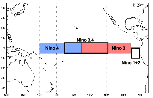
La Niña is the counterpart to El Niño, associated with cooler-than-average sea surface temperatures (SSTs) over the eastern equatorial Pacific. La Niña tends to favor an upper-level ridge over the northeast Pacific and a downstream trough over western North America. The classic effect on U.S. winters is to accentuate temperature contrasts between a chilly Northwest and a mild South, with an active polar jet stream leading to frequent storms and fronts. La Niña events often occur in pairs: the last set was in 2010-11 and 2011-12. A brief, weak La Niña extended through autumn and early winter 2016, and SSTs are once again near the La Niña threshold (0.5°C below average in the Niño3.4 region of the equatorial Pacific).
In its last monthly outlook, issued October 12, NOAA gave 55-65% odds that La Niña will be in place this fall and winter. Most of the global models analyzed by the Australian Bureau of Meteorology on October 16 indicated La Niña conditions would develop. With trade winds beginning to strengthen in the last few days, and a large pool of cooler-than-average water lurking below the surface of the tropical Pacific (see Figure 1), La Niña does appear to be a good bet for this winter.
 beneath the equatorial Pacific, averaged across the 10-day period centered on Oct. 10, 2017.") |
| Figure 1. Subsurface temperature anomalies (departures from average, in degrees C) beneath the equatorial Pacific, averaged across the 10-day period centered on Oct. 10, 2017. Image credit: NOAA/NWS Climate Prediction Center. |
 and precipitation (right) across the contiguous U.S. for winter 2017-18 (Dec. through Feb.), as predicted by NOAA on October 19, 2017") |
| Figure 2. The outlook for temperatures (left) and precipitation (right) across the contiguous U.S. for winter 2017-18 (Dec. through Feb.), as predicted by NOAA on October 19, 2017. Image credit: NOAA |
NOAA’s outlook
NOAA’s winter outlook is in line with classic La Niña expectations, but skewed toward a warm outcome, in keeping with the ongoing warmth of the 21st century. NOAA is predicting cooler-than-average conditions over the far northwest, with warmer-than-average conditions over the southern two-thirds of the nation, especially across the Southwest. The Sun Belt is expected to lean drier than average, with pockets of above-average precipitation over the Northern Rockies and the Midwest. “Despite the outlook favoring above-average precipitation this winter, drought is likely to persist in parts of the northern Plains,” said a NOAA news release, which also warned that drought could develop across parts of the South.
Additional perspective from The Weather Company
There’s more than La Niña in the mix, of course. NOAA cites the Arctic Oscillation and the Madden-Julian Oscillation as just two of the subseasonal factors that can influence weather over a period of several weeks but that aren’t reliably predictable months in advance.
At The Weather Company, chief meteorologist Dr. Todd Crawford and colleagues have drilled down to see if there’s anything we can deduce on how the North Atlantic Oscillation (NAO, closely related to the Arctic Oscillation) might co-evolve with La Niña this autumn and winter. Figure 3 shows a striking difference in month-by-month outcomes during La Niña when the NAO averages negative (center row) versus when it averages positive (bottom row).
 |
| Figure 3. Provided that a La Niña is in place, U.S. winters tend to be much colder when the North Atlantic Oscillation is negative (center row) than when the oscillation is positive (bottom row). Image credit: NOAA/NCEI graphics, courtesy Dr. Todd Crawford, TWC. |
The cold signal from La Niña tends to materialize over the Pacific Northwest by February. However, as seen in Figure 3, there can also be pronounced colder-than-average weather across the Midwest and Northeast from late autumn into early winter if the NAO is negative (center row). Seasonal climate models, such as the NOAA Climate Forecast System, version 2, can’t tell us how the NAO will evolve from week to week or month to month. Those models are predicting a very mild U.S. winter outside of the Pacific Northwest, said Crawford.
“Is there any hope for those looking for a colder winter this year?” Crawford asked in the TWC’s monthly outlook for clients. “If we relied solely on climate model forecasts, the answer would be a decisive ‘no’. However, there was very little North Atlantic blocking last winter that would allow some of the western cold to impact the eastern US. Could we see more North Atlantic blocking this winter?” Looking more closely at October-November NAO values, Crawford and colleagues found that a swing toward negative NAO in late October and early November raises the odds that the subsequent winter will feature a largely negative NAO. That gives us something to watch for over the next month, he noted. He added: “Current forecasts are in good consensus in a trend towards decreasing NAO values and more blocking as we progress into late October, which gives some hope for a little more North Atlantic blocking this winter than last.”
Based on these and other signals, The Weather Company is leaning a bit more than NOAA toward a chance of early-winter Arctic outbreaks causing colder-than-average conditions over the Midwest and Northeast. “This represents a reasonable compromise and nod towards the potential for more blocking this winter, but with the clear concern that it may not materialize,” said Crawford.
 across the contiguous U.S. for each year from 1895-96 through 2016-17. Image credit: NOAA/NCEI.") |
| Figure 4. Average winter temperature (Dec. through Feb.) across the contiguous U.S. for each year from 1895-96 through 2016-17. Image credit: NOAA/NCEI. |
Nudging our winters warmer: human-produced greenhouse gases
As the amounts of human-generated greenhouse gases continue to increase in our atmosphere each year, winters are getting undeniably warmer across the United States—but there is still enough variability from year to year, region to region, and month to month to keep us from getting rid of our cold-weather gear. For the contiguous U.S., most but not all winters in the 21st century have been warmer than the 20th-century average (see Figure 4). In data going all the way to 1895, three of the ten warmest winters on record have occurred in the 2010s, and six of the ten warmest have been since 2000.
Even those warm winters have had some noteworthy blasts of cold and snow, especially across the Midwest and Northeast. Last winter saw the nation's second-warmest February on record, including an extreme late-month "warm wave" that helped urge spring vegetation to bloom weeks ahead of schedule across most of the nation. Yet a massive snowstorm in March 2017 brought huge accumulations just inland from the I-95 corridor, including the heaviest 24-hour snowfall on record in Binghamton, NY. This juxtaposition serves as a reminder that human-produced climate change is a relentless long-term atmospheric trend, not a recipe dictating every day's weather.


