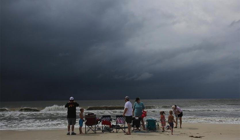
| Above: A family watches the first rain clouds from Tropical Storm Gordon roll in on Tuesday, Sept. 4, 2018, in Dauphin Island, Ala. Image credit: AP Photo/Dan Anderson. |
Poised on the threshold of hurricane strength, compact Tropical Storm Gordon was headed on Tuesday night toward an encounter with the central Gulf Coast. As of 5 pm EDT, Gordon was located about 95 miles southeast of Biloxi, MS, moving northwest at 15 mph. Gordon was packing top sustained winds of 70 mph, just shy of hurricane strength (74 mph).
Gordon’s observed rains and winds
Radar data from the Mobile, Alabama radar on Tuesday evening showed that Gordon’s heavy rain bands, with rainfall amounts up to 0.9” per hour, were affecting coastal Alabama and the Florida Panhandle. The radar data showed that Gordon was progressing towards building an eyewall along the north side of the center, with about 50% of one complete by 6 pm EDT (see Figure 1 below). If Gordon had another 12 hours over water, it would have been able to complete that process, but fortunately, it does not have time to do so.
 |
| Figure 1. WU depiction of NWS/NEXRAD radar from 6:15 pm EDT Tuesday, September 4, 2018. |
The highest rainfall amounts observed at any WU Personal Weather Stations between 8 am and 6 pm EDT Tuesday were 5.23” at Cape San Blas, Florida and 2.23” at Port St. Joe, both located on the Florida Panhandle’s big protrusion near Apalachicola.
The highest winds at any marine buoys as of 6 pm EDT Tuesday were 47 mph, gusting to 60 mph, measured at 5:50 pm EDT at buoy 42102, located 50 miles southeast of Mobile, Alabama. Waves were 13.5 feet high at the buoy.
Forecast for Gordon
With no major change to the steering flow expected through Wednesday, Gordon should make landfall not far from Biloxi within an hour or two of midnight Tuesday night. Although the official forecast track issued at 5 pm by the National Hurricane Center does not show Gordon as a hurricane, this is largely because the first point in the forecast track is at 1 am Wednesday, after Gordon is predicted to make landfall. Gordon has a very good chance of becoming a Category 1 hurricane just before landfall, after which it would rapidly fall back below hurricane strength.
NEW: NOAA's #GOES16 produced this visible/infrared "sandwich loop," showing #TropicalStormGordon, approaching the U.S. Gulf Coast this afternoon, Sept. 4, 2018. Updates: @NHC_Atlantic pic.twitter.com/ZuyTZB61vx
— NOAA Satellites PA (@NOAASatellitePA) September 4, 2018
Wind threat: Any hurricane-force winds would most likely be confined to a very small area near the coast just east of the eye. Winds sustained at tropical storm strength (at least 39 mph) can be expected across large parts of the Mississippi and Alabama coasts, perhaps extending inland across Mobile Bay and into southern Mississippi in the early morning hours on Wednesday. Such winds are strong enough to bring down trees and power lines, especially when the soil is saturated.
Storm surge threat: Louisiana State’s storm surge update page for Gordon showed widespread 1’ – 2’ storm surges late Tuesday afternoon along the LA/MS/AL/FL coast. The highest surge thus far was 2.28’ at the Bonnet Carre floodway near I-10 just west of New Orleans at around 3 pm CDT Tuesday. High tide along the Mississippi/Alabama coast will occur near midnight, when the surge from Gordon is also likely to peak, so residents should be prepared for these potential inundations above ground level:
2 to 4 feet: Mouth of the Mississippi River to mouth of the Pearl River
3 to 5 feet: Mouth of the Pearl River to Dauphin Island, AL
2 to 4 feet: Dauphin Island, AL, to Navarre, FL, including Mobile Bay
 |
| Figure 2. Rainfall outlook for the seven-day period from 8 pm Tuesday, September 4, 2018, to Tuesday, September 11. Image credit: NOAA/NWS/WPC. |
From Gulf Coast to Midwest, torrential rain is Gordon’s biggest threat
Gordon will likely be one of those tropical cyclones whose impact in the days after landfall is greater than during landfall. Gordon is expected to dump widespread 4” – 8” rains along a swath roughly 50 – 100 miles wide from the Mississippi/Alabama coast to the Arkansas/Mississippi border. Totals near the coast could exceed 12”, and similar amounts could occur over or near Arkansas by Thursday or Friday. At that point, moisture from Gordon will be sweeping northward into the Midwest, which has been hard hit by multiple heavy rain and flood events over the last several weeks.
Models suggest that Gordon’s remnants could dump very heavy rains on Friday and Saturday along a convergence zone expected to lie from northern Missouri to northern Ohio, and eventually into upstate New York. The exact placement of this band may shift north or south as the situation unfolds. In short, significant flood impacts from Gordon and its remnants will be a possibility throughout the week ahead.
Any rainfall from Gordon’s remnants will only exacerbate an already troublesome setup in the Upper Midwest. The NOAA/NWS Weather Prediction Center (WPC) has placed parts of southeast Minnesota and central Wisconsin under a high risk of excessive rainfall from Tuesday night to Wednesday afternoon. (This is separate from the high-risk areas for tornadoes and severe thunderstorms issued by the NOAA/NWS Storm Prediction Center.) Heavy showers and thunderstorms could drop 3” – 6” over large parts of the outlooked area, with some local amounts perhaps rivaling totals one would expect just once every 100 years on average. Some parts of southern Minnesota and central Wisconsin received 2” – 4” from Monday into Tuesday, and 10” – 15” has fallen over parts of southern Wisconsin in the last 30 days. See the weather.com writeup for more on the flood threat in this region.
WPC High Risk Days (in/near a High Risk Area) accounted for 41% of flood-related fatalities and 92% of flood-related damages in the CONUS despite only being valid on ~15 days per year.
— Alex Lamers (@AlexJLamers) August 28, 2018
(Presented this today at #NWAS18; uses Storm Data 2014-2017) pic.twitter.com/mDIRmnTaJc
For more on the other tropical cyclones spinning across the Atlantic and Pacific, and the potential for more in the Atlantic, see our full report from earlier Tuesday.
Dr. Jeff Masters co-wrote this post.


