| Above: A supercell thunderstorm looms over eastern Colorado west of Limon on June 19, 2018. Image credit: Bob Henson. |
The biggest experiment in years to target supercells and tornadoes across the Great Plains kicks off this week, just in time for what promises to be one of the biggest severe weather outbreaks of the year. Along with a fleet of ground-based vehicles, this project will include two starkly different types of airborne platforms, one with decades of experience and the other freshly minted.
The TORUS project (Targeted Observation by Radars and UAS of Supercells) is drawing on a $2.4 million grant from the National Science Foundation, plus about $1.5 million from NOAA. Springtime field campaigns are set for 2019 and 2020, with as many as 42 days of operations possible.
This year’s experiment will unfold through June 16 across a domain extending from Texas to North Dakota. As TORUS gets rolling, the plains are about to enter what’s likely to be an exceptionally active week of severe weather (see below).
 |
| Figure 1. Graduate student Alex Erwin drills a pipe that will hold an instrument cluster on the University of Nebraska's newest storm chase vehicle. Image credit: University of Nebraska–Lincoln. |
TORUS harks back to other large-scale tornado studies in the Great Plains, including the original VORTEX project (1994-95) and the VORTEX2 follow-up (2009-10). This time around, the researchers hope to drill even deeper, gathering more precise data with improved instruments to understand a supercell’s inner workings and to check the validity of computer models that can simulate the atmosphere around supercell thunderstorms in more detail than ever.
Some weather patterns are clearly primed to produce tornadoes, which opens the door to probabilistic alerts that might be issued an hour or more before the first twister develops (a big focus of recent NOAA efforts). Other storm setups are more ambiguous. Only a small fraction of rotating supercell thunderstorms end up producing tornadoes. It can still be a challenge to determine from radar data exactly which supercell will do the trick until it either does or doesn’t. That’s a big reason why most tornado warnings—about 70% in recent years—are false alarms.
The catch, though: “If you reduce the false alarm rate, you also reduce the rate of detection,” said TORUS lead investigator Adam Houston (University of Nebraska–Lincoln, or UNL). “We need to improve that gap to save lives. We can do that if we can improve our understanding of small-scale structures and small-scale processes that lead up to storms.”
 |
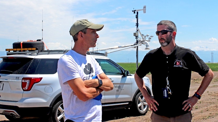
| Figure 2. Adam Houston (right) with a colleague on a research storm chase. Image credit: University of Nebraska-Lincoln. |
Data from TORUS could help improve warnings by nailing down how tornadic supercells evolve from inception to twister production, including the role of surface boundaries that often separate rain-cooled air to the north; warm, unstable air to the southeast; and drier air to the southwest of a supercell. These boundaries help generate near-surface vorticity (spin) that flows toward and into the supercell, boosting the odds of tornado production, and they’ll be a major focus of data gathering in TORUS.
“Every place in the United States is vulnerable to supercell thunderstorms,” said Houston. “What we learn in this laboratory called the Central Plains is applicable everywhere.”
A study in aerial contrasts
The “UAS” in the spellout of TORUS stands for unmanned aircraft systems—in other words, drones (UAVs, or unmanned aerial vehicles), together with the communications and control systems that guide them.
In recent years, drones have gathered some jaw-dropping imagery of severe weather from entirely new perspectives. A drone operated by Brandon Clement caught one tornado crisscrossing the landscape of south-central Oklahoma near Hickory on April 30.
TORUS is the first large-scale thunderstorm study to employ more than one drone, according to Houston. The four drones in TORUS will collect video (though it won’t be available in real time), but their main purpose is to gather weather data from just above ground level, where detailed observations are especially hard to come by. They’ll be allowed to fly as high as 2500 feet in the field campaign.
 |
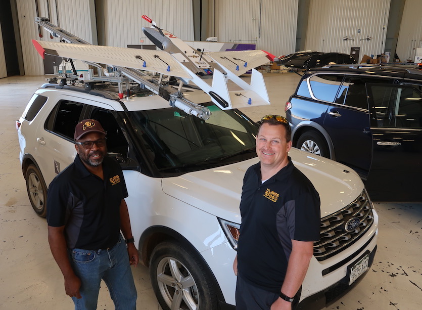
| Figure 3. Brian Argrow and Steve Borenstein (University of Colorado Boulder) with the custom-designed pneumatic propeller that will send drones into the air near supercell thunderstorms. Image credit: Bob Henson. |
“We’ve always had an interest in weather research,” Brian Argrow told me at the TORUS media day in Salina, Kansas, on Tuesday. Argrow is the chair of aerospace engineering sciences at the University of Colorado Boulder, a leader in drone-related applications. For TORUS, the department worked with the manufacturer RiteWing to create four custom-designed drones that sport extra-strong polystyrene wings and an enhanced tail for improved yaw control.
“You could cartwheel this aircraft and fly it again,” said Steve Borenstein, chief engineer with CU’s Integrated and Remote In-Situ Sensing group (IRISS).
Just as nifty is how the drones will be put into the air: directly from the rooftops of two pilot vehicles topped with unique pneumatic launch devices. Using compressed air, the launchers will propel the drones with a force of up to 8 Gs, pushing them from 0 to 40 mph in 0.4 seconds. Once airborne, the drones—each weighing about 15 pounds, with an 8.2-foot wingspan—can fly for 2.5 to 3 hours, depending on weather conditions and research needs. They’ll stay within several miles of the launch vehicle, typically less than a mile.
A major benefit of the rooftop launch system is that it reduces the risk of lightning to the drone operators.
 |
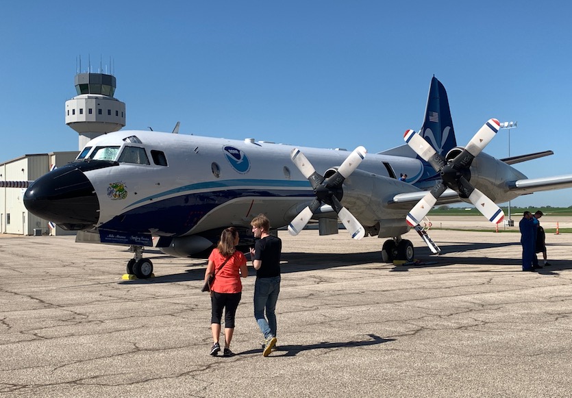
| Figure 4. The NOAA P-3 dubbed Kermit at the Salina Regional Airport on TORUS media day, Tuesday, May 14, 2019. Image credit: Bob Henson. |
Meanwhile, an aircraft nicknamed Kermit—one of NOAA’s two venerable P-3 hurricane hunters—will carry out its own sampling of the environment around supercells. For more than 40 years, Kermit has taken part in research projects around the world in addition to its bread-and-butter reconnaissance flights into tropical cyclones. “We do a lot of our heavy lifting in the off season with projects like this,” said Justin Kibbey, an aircraft commander from NOAA’s Aircraft Operations Center.
Kermit underwent a major overhaul in 2015-16, giving the plane more-fuel-efficient engines, state-of-the-art avionics, and refurbished wings. The aircraft’s dual-Doppler system, which includes both forward- and backward-pointing transmitters and receivers, is ready to gather crucial data from within and around supercells.
With recent improvements to the P-3’s onboard radar, “we can now get a vertical slice of measurements through the full storm depth roughly every 300 meters [980 feet] along the track,” said Dr. Conrad Ziegler (NOAA National Severe Storms Laboratory, or NSSL), who is serving as chief scientist on Kermit flights during TORUS.
At ground level, TORUS will be deploying eight instrument-studded mesonet vehicles, three mobile radar systems, a mobile lidar system, and three radiosonde (weather balloon) launch vehicles. Equipment and staffing for surface deployments are being provided by UNL, NSSL, Texas Tech University, and the University of Oklahoma's Cooperative Institute for Mesoscale Meteorological Studies, among other collaborators.
 |
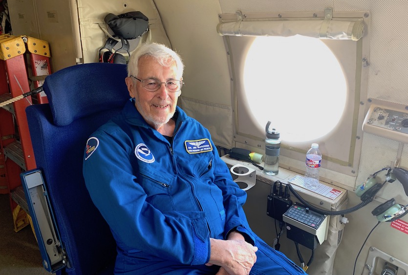
| Figure 5. NOAA scientist James (Jim) McFadden, a 50-plus-year veteran of hurricane hunting, is on hand for TORUS. McFadden and Jeff Masters were among those on a harrowing 1989 flight into Hurricane Hugo chronicled in Jeff’s article “Chasing Hugo.” Image credit: Bob Henson. |
The Plains and Midwest are bracing for an extended bout of severe weather
Mid- to late May is often a peak time for severe weather in the Great Plains—but even by climatological standards, the next few days are shaping up to be exceptionally stormy. Many eyebrows were raised on Tuesday when the NOAA/NWS Storm Prediction Center outlined risk areas for every one of the five days in its Day 4-8 outlook, spanning the period from Friday to Tuesday, May 17-21. Out of more than 3400 such outlooks issued since the product was launched in 2008, this was the first time that all five days showed a risk of severe weather—and there had been just one other time, back in 2016, when four out of five days were highlighted.
It was a bold call, but the outlook is holding firm. As of Thursday, SPC continues to have risk areas outlined for every day through Tuesday, May 21, with enhanced-risk areas shown for Friday and Saturday (see Figure 6). To top it off, it looks like another multi-day stretch of severe weather may kick in later next week.
 |
| Figure 6. WU depiction of SPC severe weather outlooks issued Thursday morning for Friday and Saturday, May 17-18, 2019. |
What’s going to make this period so volatile is a strong upper trough—strikingly cold and intense for mid-May—now pushing onto the West Coast. The trough is bringing lowland rains and mountain snows at an unusually late point in California’s wet season. On Wednesday, several CoCoRaHS stations near Cazadero in Sonoma County picked up more than 4” of rain.
An exceptionally strong low-latitude jet stream will recharge the western trough several times over the next few days, keeping California unusually damp for so late in the spring. Over the next week, large parts of the state may get up to twice their typical rainfall for the entire month of May.
As the cold upper-level air and powerful jet-level winds extend into the Plains, they will overtop an increasing fetch of warm, humid air from the Gulf, leading to hefty amounts of both instability and vertical wind shear. Right now, it appears Friday and Monday will be the most active days for supercell thunderstorms, very large hail, and the possibility of tornadoes. The day-to-day picture is subject to change, though, especially with the powerhouse upper low just now moving onshore and into the nation’s weather-balloon sampling network.
One threat is clear enough: we’ll have to watch for an increasing risk of flash flooding, as round after round of intense storms drench the already-saturated soils over large parts of the Plains, Midwest, and Mississippi Valley.
We’ll have more on the upcoming severe weather outbreak in a post on Friday. In the meantime, check out weather.com’s day-by-day breakdown.


