| Above: "Sea smoke" (which forms as very cold air moves over water) rises from Lake Superior as the ship St. Clair comes to harbor on Sunday, Dec. 31, 2017, at Canal Park in Duluth, Minn. The ship arrived during the coldest holiday week (Dec. 25-31) ever recorded in Duluth. The average temperature for the seven-day period, including both highs and lows, was a bone-chilling –12.1°F. Image credit: David Joles/Star Tribune via AP. |
One of the warmest years in U.S. history ended with one of the coldest blasts ever recorded east of the Rockies for the week between Christmas and New Year’s. Even though 2018 is now under way, the cold isn’t gone—and an explosively intensifying storm along the Gulf Stream will double down on the misery for millions along and near the East Coast.
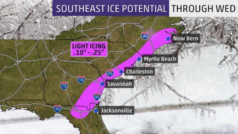
On Tuesday morning, sleet pellets and snowflakes were peppering coastal areas near Houston (which had its warmest year on record in 2017). The unusual spritz was triggered by a surge of jet-stream energy diving into the cold upper trough that’s kept the eastern two-thirds of the nation in the deep freeze for more than a week. As this upper-level impulse pulls across the Gulf of Mexico, light freezing rain could fall late Tuesday night into early Wednesday as far south as southeast Georgia and the elbow of the Florida Panhandle, where a rare winter storm warning was in effect. Amounts should be light enough to avoid widespread power loss and tree damage, but roadways could be quite hazardous. The ice may be capped with an inch or two of snow as far south as Georgia.
WU weather historian Chris Burt looks back at some of the Southeast's most spectacular winter weather events—including the colossal FL/GA/SC snow of 1800 and the New Orleans blizzard of 1899—in this archival post from 2011.
 |
| Figure 1. Icing outlook for the Southeast U.S. as of midday Tuesday, Jan. 2, 2018. Image credit: weather.com. |
#WXFIT ‘Lake’ effect? Arctic air is modified across the warm Gulfstream this morning - producing organized (unusual for our neck of the woods!) bands of precipitation. pic.twitter.com/0rIb86gp4c
— Steven Lazarus (@slazmo) January 2, 2018
How big a nor'easter?
#WXFIT ‘Lake’ effect? Arctic air is modified across the warm Gulfstream this morning - producing organized (unusual for our neck of the woods!) bands of precipitation. pic.twitter.com/0rIb86gp4c
— Steven Lazarus (@slazmo) January 2, 2018From the mid-Atlantic to New England, the big threat will be snow, strong winds, and brutal cold. As cold air and upper-level energy overspread the warm sea-surface waters of the Gulf Stream, the developing surface low should more than qualify for “bombogenesis” (a deepening of at least 24 millibars in 24 hours). There is very high confidence on the general track and intensity of this storm as it heads from off the mid-Atlantic Coast toward Nova Scotia, which will get a direct hit of heavy snow and high wind. As usual for East Coast winter storms, though, the devil lies in the details, including exactly how far northwest the storm tracks and the width of its swath of heavy precipitation.
As of the 12Z model runs on Tuesday morning, there was still enough uncertainty to keep a chance of significant snow along the Interstate 95 corridor from Washington to New York. The highest-confidence areas for snow include far eastern North Carolina and southeast Virginia, the Delmarva Peninsula, eastern New Jersey, and southeast New England. Amounts should be under 6” in many places, but more than a foot could fall across eastern Long Island, Rhode Island, and the swath from eastern Massachusetts to coastal Maine. There’s a bigger-than-usual asterisk on these projected amounts, depending on the track and evolution of the storm. If anything, models have been inching closer to the coast with the low placement. This would push the zone of significant snow further inland and hike the amounts along the immediate coast, with blizzard conditions not out of the question for parts of coastal New England. Watch for more details and updates on this storm, dubbed Grayson by The Weather Channel, at weather.com.
The coup de grâce on the back side of this nor’easter will be a fierce blast of high wind and bitter cold pushing from the Midwest into the mid-Atlantic and Northeast. High temperatures on Friday and Saturday could struggle to reach 10°F as far south as northern Pennsylvania and New Jersey, and much of New England is likely to remain below zero all day.
A quick thaw on the way—but not much of one
A welcome push of somewhat milder air will bring 60s into Texas over the weekend, and perhaps provide a day of readings above 32°F from Illinois and Michigan to New England early next week. The relief won’t last long, though, as yet another Arctic outbreak is on tap to sweep across most of the central and eastern U.S. later next week. Residents may find themselves gazing longingly toward the U.S. Southwest, where temperatures are predicted to remain milder than average throughout the next week and beyond.
 |
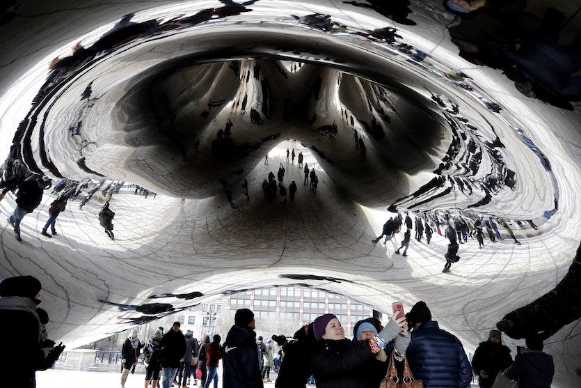
| Figure 2. Bundled-up people are reflected by the Cloud Gate at Millennium Park in Chicago, Ill., on Sunday, Dec. 31, 2017. Image credit: AP Photo/Nam Y. Huh. |
A 21st-century cold wave for the agesThe eastern two-thirds of the United States hasn’t seen a December-January cold outbreak quite like this one in many decades. All-time record lows are hard to obtain in midwinter these days, given our warming climate, but this outbreak has managed a few monthly low temperatures, especially in Michigan (see below). Many locations across the central and eastern U.S. had their coldest New Year’s Eve and/or New Year’s Day in many years, and in some cases since records began. Even more impressive has been the sheer duration of the intense cold, especially during the week from Christmas to New Year’s—a time when Americans are arguably more keenly attuned to the weather than usual because of holiday activities. Many locations in the Midwest and Northeast had their coldest or second coldest holiday week on record (Dec. 25-31), including: Perhaps ironically, many of the New Year’s Day “polar plunges” that raise money for nonprofits across North America were cancelled on Monday, including Chicago’s and Toronto’s, because of the cold conditions. In New York City, though, Coney Island went ahead with its 116th annual plunge. A full recap of cold records over the last few days, plus a detailed look at what’s coming this weekend, can be found at weather.com.  |
| Figure 3. People taking part in Coney Island's annual New Year's Day Polar Plunge frolic in the Atlantic surf on Monday, Jan. 1, 2018. Temperatures hovered at about 17°F (-8°C) for the annual tradition, which began in 1903. Image credit: AP Photo/Peter Morgan. |
A historic cold spell in Michigan: observations from Jeff Masters
WU’s Jeff Masters, who lives just northwest of Detroit, filed this report from one of the worst-hit locations in this year-end cold wave.
“I’ve endured more than 50 winters in Michigan, but the relentless, intense cold that has gripped the Great Lakes State since Christmas has been remarkable, and will enter epic territory late this week. My backyard PWS has seen lows below zero Fahrenheit an impressive six of the eight days since Christmas, with notable minimums of -18°F and -19°F on December 27 and 28. Nearby Flint airport hit –18°F on December 28, which was their lowest temperature ever recorded in the month of December. The previous record was –14°F, set just the previous day.
“What’s also remarkable is the extended duration of this cold wave. Both Detroit and Flint have failed to reach 20°F for eight consecutive days, going back to December 26. If current forecasts prove accurate, both cities will have streaks of 12 consecutive days with a high below 20°F by Saturday. The coldest days will be Thursday and Friday, when highs will struggle to get above zero. These streaks are forecast to end on Sunday, when highs should approach the upper twenties. The record-longest streak with highs below 20°F is 11 days in Detroit and 12 days in Flint. Both streaks occurred during the infamous winter of 1978-79, when I was a freshman at the University of Michigan. I can remember trekking with a frozen face across the frozen tundra of the Michigan ‘Diag’ on my way to classes that winter, wondering when I might see a winter of this epic intensity again. Well, it took 39 years!”
The Great Lakes are freezing rapidly
The intense cold of recent days has accelerated ice formation on the Great Lakes, which were all experiencing above-average levels of ice cover as of January 2. Shallow Lake Erie had the most ice coverage, at 40%, and this coverage is forecast to expand to 87% by the end of the week. This will greatly reduce the odds of lake-effect snowstorms like the record-smashing 64 inches of snow that fell in 60 hours in Erie, Pennsylvania, during Christmas week.
 |
| Figure 4. Most of Lake Erie is predicted to be ice-covered by January 7, 2018, although a small area adjoining western New York may remain unfrozen. Image credit: NOAA Great Lakes Environmental Research Laboratory. |
 |
| Figure 5. Departures from average temperature (degrees F) for December 2017 (left) and the holiday week of Dec. 25-31 (right). As is often the case in La Niña winters, cold departures from normal were especially pronounced toward the northern tier of states. Image credit: NOAA/NWS Climate Prediction Center. |
Could December and January both end up milder than average for the nation?
Amazingly, the first three week of December were so mild for the U.S. as a whole (especially the Southwestern states) that the brutal holiday cold wave may not have been enough to bring the nation’s December average below normal. We’ll know for sure in a few days, when NOAA issues its summary of December climate. The bizarre juxtaposition meant, for example, that Sioux Falls, SD, ended up 1.9°F above average for the month of December, even though its final week of the month was record-cold.
It’s possible January could end up warmer than average for the nation as a whole, thanks to the persistent Southwestern warmth. On the other hand, it’s very possible that the central and eastern U.S. will continue to trend colder than average well into mid-January, if current extended model runs are to be believed.
Dr. Jeff Masters contributed to this post.


