| Above: A splitting supercell thunderstorm near Childress, TX, on Monday afternoon, April 30, 2018. Under certain types of wind shear, a supercell storm may split into a left-moving cell (rotating anticyclonically) and a right-moving cell (rotating cyclonically). Typically, the right-moving cell is the more dangerous one. Image credit: Courtesy Gabe Garfield, @WxGabe. |
As predicted, the first three days of May are on track to bring a burst of severe weather from the Great Plains into the Mississippi Valley, including the potential for tornadoes, very large hail, damaging winds, and localized flash floods.
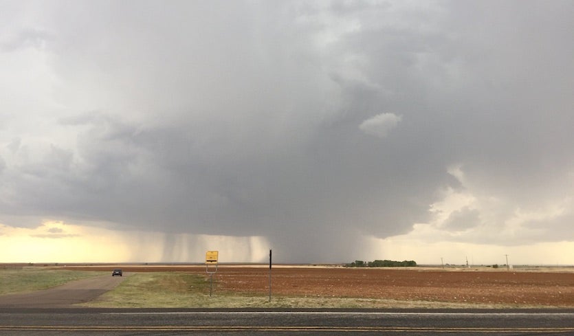
In a low-key prelude to the onslaught, Monday evening produced around three dozen reports of severe hail and wind scattered from Texas to Iowa. The biggest concentration was across central Nebraska, where golf-ball-sized hail occurred near the town of Lynch. No major damage or injuries were reported from Monday’s storms.
The center of action on Tuesday will be the Central Plains, mainly along a stationary front extending from central Kansas to southwest Wisconsin. Impulses of upper-level energy traversing the front are expected to spark intense thunderstorms, with more isolated cells along a dryline from Kansas to western Oklahoma. The risk is greatest near the “triple point”–the intersection of the front and dry line—in central Kansas. Late Tuesday morning, the NOAA/NWS Storm Prediction Center upgraded the area near the triple point to a moderate risk, the second-highest of the severe weather threat categories used by SPC.
A large-scale tornado outbreak isn’t expected on Tuesday, but one or more strong tornadoes are possible, mainly near the triple point in central Kansas where several long-lived supercells will likely form. Very large hail is also possible in the moderate-risk area.
") |
| Figure 1. WU depiction of severe weather risk areas as designated at midday Tuesday, May 1, by the NOAA/NWS Storm Prediction Center for Days 1 and 2 (left to right), or Tuesday and Wednesday, May 1-2, 2018. The small red areas for Tuesday and Wednesday denote a moderate risk of severe weather, the second-highest of SPC’s five risk categories. |
Severe storms will be more widespread on Wednesday along the front and dryline, all the way from the Texas/Mexico border to Lake Michigan. The Day 2 outlook from SPC features a large enhanced-risk zone across parts of Oklahoma, Kansas, Missouri, and Iowa. Once again, the triple-point region will be a focal point: the updated Day 2 outlook for Wednesday included a small moderate-risk zone in far northeast Kansas and far northwest Missouri. Storms will likely morph into a mesoscale convective complex in this area, with a chance of wind gusts over 70 mph, very large hail, and torrential rain. Further west, storms will be more scattered along the dry line from Kansas through Oklahoma, but any that do develop run the risk of quickly becoming isolated supercells that could generate tornadoes, especially toward evening.
On Thursday, the frontal zone and the associated severe threat will be pushing toward Missouri and Illinois. The upper-level trough driving this week’s severe weather will be lifting out, so the wind shear is expected to be more favorable for localized high winds and heavy rains as opposed to large hail or strong tornadoes. Pockets of higher risk could materialize on Thursday depending on where clouds and storms from Wednesday night persist into Thursday.
Right now it appears the U.S. severe-weather threat will lessen considerably next week, as upper-level energy slackens and low-level moisture returns to the scant side for early May.
Severe weather rages across Europe as April segues into May
Europe has been giving the Great Plains a run for its money in recent days. Very warm temperatures for the end of April have joined forces with an energetic jet stream to spawn several days of intense thunderstorms unusual for this early in the year. The storms produced almost half a million lightning flashes in just 48 hours (see embedded tweet below).
What an active 2-day span it has been! Over 450 000 lightning flashes detected over Europe! April sure ended with a bang! We wonder what May has in store. Certainly storm season 2018 has started with a bang! Map. @Blitzortung_Org pic.twitter.com/JInHLjAOft
— severe-weather.EU (@severeweatherEU) May 1, 2018
Extreme damage to a farm in #Belgium caused by yesterday's extraordinary long-track tornadic supercell, that tracked from the Morvan all the way into Belgium. Source: https://t.co/aP03vicW9B relayed to #ESWD https://t.co/0rhpEkOgSy by Bas v/d Ploeg. @essl_ecss pic.twitter.com/nYw6gJinV6
— Pieter Groenemeijer (@pgroenemeijer) April 30, 2018
Golf-ball-sized hail pummeled Wizna, Poland, on Tuesday, causing widespread damage to cars and roofs, according to the European Severe Weather Database. Another noteworthy hailstorm on Tuesday pelted Jaén, Spain (see video below).
Una importante granizada sobre Jaén capital, está dificultando al tráfico en estos momentos. Y aún sigue granizando...
— Storm Málaga (@Storm_Malaga) May 1, 2018
Vídeo: @MiguelBravoPu.
CC: @ecazatormentas, @AEMET_Esp, @AEMET_SINOBAS, @InfoMeteoTuit @StormchaserUKEU @severeweatherEU y @E112Andalucia. pic.twitter.com/WWg34mOGbV
More great lightning over Hungary last night, April 30! Photo: Nagykovácsi Zsolt pic.twitter.com/raQNfgQFDo
— severe-weather.EU (@severeweatherEU) May 1, 2018
Farewell and good riddance to an April on ice (except in the Desert Southwest)
One of the coldest Aprils on record for large parts of the central and eastern U.S. is finally behind us. A dramatic pulse of warmth swept through the Great Lakes on Monday, April 30, leading to some impressive diurnal ranges (from the daily low to the daily high) for this region. Chicago soared from a low of 40°F to a high of 80°F, while Milwaukee vaulted from 37°F to 79°F and Alpena, Michigan, leapt from 26°F to 69°F.
The warmth on the last day of the month was just enough to keep some towns and cities from setting their all-time coldest April, but quite a few still made the cut. Here’s a sampling from various states:
Cooperstown, NY: 33.7°F (old record 37.2°F in 1907; records began in 1893)
Rochester, MN: 34.5°F (old record 37.6°F in 1950; records began in 1886)
Sioux Falls, SD: 37.5°F (old record 37.8°F in 1950; records began in 1893)
Spencer, IA: 36.6°F (old record 39.8°F in 1951; records began in 1895)
Flint, MI: 39.1°F (old record 39.4°F in 1950; records began in 1921)
St. Joseph, MO: 45.9°F (old record 46.6°F in 1983; records began in 1908)
Mineral Wells, TX: 60.2°F (old record 60.5°F in 2007; records began in 1948)
Even as Mineral Wells had its coolest April on record, another Texas city had its warmest. El Paso’s average of 70.6°F beat the old record of 70.3°F from 2011; records in El Paso began in 1887. Also notching its warmest April on record was Needles, CA (79.2°F, beating 78.2°F from 1989; records began in 1888).
One vivid sign of the persistent chill that’s plagued the Midwest: Chicago went through both March and April without a single thunderstorm. It’s the first time that’s happened since 1915 and only the fourth time since records began in 1871.


