| Above: The Saharan Air Layer (SAL) analysis from 8 am EDT Thursday, July 27, 2017, showed a large area of dry Saharan air in the tropical Atlantic to the north of a tropical wave we are watching for development. Image credit: University of Wisconsin CIMSS/NOAA Hurricane Research Division |
A tropical wave located at 11 am EDT Thursday near 11°N, 31°W, about 400 miles southwest of the Cabo Verde Islands, was headed west at 5 - 10 mph, and has marginal potential to develop into a tropical depression early next week.
Satellite images on Wednesday morning showed that the wave was on the northeast edge of a band of heavy thunderstorms associated with the Intertropical Convergence Zone (ITCZ), a semi-permanent band of heavy thunderstorms that extends across the tropics. The wave had more spin than on Tuesday, but still only a limited amount of heavy thunderstorm activity. The dry air of the Saharan Air Layer (SAL) was to the north of the disturbance, and was likely interfering with development. Wind shear was low to moderate, 5 – 15 knots, which was favorable for development. Sea Surface Temperatures (SSTs) were just warm enough for development, near 27°C (81°F)--about 1°F above average.
Forecast
The wave may struggle to separate itself from the ITCZ over the next few days, and the presence of dry air, marginally warm SSTs, and the relatively low latitude of the system should also act to slow development. In addition, the Madden-Julian Oscillation (MJO), a periodic pulse of thunderstorm activity that circles equatorial regions of the globe every few weeks, is in a phase that will tend to suppress development of Atlantic and Eastern Pacific tropical cyclones over the coming five days.
The 0Z Thursday run of the UKMET model did predict that this wave would develop into a tropical depression over the weekend, but the operational versions of our other two top models for predicting tropical cyclone genesis--the European and GFS models--did not. However, there was more support for development of the wave in the 0Z Thursday runs of the GFS ensemble forecast and European model ensemble forecast, compared to their runs from 24 hours previous. Nearly all of these forecasts showed the storm dying out before reaching any land areas, and it is clear that even if the system develops into a tropical depression, it will struggle with dry air, marginal SSTs, and wind shear. In their 8 am EDT Thursday Tropical Weather Outlook, the National Hurricane Center (NHC) gave the system 2-day and 5-day odds of tropical cyclone development of 0% and 30%, respectively, up 10% compared to the Wednesday morning forecast.
The European model is giving more support for development next week of a new tropical wave predicted to emerge from the coast of Africa this weekend.
 |
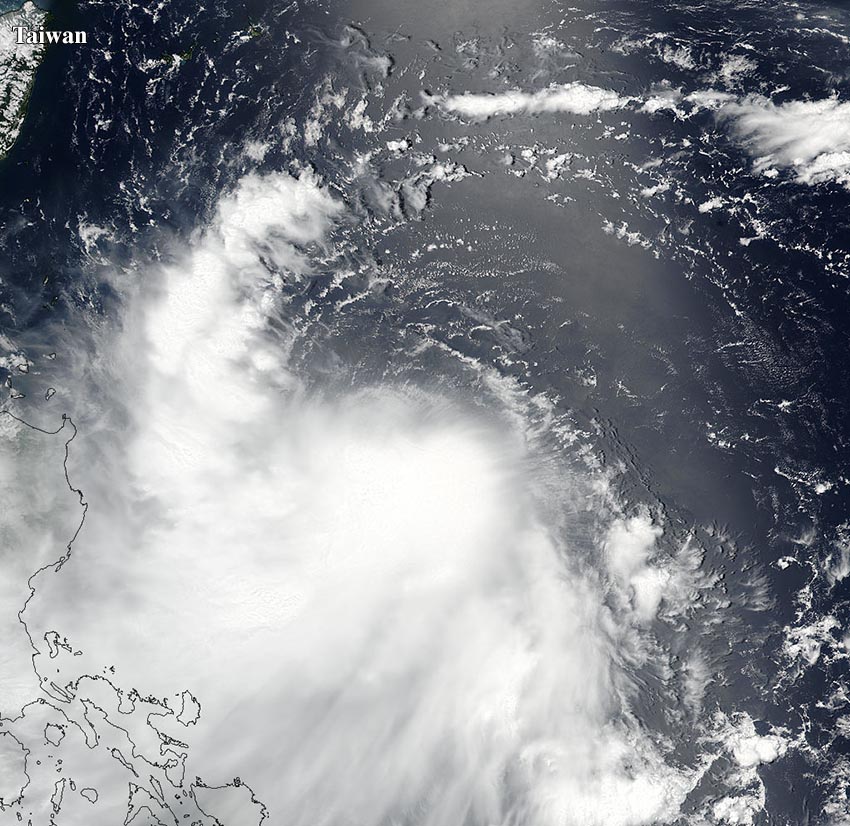
| Figure 1. Visible VIIRS satellite image of Tropical Storm Nesat in the Pacific at 8:24 pm EDT July 26, 2017. Image credit: NASA. |
Taiwan may get 2017’s first landfalling typhoon
Tropical Storm Nesat formed in the waters about 500 miles east of the Philippines on Tuesday, and may become the season’s first landfalling typhoon this weekend in Taiwan. Nesat is over waters very favorable for development, with SSTs near 31°C (88°F), but is contending with moderate wind shear of 15 – 20 knots. Wind shear should drop to the 10 - 15 knot range by Friday, which should allow Nesat to slowly intensify from its 65 mph winds on Thursday morning to a Category 1 typhoon with 90 mph winds by Friday afternoon, as the storm heads northwest towards Taiwan. By Friday night, strong upper-level winds out of the northeast should create high enough wind shear to begin weakening Nesat, and the Joint Typhoon Warning Center is predicting that Nesat will make landfall Saturday morning (U.S. EDT time) in Taiwan at Category 1 strength.


