| Above: As Boston suffers through a heat wave on July 21, 2011, Andrew Rosario and his mother, Maria, try to keep cool with their dog Timmy on their front stoop. Image credit: Suzanne Kreiter/The Boston Globe via Getty Images. |
Just a week after the solstice, summer is preparing to hit the U.S. with a vengeance. A dome of intense heat—not too far from record intensity for so early in the summer—will migrate from the Rockies to the Midwest and Northeast by this weekend, accompanied by worsening air quality. Meanwhile, an unusually thick layer of dust from the Sahara will bring hazy skies to the Central U.S. late in the week.
Scorching temperatures will peak across the southern and central Rockies over the next couple of days. An air quality alert for low-level ozone is in place for the Phoenix area, where temperatures are expected to reach or exceed 110°F on Tuesday and Wednesday. Late June is normally one of the hottest times of the year across the Southwest, as the dry climate allows the full summer sun to do its worst, so record highs are not expected in Phoenix. The city's all-time high of 122°F was notched on June 26, 1990.
More impressive by local standards would be the 102°F predicted for Denver on Thursday. The city’s all-time high of 105°F was recorded in 2012 on both June 25 and 26, as well as on July 20, 2005. In nearby Cheyenne, Wyoming, the mercury could get within several degrees of the city’s all-time high of 100°F, set most recently on June 23, 1954.
 |
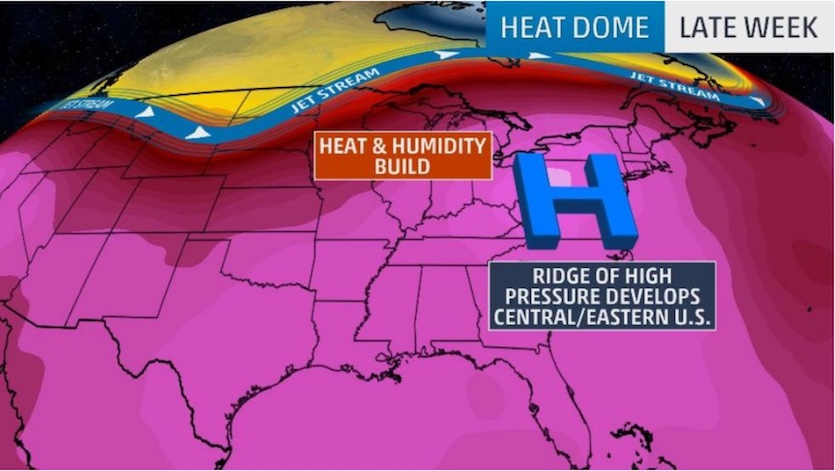
| Figure 1. A dome of intense early-summer heat will build across the Midwest and Northeast U.S. by late this week. Image credit: weather.com. |
The heat’s grip will intensify from Thursday into the weekend from the South across the Midwest and into the Northeast. An excessive heat watch is in effect starting Thursday for the St. Louis area. Record highs are not expected in St. Louis, but nighttime lows will struggle to dip below 75°F and daytime highs could approach 100°F from Thursday through Sunday. With rich moisture in place, the heat index could reach 110°F at times. Multiple days of heat with very warm nights are the most dangerous setup for heat-related illness. By Friday afternoon, temperatures will likely be in the 90s across most of the U.S. east of the Mississippi.
As the heat wave progresses eastward, the best chance of setting daily records will occur this weekend from the Great Lakes across New York and into New England. Proximity to the Atlantic tends to make August the hottest time of the year here, so a heat wave as early as this can have an outsized impact. Some of the forecast highs that would set daily records highlighted by weather.com include:
- Saturday: Detroit, MI (96°F); Rochester, NY (96°F); Burlington, VT (93°F)
- Sunday: Concord, NH (99°F); Rochester, NY (96°F); Burlington, VT (96°F); Worcester, MA (94°F); Buffalo, NY (93°F); Caribou, MN (89°F); Binghamton, NY (87°F)
Cities from Washington, D.C., to Portland, Maine, will certainly feel the warmth this weekend, although it’s possible that light onshore winds will bring some cooling relief along the coast of New England—potentially keeping temperatures below 90°F in Boston, for example.
 |
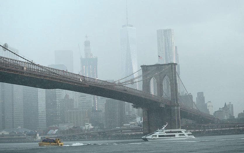
| Figure 2. Haze envelops New York City on July 25, 2016, when the temperature hit 93°F during a major heat wave. Six of NYC’s ten ozone monitoring stations recorded 8-hour ozone levels in excess of the federal standard of 70 ppb during that week’s heat wave. Image credit: Kena Betancur/Getty Images. |
Dangerous levels of ozone pollution likely during the heat wave
This week’s heat wave will be accompanied by light winds, which will allow air pollution levels to build, bringing the worst ozone air pollution thus far this year to much of the Midwest and Northeast United States. Ground-level ozone, which is created from chemical reactions between volatile organic carbon (VOC) compounds and nitrogen oxides, is created more readily at warmer temperatures. Extreme heat helps these chemical reactions occur faster, and we can expect to see many areas with ozone pollution topping out in the “Unhealthy” range during the heat wave. At this level of pollution, people who are sensitive to air pollution can see increased risk of stroke, heart attack and breathing problems, and even healthy people may experience discomfort.
An air pollution episode as widespread and severe as the one this week is a threat to cause hundreds of premature deaths. According to a 2018 study done by the Health Effects Institute (a U.S. non-profit corporation funded by the EPA and the auto industry), ozone pollution in the U.S. caused approximately 12,000 premature deaths per year between 2010 and 2016. Air pollution deaths are calculated using epidemiological studies, which correlate death rates with air pollution levels. Air pollution has been proven to increase the incidence of death due to stroke, heart attack and lung disease. Since these causes of death are also due to other factors—such as lifestyle and family history—we typically refer to air pollution deaths as premature deaths. A premature air pollution-related death typically occurs about twelve years earlier than it otherwise might have, according to Caiazzo et al., 2013.
Dust from Africa to reach North America this week
Residents from Texas to Wisconsin will have an unusual pollution concern this weekend—fine particulate matter (PM2.5) from African dust. A large and impressive outbreak of Saharan Air Layer (SAL) dust is on its way to North America this week, and NASA’s GMAO model shows the dust reaching Texas on Friday and Chicago on Sunday. While this dust will probably not elevate PM2.5 levels above the federal air pollution standard, it will cause hazy skies and decreased air quality.
We’ll be back later today with a post from Chris Burt on some of the nation’s most intense June heat waves in history.
Dr. Jeff Masters co-wrote this post.


