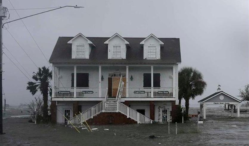
| Above: Storm surge waters surround buildings as Hurricane Florence hits Swansboro N.C., Friday, Sept. 14, 2018. (AP Photo/Tom Copeland. |
Hurricane Florence was only a Category 1 storm on the Saffir-Simpson wind scale when it struck, but the hurricane’s massive wind field brought a huge storm surge to the coast that broke all-time high-water records as much as 65 years old. Two of the three tide gauges on the south coast of North Carolina that have long-term records going back to 1954 or earlier (Beaufort and Wilmington) had those records fall on Friday, and the other station (Wrightsville Beach) notched its third highest water level on record. Long-term storm surge records like this are very difficult to break, and speak to how large and dangerous Florence’s storm surge has been. The threat from Florence's surge is not over yet, either--the National Hurricane Center was warning on Friday night that Florence's storm surge could still bring water levels up to 12 feet above ground in eastern North Carolina.
This @weatherchannel visualization of storm surge is an amazing and sobering use of technology to show what hurricanes like Florence can do pic.twitter.com/fuszIcOR3s
— Brian L Kahn (@blkahn) September 13, 2018
The largest storm surges reported on Friday from Florence were in New Bern and Emerald Isle, North Carolina, where water levels reached 10.1 feet and 7.0 feet above ground, respectively, according to the National Hurricane Center. New Bern, a city of about 30,000 residents, saw significant storm surge flooding after the Neuse River overflowed its banks and swept into the town. Craven County spokeswoman Amber Parker told ABC News that some people were trapped on their roofs. "I would say certain areas of New Bern are very desperate," she told the network. At least 200 people had been rescued on Friday morning, with another 120 people still awaiting rescue as of 10:30 a.m. Friday morning in New Bern, city spokeswoman Colleen Roberts told the Associated Press.
 |
| Figure 1. The history of high-water levels (storm tide) in Wilmington, North Carolina since 1935. Prior to Hurricane Florence, the highest storm tides were during Hurricane Matthew in 2016 and Hurricane Hazel in 1954. Note that sea level in Wilmington has risen by close to 8 inches since Hazel struck. The red line marks a water level that has a 1% chance of occurring per year: a 1-in-100-year event. Florence’s water level fell above this line, making it a rarer than 1-in-100-year event. Image credit: NOAA/NWS/MDL. |
A record 1-in-100-year high water level at Wilmington, NC
The record for all-time highest water level at Wilmington, NC, where records extend back to 1935, fell on Friday. At 3:30 pm EDT, the water level (storm tide) reached 3.60’ above the high tide mark (Mean Higher High Water, or MHHW), beating the all-time record of 3.48’, set on October 8, 2016, during Hurricane Matthew. In third place is the 3.47’ water level set on October 15, 1954 during Hurricane Hazel. The water was pushed in by Florence’s unrelenting onshore winds, which were sustained at 48 – 64 mph during the period 8 am – 8 pm EDT Friday. According to data from NOAA, the new record water level rated as more than a 1-in-100-year event (less than a 1% chance of happening in a given year). As of this writing (8 pm EDT), the storm surge was still rising, and stood at 4.9 feet. Since low tide was approaching, though, water levels (the storm tide) had fallen below the record high mark.
 |
| Figure 2. Water levels in Beaufort, NC during Hurricane Florence. The blue line is the expected water level, which fluctuates by about 4 feet with the tide; the red line is the observed water level (the storm tide), and the green line is the difference between the two (the storm surge). Image credit: NOAA Tides and Currents. |
 in Beaufort, North Carolina since 1953") |
| Figure 3. The history of high-water levels (storm tide) in Beaufort, North Carolina since 1953. Prior to Hurricane Florence, the highest storm tide was during Hurricane Hazel in 1954 and Hurricane Ione in 1955. Note that sea level in Beaufort has risen by close to 8 inches since Hazel struck. The red line marks a water level that has a 1% chance of occurring per year: a 1-in-100-year event. Florence’s water level would have been a 1-in-100-year event had it occurred in 1954, but now is closer to a 1-in-50-year event. Image credit: NOAA/NWS/MDL. |
A record-high water level observed at Beaufort
Friday morning at 3:24 am EDT, a storm surge of 5.51 feet was recorded at the Beaufort, NC gauge. Fortunately, the tide was receding rapidly at that point, but the storm tide (the combination of the surge and tide) still set an all-time water level at the gauge near 2 am: 3.74’ above the high tide mark (Mean Higher High Water, or MHHW). According to NOAA, this broke the previous all-time water level record of 3.39’ above MHHW set on October 15, 1954, during Category 4 Hurricane Hazel (and tied on September 19, 1955 during Category 2 Hurricane Ione). Note that sea level in Beaufort has risen by about 0.7 feet since the time of Hazel, largely due to human-caused climate change, and Florence would not have been able to break Hazel’s record without it.
Third-highest water level on record at Wrightsville Beach
At Wrightsville Beach, where records extend back to 1954, a storm surge of 3.77’ was observed at 10:54 am EDT, and a storm tide of 4.11’ above the high tide mark (Mean Higher High Water, or MHHW). This is the third highest water level on record for the site, behind the 11.72’ on October 15, 1954 during Category 4 Hurricane Hazel, and the 8.22’ level reached on September 6, 1996, during Category 3 Hurricane Fran.
Wrightsville Beach is only about 10 miles east of Wilmington, so it may seem strange that the storm tide record from Hurricane Hazel is so much higher (11.72’) compared to the one for Wilmington (3.47’). That’s because the Wilmington tide gauge is located on the Cape Fear River, about 20 miles inland from the coast, where the surge from fast-moving Hurricane Hazel was not able to easily penetrate. However, slow-moving Florence had much more time to push a high surge up the river.
 |
| Figure 4. Damage in North Topsail, North Carolina, after the storm surge from Category 3 Hurricane Fran of 1996. Approximately 90 percent of the homes in North Topsail Beach sustained damage from the combined impact of storm surge and wind. An estimated storm tide about 6 - 7’ above ground caused much of the damage. Image credit: USGS. |
The East Coast’s town most vulnerable to coastal flooding takes a direct hit
What may be the most vulnerable town to coastal flooding on the U.S. East Coast, North Topsail Beach, North Carolina, took a direct hit from the worst of Hurricane Florence’s storm surge on Friday. In their excellent 2016 book, Retreat From a Rising Sea: Hard Choices in an Age of Climate Change (see my review here), Duke University sea level rise expert Dr. Orrin Pilkey and co-authors ranked North Topsail Beach as the second-most dangerous island for development in the United States, behind only Dauphin Island, Alabama. North Topsail Beach, an 11.1-mile long community on the northern third of Topsail Island, is low and narrow (25 yards wide in some locations), and has a single escape road that easily floods and will prevent escape even in the earliest phase of an approaching hurricane. The single row of dunes on the island was bulldozed up from the beach, and disappears quickly in storms. Hurricane Fran (1996), a Category 3 storm with 115 mph winds that made landfall near Cape Fear, North Carolina, brought a storm surge estimated at 6 – 7 feet above ground, which cut at least six inlets across the island.
 |
| Figure 5. Houses are seen near high tide on September 11, 2018 in on North Topsail Beach, North Carolina, two days before the arrival of Hurricane Florence. Image credit: Logan Cyrus /AFP/Getty Images. |
“The irresponsibility of development on this hazardous island is breathtaking,” the authors wrote. “A number of high-rise condominiums and hotels have been built, including the high-end St. Regis Resort and Villa Capriano condo/hotels.” A 2009 technical report co-written by Dr. Pilkey and geologist William Neal, North Topsail Beach, North Carolina: A model for maximizing coastal hazard vulnerability, has more detail on why they rate this location as being so dangerous. In fact, development on the islands is so ill-advised that residents there cannot get flood insurance from the National Flood Insurance Program, or beach replenishment and some forms of disaster aid from the Federal Government. This is because of a designation under a 1982 law Congress passed called the Coastal Barrier Resource Act (CRBA), intended to discourage development on risky and environmentally sensitive areas of the coast. The development that has occurred on North Topsail Beach was criticized in a 2015 op-ed by Dr. Robert S. Young, professor of coastal geology at Western Carolina University, who called the town one of the most poorly managed beach communities in the U.S.


