Hurricanes, Typhoons & Cyclones
Ex-Beryl Headed for Bahamas, May Regenerate Late This Week
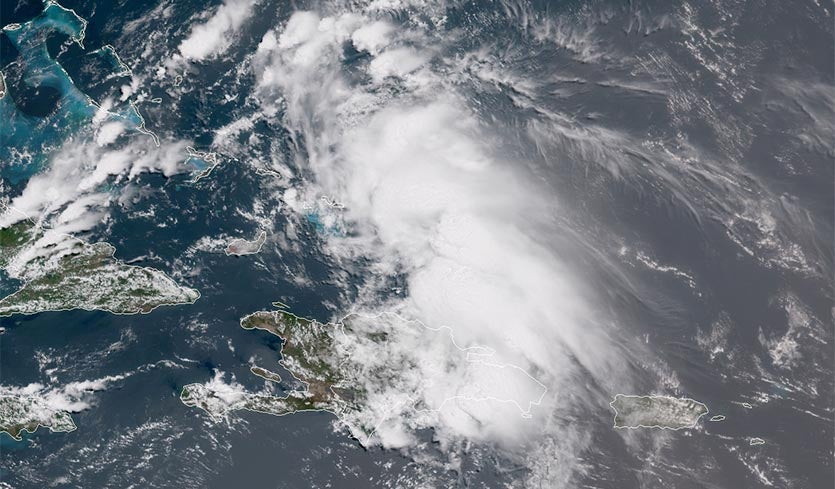
Above: Visible satellite image of ex-Tropical Storm Beryl at 12:06 pm EDT July 10, 2018. Ex-Beryl was generating heavy thunderstorms over Hispaniola and the southeast Bahamas. Image credit: NOAA/RAMMB.
The remnants of Beryl brought widespread rainfall amounts of 2 – 4” to eastern Puerto Rico on Monday, with 6+” occurring in the mountainous El Yunque region (see tweet below). Satellite images on Tuesday afternoon showed that ex-Beryl was bringing heavy thunderstorms to Hispaniola and the southeast Bahamas, as the system moved west-northwest at about 15 mph. Heavy rains of 2 - 4" can be expected along the path of the storm.
Preliminary rainfall totals associated with the remnants of Beryl. Acumulaciones de lluvia preliminares asociadas con los remanentes de Beryl. #prwx #usviwx pic.twitter.com/mdxwIy5GjA
— NWS San Juan (@NWSSanJuan) July 10, 2018
Preliminary rainfall totals associated with the remnants of Beryl. Acumulaciones de lluvia preliminares asociadas con los remanentes de Beryl. #prwx #usviwx pic.twitter.com/mdxwIy5GjA
— NWS San Juan (@NWSSanJuan) July 10, 2018Forecast for Beryl’s remnants
The ridge of high pressure steering Beryl’s remains will take them into the central Bahamas by Wednesday afternoon, at which time the system will turn to the north and follow the path of Tropical Storm Chris. The SHIPS model predicts that wind shear will drop from its current very high 35 knots to a low 5 – 10 knots by Wednesday afternoon, and SSTs will be near 28.5°C (83°F). These conditions are favorable for development, and the 0Z Tuesday runs of our top models for predicting tropical cyclone genesis—the European, GFS, and UKMET models—all predicted some weak re-development of ex-Beryl on Friday, when the system is predicted to be a few hundred miles west of Bermuda. The long-range track of whatever might become of Beryl remains murky at this point. Most likely, the system will move northeastward on the heels of Chris, at least initially, but the steering currents are predicted to weaken by late this week between Bermuda and the mid-Atlantic coast, so it's possible that the regenerated system will linger for some time.
In their 8 am EDT Tuesday Tropical Weather Outlook, the National Hurricane Center gave ex-Beryl 2-day and 5-day odds of regeneration of 20% and 50%, respectively. The Hurricane Hunters are scheduled to investigate ex-Beryl on Wednesday afternoon.
We’ll have an update on Tropical Storm Chris later today, after the latest hurricane hunter data is available. Chris has begun its long-awaited move to the northeast towards Canada, and has developed a well-formed eye on satellite imagery.
Bob Henson contributed to this post.
The Weather Company’s primary journalistic mission is to report on breaking weather news, the environment and the importance of science to our lives. This story does not necessarily represent the position of our parent company, IBM.