| Above: The Transantarctic Mountains along the coast near Terra Nova Bay, Antarctica. The mountains steeply rise 5000-6500 ft (1500-2000 m) from the coast and serve as a barricade to the East Antarctic Ice Sheet, the vast field of white extending from the crest of the mountains to the horizon. See Figure 2 below for an alternate perspective. Image credit: Pete Akers. |
Editor's note: Paleoclimate researcher Pete Akers (Institut des Géosciences de l’Enivironnement or IGE in Grenoble, France) is a participant in the 2019-20 East Antarctic International Ice Sheet Traverse (Project EAIIST). Pete is writing about the project in a special series for Category 6. See Pete's author page for other posts in the series.
Getting to Antarctica is no easy task. The first members of the EAIIST mission (including me) made it to Antarctica on November 9 after boarding a modified Airbus passenger jet in Hobart, Tasmania, and flying five hours to the Italian Mario Zucchelli Station on Terra Nova Bay. Flights to Antarctica do not get refueled on the continent; instead, they carry enough fuel to fly to their destination and almost immediately load returning passengers and head home.
Flights and ships to Antarctica leave from one of a few common disembarking cities. Depending where in Antarctica you are going, you may leave from Punta Arenas, Chile (for West Antarctica and the Antarctic Peninsula stations); Cape Town, South Africa (for the Japanese East Antarctic stations); or the big hubs of Hobart, Tasmania, and Christchurch, New Zealand (for the all-year American, Russian, and European stations in East Antarctica). Our group was a bit weary after arriving in Hobart after 40+ hours of traveling from France, and we only had three to five hours of sleep before having to catch the Antarctica flight, but we were nonetheless excited to keep forging ahead.
 |
| Figure 1. The sign greeting you at the Hobart Airport right before boarding your plane to Antarctica. All images in this post are by Pete Akers unless otherwise noted. |
The first glimpse of sea ice several hours into the flight sparked some excitement, and the approach to Antarctica’s coast revealed a spectacular rampart of rugged mountains. These are the Transantarctic Mountains, and they provide the 2000-mile (3500-kilometer) boundary between East and West Antarctica. The tallest peak (Mount Kirkpatrick), at 14,856 ft (4528 m) is 400 ft (125 m) higher than any mountain in the Rockies, and the mountain range blocks the direct flow of many of East Antarctica’s glaciers to the Ross Sea.
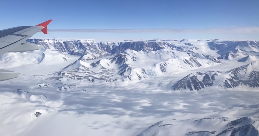 |
| Figure 2. A broader view of the Transantarctic Mountains shown at top—located along the coast near Terra Nova Bay, Antarctica—showing the top of the mountains’ ridge and the barricaded ice sheet. Here you can get a sense of the massive scale (both extent and depth) of the ice sheet. |
These mountains also interact with the Antarctic winds to create one of Earth’s most extreme environments: Antarctic Dry Valleys. In these spots, winds rapidly descend over the mountains, drying adiabatically as they drop and funneling very dry air into the valleys. Most of the time, there is almost no water present in the valleys in any form, as the ice sheet is blocked from entering these valleys by the mountains, and any snow that falls rapidly disappears in the face of the dry wind through sublimation (going directly from ice to water vapor without melting in between).
Despite the incredibly dry and cold conditions, life exists here in the form of photosynthetic bacteria that live within rocks. The extreme conditions of these valleys have led researchers to study them as analogs to Mars.
Ice runways
Airfields and runways in Antarctica are created by flattening a strip of snow on the ice sheet or on sea ice. The runway at Terra Nova Bay where we first landed in Antarctica is Terra Nova Bay: the sea ice is so thick that it makes a sturdy and safe base for a landing (at least at this time of year before the height of summer). No runway lights and a lack of contrast between snow airstrips and the surroundings means that landings are not possible at night or during overcast and snowy conditions. Flights to Antarctica are commonly delayed for many days while waiting for cooperative weather, and some flights have flown nearly all the way to their destination before having to turn back around when landing conditions were not optimal. Weather forecasts and observations are therefore very important, and the new weather stations that we are installing in EAIIST will be able to provide valuable additional data to pilots and forecasters.
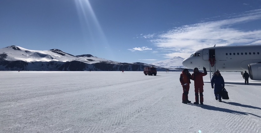 |
| Figure 3. Disembarking on the snow runway constructed on the sea ice of Terra Nova Bay, Antarctica. |
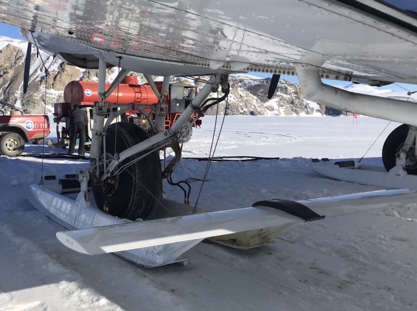 |
| Figure 4. Ski-equipped landing gear for a plane that travels between stations in Antarctica. |
Once landed at one of the main runways in Antarctica, smaller planes provide flights between the different scientific stations. In our flight to Antarctica, we were joined by numerous Italian, South Korean, and French staff all leaving from Hobart to go to various stations. People going to Concordia station (the all-year French-Italian station at the top of the ice sheet) had a plane waiting at Terra Nova Bay to immediately take them on the next leg of their trip. Our EAIIST team members stayed one night at Mario Zucchelli station before a flight was able to take us to our destination of Cap Prud’homme (the mechanical and logistics base for French traverses, located a couple of miles from Dumont d’Urville station).
While only at Zucchelli one night, we enjoyed the sight of the nearby Mount Melbourne volcano and the self-serving ice cream station (current flavors: pistachio and coffee) and espresso bar.
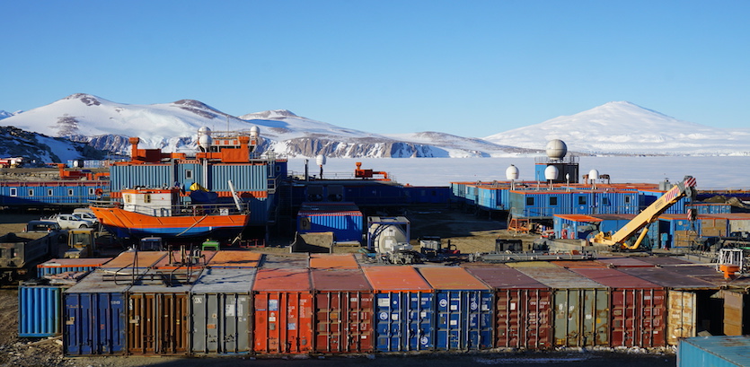 |
| Figure 5. The Italian Mario Zucchelli Station, with the 9000-ft (2700-m) stratovolcano Mt. Melbourne in the background and frozen Terra Nova Bay (site of the airstrip) in between. |
The environment of Adélie Land
Unlike the area around Mario Zucchelli station, the coast of Adélie Land where Dumont d’Urville and Cap Prud’homme stations are located has no mountains. Instead, the East Antarctic Ice Sheet is free to flow directly into the Southern Ocean. Except for a few rocky islets covered in penguins and seals, the entire landscape is ice, with the Astrolabe glacier looming several hundred feet over the frozen ocean. With the summer solstice fast approaching here, the sea ice near shore is still over 4 ft (1.3 m), thick and vehicles regularly drive the 2.8 miles (5 kilometers) across the frozen sea surface between Cap Prud’homme on the mainland and the island-based Dumont d’Urville. However, every day we see the open water on the horizon getting closer as winds and warming spring waters break up the sea ice. In a month, the local sea ice will largely be all gone, restricting travel between the two stations to helicopter or boat. As of yet, our dining room view over the ocean is still spectacular, with scattered massive icebergs emerging out of the frozen sea and catching the last light of the long polar day.
 |
| Figure 6. Cap Prud’homme station, the French base for traverse logistics and vehicle maintenance. The Dumont d’Urville Station is located on the island slightly right of photo center. The flat region between the stations is the frozen ocean, and the ice road between the two stations can be seen at right. Dark points rising out of the sea ice are rocky islands, while the white peaks are all icebergs. What looks like ridges on the far horizon are actually massive icebergs from the Astrolabe glacier; from this view, there’s nothing beyond Dumont d’Urville’s island but ocean for thousands of miles. |
One ever-present part of life in an Antarctic coastal station is wind. Winds in Antarctica generally blow from the highest points of the ice sheets (the domes) toward the coasts. These are the katabatic winds, and they form as the cold dense air at the domes flow downhill under the force of gravity. This frigid air is already very dry, but as the wind descends in elevation, it warms and dries adiabatically while gathering speed. If this sounds familiar, you might be thinking of the Santa Ana and Diablo winds of California, which are also katabatic winds. In that much warmer environment, the descending hot, dry air can fuel catastrophic wildfires.
Unlike California’s balmy air, the Antarctic air starts off so cold (usually colder than –40°F/C) that the winds are still frigid even after adiabatic warming. By the time the katabatic winds reach the coast, the wind is generally blowing at least 10-20 mph (16-32 km/hr) and can reach hurricane force speeds when an offshore low pressure system increases the pressure gradient. Katabatic winds at Dumont d’Urville have reached over 200 mph (320 km/hr) in the past; during our stay so far, winds have gusted over 80 mph (130 km/hr) and sculpted some impressive drifts around our caravan.
These chilly winds aren’t all bad, though; they help speed up the sea ice break-up in summer that allows ships to resupply the stations. They are also critical to the local environment, as the persistent winds keep sea ice from forming in some spots even in winter. These open water patches are called polynya, and they are crucial spots where Antarctic wildlife like penguins, terns, and seals can access the ocean for feeding year-round.
And while the lack of coastal mountains in Adélie Land prevents the formation of dry valleys like near McMurdo, the strong winds here at Cap Prud’homme still scour away snow from the coastal ice sheet, leaving vast expanses of polished ice that glows blue in the light. The blue color is because this ice originated from deep under the ice sheet’s surface, and the pressure drove out most of the air bubbles. In this very pure and dense ice, red light is absorbed more than blue light, giving the ice its blue tint. In other places in Antarctica, similar “blue ice” zones have been found to contain ice up to 1.5 million years old. Concentrations of meteorites can also be found in these zones.
EAIIST traverse preparation
Work preparing for the traverse continues no matter the weather. Our first week at Cap Prud’homme mostly involved unpacking and inspecting the gear and equipment that came by ship from France. Much of gear crates are moved by hand, but luckily heavy equipment equipped with snow treads are available at Prud’homme to help with the heaviest equipment, such as the seismic stations and large batteries.
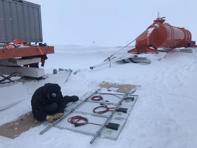 |
| Figure 7. EAIIST team member Mathieu Casado assembles solar panels at Cap Prud’homme for later use at a seismic station installed as part of EAIIST. |
While the members of EAIIST worked on repacking and calibrating equipment, the great mechanical team from Prud’homme were busy tuning the snow tractors that will pull the traverse sleds, filling and moving fuel tanks, and installing communications equipment. All this work is performed outside (even the vehicle maintenance) in temperatures hovering around 20 to 35°F (–8 to 2°C), and often with strong winds and/or snow. Luckily, the French polar program gives a well-stocked polar clothing set to all workers and researchers, and warmth is only an extra layer away.
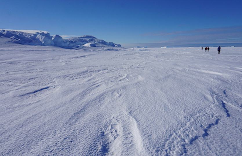 |
| Figure 8. Members of Project EAIIST hike across the sea ice near the French Dumont d’Urville Station, Adélie Land, Antarctica, on November 19, 2019. |
Two days before we leave on our traverse, some of the Cap Prud’homme staff will forge ahead on their supply traverse to Concordia. In total, their caravan will consist of six snow tractors pulling 13 fuel tanks, six containers of restocking supplies, and two living quarters.
We will follow their tracks with our own caravan, quickly ascending the steep coastal ice sheet slope and leaving the wildlife, mild temperatures, and ocean views behind for the vast snowy expanse of the East Antarctic Plateau.
Pete Akers has created this and other articles in this series in his personal capacity. The views expressed are his own and do not necessarily represent the views of IGE, CNRS, IPEV, or EAIIST.


