Bavi, a western Pacific storm, will rapidly intensify and head toward the Northern Marianas and Guam. Here's the latest forecast and what you need to know.
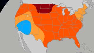
July's outlook for the U.S. has become tricky, especially with how long heat will last. Here's our latest thinking not only on temperatures, but also rainfall.
On average, hundreds die each year in the U.S. due to heat, more than any other weather. Here's why it's deadlier than lightning, tornadoes and hurricanes.
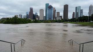
After Tropical Storm Arthur's brush near Houston, you may wonder if a hurricane is a concern for some World Cup cities. Here's what history shows through July.