Here's how hot and humid the World Cup cities in the U.S., Mexico and Canada typically are in June and July, and how much it's increasing in a warming world.
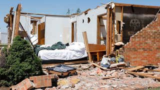
A tornado that struck Bogue Chitto, Mississippi, wrecked all but one of the 25 mobile homes in the Wash Trailer Park. But amid the rubble, a storm chaser and search-and-rescue volunteer with the United Cajun Navy found two kittens that somehow survived. Now they have a new forever home.