Skip to Main Content
_
Sensor Network
Maps & Radar
Severe Weather
News & Blogs
Mobile Apps
More
Search
close
gps_fixed
gps_fixed
Find Nearest Station
Manage Favorite Cities
Log In
Go Ad Free
account_box
Log in
Go Ad Free
settings
Settings
Sensor Network
Maps & Radar
Severe Weather
News & Blogs
Mobile Apps
Historical Weather
star
Current Weather for
Popular
Cities
San Francisco, CA
51
°
F
Mostly Cloudy
Manhattan, NY
51
°
F
Cloudy
Schiller Park, IL (60176)
warning
65
°
F
Fair
Boston, MA
53
°
F
Partly Cloudy
Houston, TX
77
°
F
Cloudy
St James's, England, United Kingdom
61
°
F
Cloudy
Search
close
gps_fixed
gps_fixed
Find Nearest Station
Manage Favorite Cities
settings
--
Feels like
--
--
--
/
--
--
--
--
--
--
--
--
--
--
12AM
6AM
NOON
6PM
12AM
May 13
+0000
May 14
Full Forecast
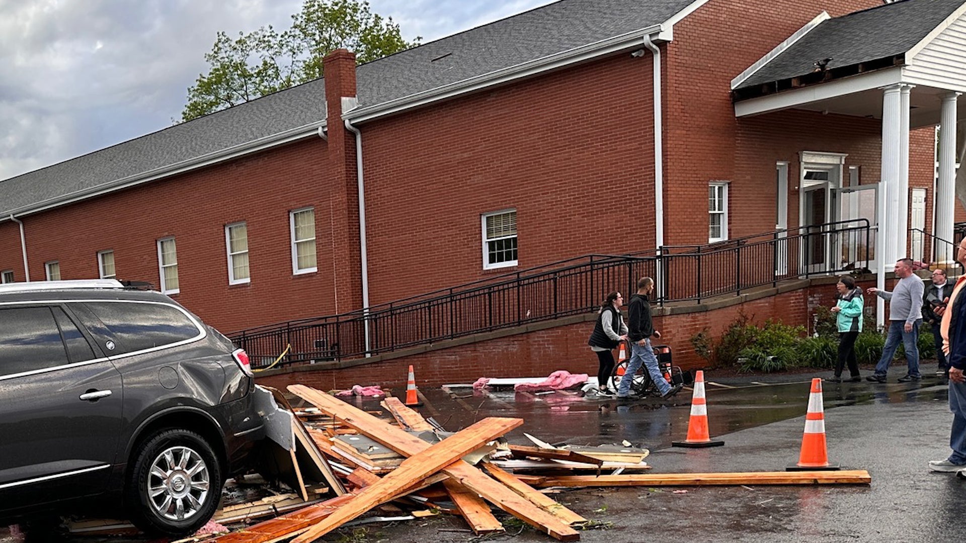
Twister Hits Pennsylvania Church Packed With People
A church was filled with people when a tornado touched down in Finleyville, Pennsylvania. Watch the video to see what happened in the town just south of Pittsburgh.
Twister Hits Pennsylvania Church Packed With People
Stormy Pattern In South Could Produce Severe Weather
Scattered severe storms and heavy rain will affect the South this week. The Midwest and East will also see a wet weather at times this week.
Stormy Pattern In South Could Produce Severe Weather
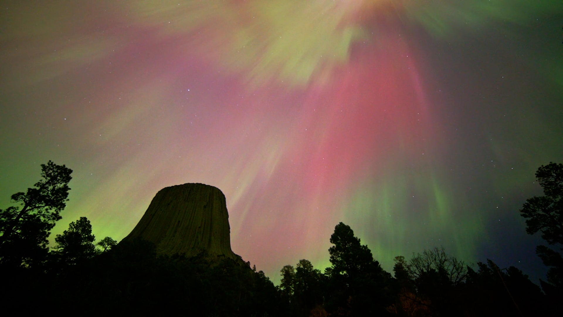
Watch: Time-Lapse Of The Weekend's Stunning Celestial Show
The brilliant weekend northern lights display across the U.S. is your moment of Zen. Watch this video to see it in time lapse.
Watch: Time-Lapse Of The Weekend's Stunning Celestial Show
Goofy Pet Photo Award Finalists Revealed; The Images Are Hilarious
There’s a grinning donkey, some goofy horses, and a lot of funny cats and dogs. Which is your favorite Comedy Pet Photo Award finalist?
Goofy Pet Photo Award Finalists Revealed; The Images Are Hilarious
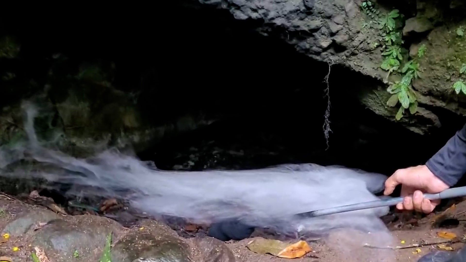
The 'Cave Of Death' Explained
See why the Cave of Death, or Cueva de la Muerte, has a lethal “dead zone.”
The 'Cave Of Death' Explained
Please enable JavaScript to continue using this application.