Skip to Main Content
_
Sensor Network
Maps & Radar
Severe Weather
News & Blogs
Mobile Apps
More
Search
close
gps_fixed
gps_fixed
Find Nearest Station
Manage Favorite Cities
Log In
Go Ad Free
account_box
Log in
Go Ad Free
settings
Settings
Sensor Network
Maps & Radar
Severe Weather
News & Blogs
Mobile Apps
Historical Weather
star
Current Weather for
Popular
Cities
San Francisco, CA
warning
63
°
F
Partly Cloudy
Manhattan, NY
56
°
F
Cloudy
Schiller Park, IL (60176)
warning
79
°
F
Mostly Cloudy
Boston, MA
59
°
F
Partly Cloudy
Houston, TX
81
°
F
Cloudy/Wind
St James's, England, United Kingdom
47
°
F
Rain
Search
close
gps_fixed
gps_fixed
Find Nearest Station
Manage Favorite Cities
settings
warning
Active Advisory
:
Small Craft Advisory
(
See More
)
--
Feels like
--
--
--
/
--
--
--
--
--
--
--
--
--
--
12AM
6AM
NOON
6PM
12AM
Apr 27
+0000
Apr 28
Full Forecast
Particularly Dangerous Situation Declared Amid Ongoing Threat
A tornado outbreak is in progress across the Plains and Midwest. Here's the latest.
Particularly Dangerous Situation Declared Amid Ongoing Threat
Hold Tight, More Tornadoes Expected Today
The chance of tornadic storms continues in the Plains. Here's what to know.
Hold Tight, More Tornadoes Expected Today
Intense Video Shows Nebraska Tornado’s Massive Debris Vortex
Frightening footage captured the moments a tornado tore through Lincoln, Nebraska, creating a massive, swirling mass of debris.
Intense Video Shows Nebraska Tornado’s Massive Debris Vortex
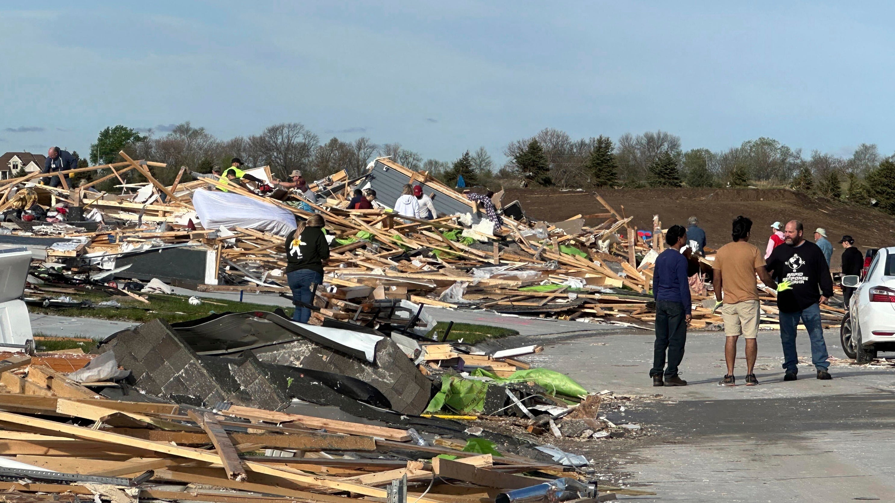
Violent Tornado Outbreak Hits Multiple States; Shocking Scenes In Omaha Suburb
Tornadoes and damaging severe weather moved across parts of the Plains Friday, causing widespread damage to homes and buildings in Iowa and Nebraska.
Violent Tornado Outbreak Hits Multiple States; Shocking Scenes In Omaha Suburb
This Is Another Forecast That Should Grab Your Attention
This is another forecast that should grab your attention.
This Is Another Forecast That Should Grab Your Attention
Please enable JavaScript to continue using this application.