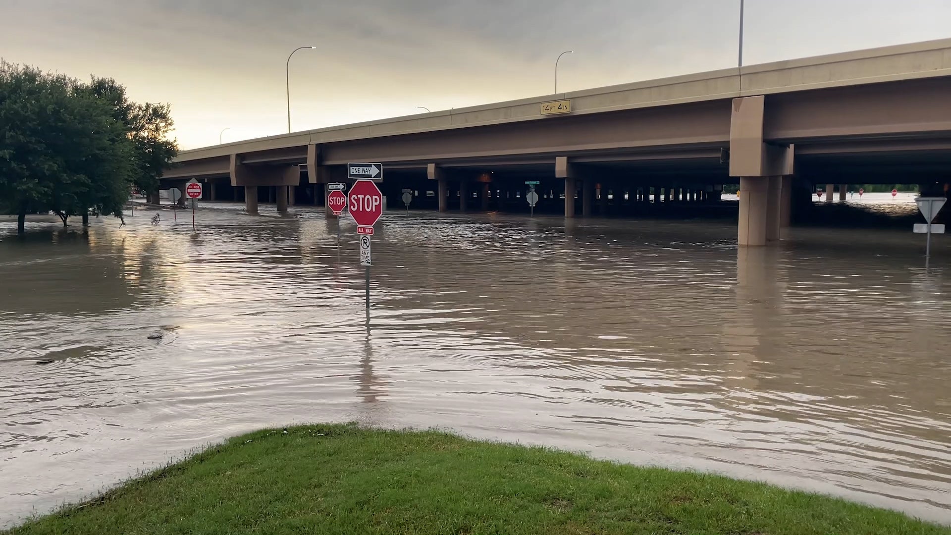
Texas once again faced the wrath of spring severe storms with the latest storms bringing destructive hail, powerful winds and flooding to parts of the Lone Star State. Some residents were still recovering from the last round of damaging storms.
While on stage in Madrid during the European leg of her Eras Tour, Taylor Swift called for assistance for an overheating fan in the audience. Outside temperatures soared during the day and temperatures inside the cramped stadium were made intolerable.
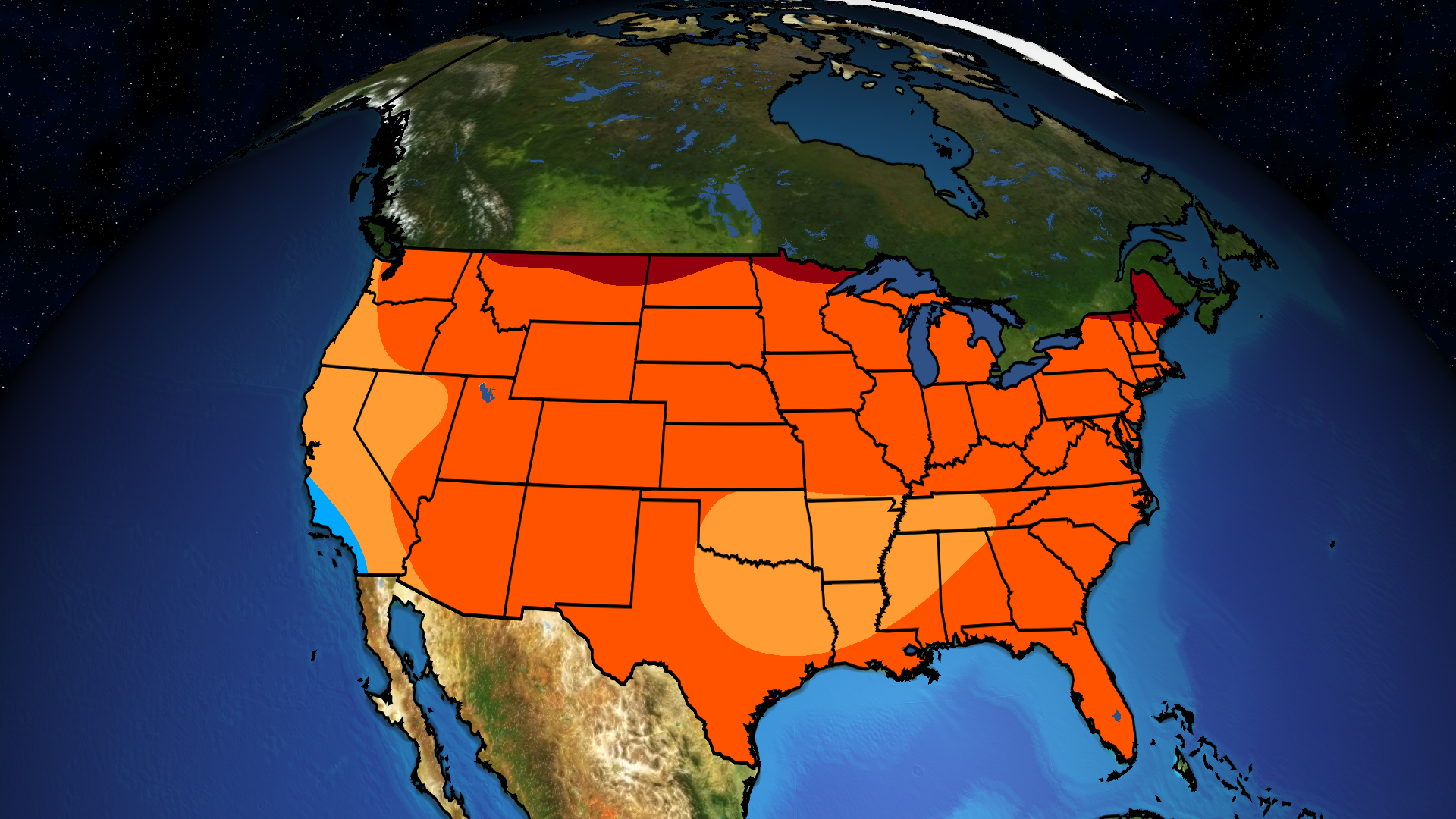
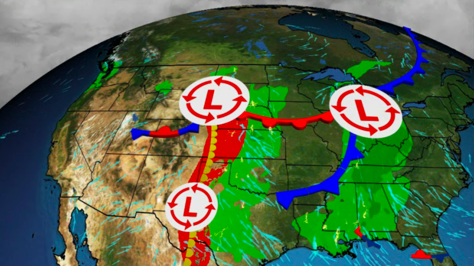
Multiple systems bring the threat of severe weather and flash flooding to the central and southern U.S. through this weekend. Here’s what you need to know as you make your weekend plans.