Skip to Main Content
_
Sensor Network
Maps & Radar
Severe Weather
News & Blogs
Mobile Apps
More
Search
close
gps_fixed
gps_fixed
Find Nearest Station
Manage Favorite Cities
Log In
Go Ad Free
account_box
Log in
Go Ad Free
settings
Settings
Sensor Network
Maps & Radar
Severe Weather
News & Blogs
Mobile Apps
Historical Weather
star
Current Weather for
Popular
Cities
San Francisco, CA
warning
63
°
F
Sunny/Wind
Manhattan, NY
warning
70
°
F
Partly Cloudy
Schiller Park, IL (60176)
69
°
F
Cloudy
Boston, MA
57
°
F
Partly Cloudy
Houston, TX
warning
80
°
F
Partly Cloudy
St James's, England, United Kingdom
52
°
F
Clear
Search
close
gps_fixed
gps_fixed
Find Nearest Station
Manage Favorite Cities
settings
warning
Active Advisory
:
Small Craft Advisory
(
See More
)
--
Feels like
--
--
--
/
--
--
--
--
--
--
--
--
--
--
12AM
6AM
NOON
6PM
12AM
Apr 29
+0000
Apr 30
Full Forecast
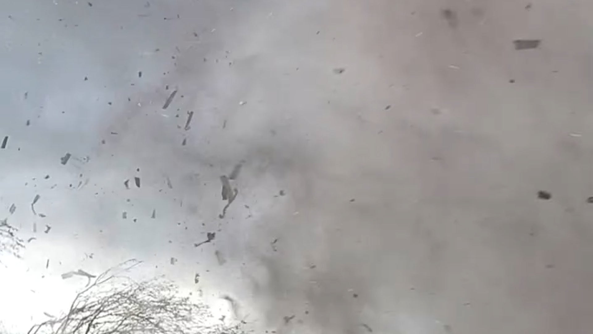
Intense Video Shows Nebraska Tornado’s Massive Debris Vortex
Frightening footage captured the moments a tornado tore through Lincoln, Nebraska, creating a massive, swirling mass of debris.
Intense Video Shows Nebraska Tornado’s Massive Debris Vortex
Bracing For Another Round Of Severe Weather
True to spring's nature, more rounds of severe weather are possible in the Plains and Midwest. Here's what to know.
Bracing For Another Round Of Severe Weather
When Will Your City Feel The Heat? The Incoming First 90-Degree Temps
We are heading into the time of year many cities see their first 90s. Here's when that happens, on average, by region.
When Will Your City Feel The Heat? The Incoming First 90-Degree Temps
The Growing Controversy Between Tourists And This Famous Landmark
Police have issued several citations and warnings since beginning to remove Hawaii’s famed Haiku Stairs, also known as “The Stairway to Heaven.”
The Growing Controversy Between Tourists And This Famous Landmark
Watch The Moment A Tornado Roars Into A Train In Nebraska
A train conductor in Lincoln, Nebraska, stayed calm and kept recording as he watched a tornado get closer and closer to his train on Friday. Watch what happened as the twister hit the train with the conductor and engineer inside.
Watch The Moment A Tornado Roars Into A Train In Nebraska
Please enable JavaScript to continue using this application.