Skip to Main Content
_
Sensor Network
Maps & Radar
Severe Weather
News & Blogs
Mobile Apps
More
Search
close
gps_fixed
gps_fixed
Find Nearest Station
Manage Favorite Cities
Log In
Go Ad Free
account_box
Log in
Go Ad Free
settings
Settings
Sensor Network
Maps & Radar
Severe Weather
News & Blogs
Mobile Apps
Historical Weather
star
Current Weather for
Popular
Cities
San Francisco, CA
65
°
F
Sunny
Manhattan, NY
warning
63
°
F
Fair
Schiller Park, IL (60176)
warning
55
°
F
Rain
Boston, MA
58
°
F
Partly Cloudy
Houston, TX
warning
81
°
F
Mist
St James's, England, United Kingdom
73
°
F
Fair
Search
close
gps_fixed
gps_fixed
Find Nearest Station
Manage Favorite Cities
settings
--
Feels like
--
--
--
/
--
--
--
--
--
--
--
--
--
--
12AM
6AM
NOON
6PM
12AM
May 9
+0000
May 10
Full Forecast
Live Updates: Tornado Damage In Multiple States, Death Toll Rises
Check back frequently all day for the latest updates.
Live Updates: Tornado Damage In Multiple States, Death Toll Rises
Severe Weather Expected To Bring Tornadoes, Wind, Hail, And Flooding
The fourth day of a severe thunderstorm outbreak will spread through the South and East Thursday. Here's a look at the forecast.
Severe Weather Expected To Bring Tornadoes, Wind, Hail, And Flooding
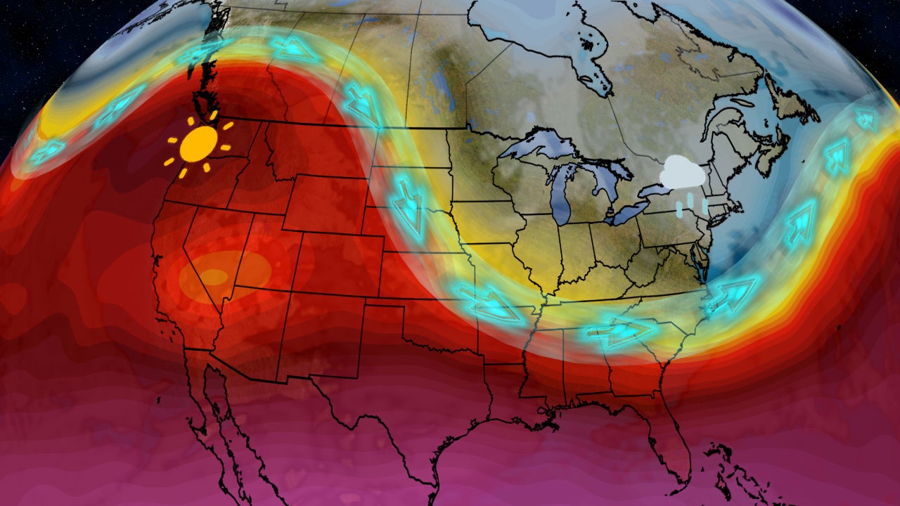
Pattern Change Ahead; What That Means For Your Forecast
Feel like your weather has been stuck in a rut? Here are the changes ahead.
Pattern Change Ahead; What That Means For Your Forecast
Tennessee Flash Flood Emergency: Springfield Inundated
A Tennessee town was hit hard and fast by floodwaters just hours after facing a tornado warning. Here’s a look at how the scene played out.
Tennessee Flash Flood Emergency: Springfield Inundated
Disneyland's Billion Dollar Expansion Plan Gets The Green Light
Disneyland has cleared the final hurdle to a major expansion of its beloved theme parks. See what new attraction could be in store and why Disneyland won’t actually be getting bigger.
Disneyland's Billion Dollar Expansion Plan Gets The Green Light
Please enable JavaScript to continue using this application.