Skip to Main Content
_
Sensor Network
Maps & Radar
Severe Weather
News & Blogs
Mobile Apps
More
Search
close
gps_fixed
gps_fixed
Find Nearest Station
Manage Favorite Cities
Log In
Go Ad Free
account_box
Log in
Go Ad Free
settings
Settings
Sensor Network
Maps & Radar
Severe Weather
News & Blogs
Mobile Apps
Historical Weather
star
Current Weather for
Popular
Cities
San Francisco, CA
56
°
F
Clear
Manhattan, NY
61
°
F
Fair
Schiller Park, IL (60176)
71
°
F
Partly Cloudy
Boston, MA
56
°
F
Partly Cloudy
Houston, TX
warning
80
°
F
Partly Cloudy
St James's, England, United Kingdom
54
°
F
Cloudy
Search
close
gps_fixed
gps_fixed
Find Nearest Station
Manage Favorite Cities
settings
--
Feels like
--
--
--
/
--
--
--
--
--
--
--
--
--
--
12AM
6AM
NOON
6PM
12AM
May 21
+0000
May 22
Full Forecast
A Triple Threat Is Headed To The Plains
A pattern change means the threat of severe weather has returned to the Plains and Midwest this week.
A Triple Threat Is Headed To The Plains
Dazzling Solar Activity Thrills Arizona Skywatchers
A timelapse captured in an Arizona backyard shows solar activity swirling from the sun.
Dazzling Solar Activity Thrills Arizona Skywatchers
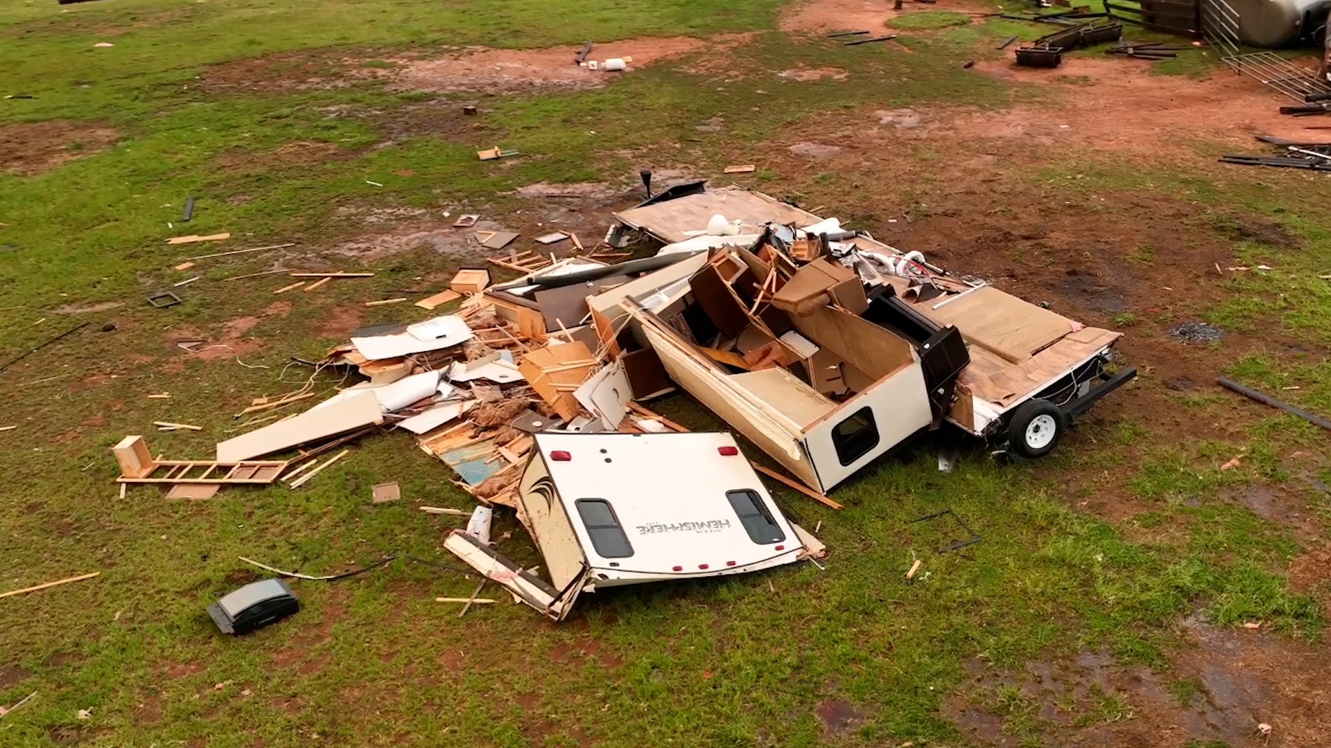
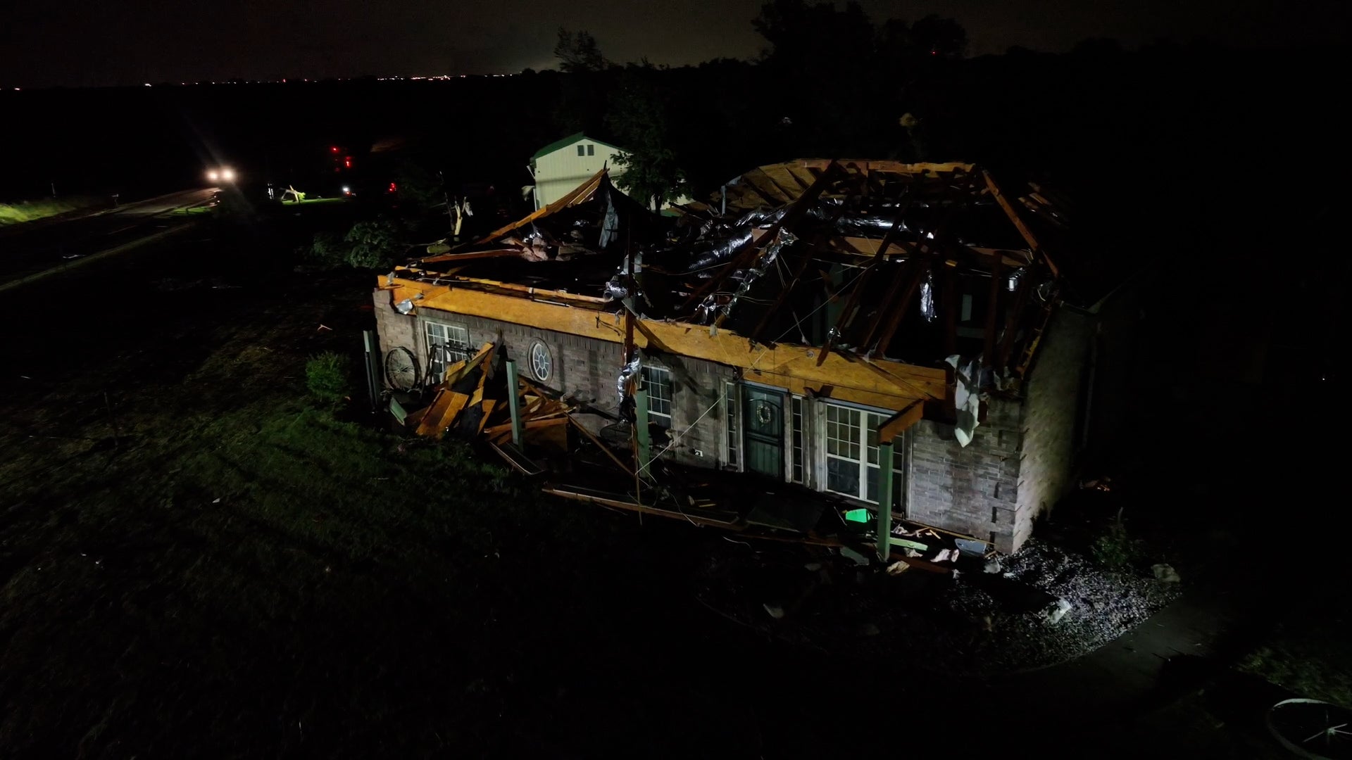
Tornadoes, Hail, A Dust Storm! Severe Weather Pounds The Plains
It was a long Sunday night for several towns in Oklahoma and Kansas as a round of powerful storms rolled into the region. Tornadoes left severe damage and a dust storm made travel nearly impossible. Here’s a look at every angle of these storms.
Tornadoes, Hail, A Dust Storm! Severe Weather Pounds The Plains
10-Year-Old Dies After Being Swept Into Tennessee Storm Drain
A community in Tennessee is mourning the loss of a 10-year-old who died from his injuries after being swept into a storm drain.
10-Year-Old Dies After Being Swept Into Tennessee Storm Drain
Tornado Shreds Homes In Central Oklahoma
Multiple tornadoes slammed central Oklahoma Sunday night. One of the hardest-hit areas was Yukon, where drone footage shows how homes were torn apart.
Tornado Shreds Homes In Central Oklahoma
Please enable JavaScript to continue using this application.