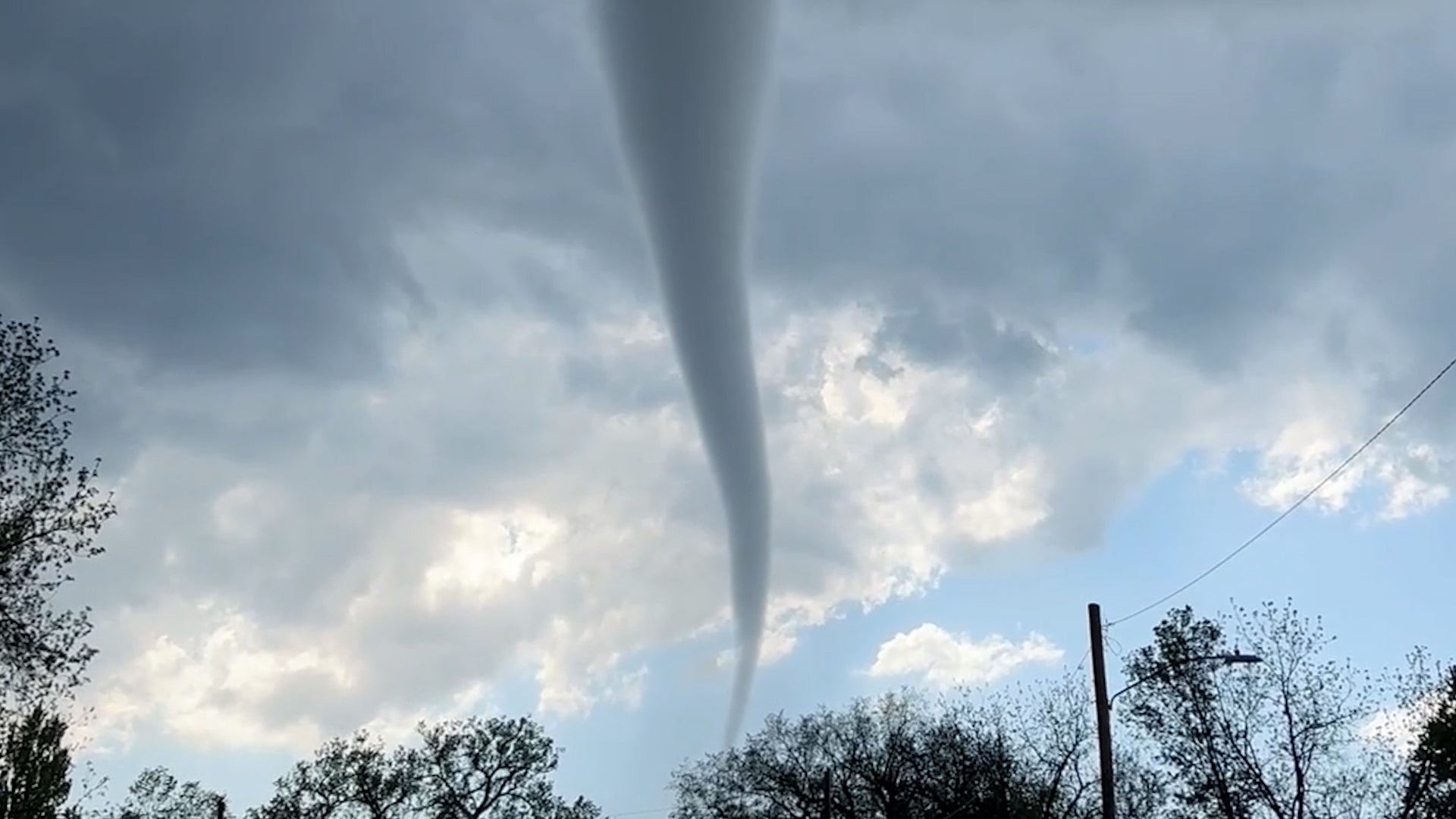
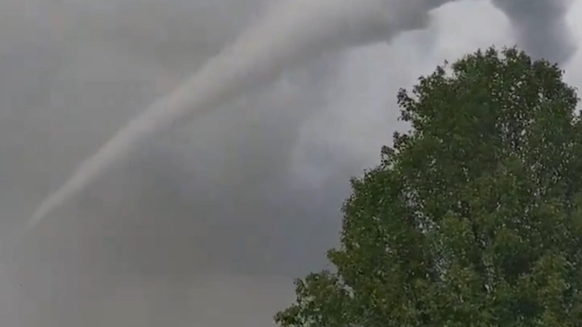
Gatlinburg, TN

6:22 AM EDT on May 21, 2013 (GMT -0400)
Elev: 1312 ft
Lon: 83.5° W
Lat: 35.7° N
Source
Rapid Fire Updates™
Updated 6:20 AM EDT Get Free Weather Stickers® Share:
Your Custom Weather Sticker®

Copy the following lines of HTML:
News
May 21, 2013
Parents hope to be reunited with their missing children.
May 21, 2013
Moore, Oklahoma is no stranger to devastating tornadoes.
May 20, 2013
The Salvation Army says it is activating disaster response teams and mobile feeding units to help residents and rescuers in Moore.
May 21, 2013
On May 20, 2013, a large deadly tornado ripped through the Oklahoma City area. Click to read the timeline of the tornado event
May 21, 2013
Several children have been pulled out of the rubble alive at a school in an Oklahoma City suburb.
May 21, 2013
President Barack Obama has declared a major disaster in Oklahoma as the state recovers from a massive tornado that ripped through the Oklahoma City suburbs Monday, killing dozens and flattening entire neighborhoods.
May 21, 2013
A monstrous tornado as much as a mile wide roared through the Oklahoma City suburbs Monday, flattening entire neighborhoods, setting buildings on fire and landing a direct blow on an elementary school.
May 20, 2013
Catastrophic tornadoes developed in Oklahoma on Monday. Here are photos and social media reports.
May 20, 2013
The moon has a new hole on its surface thanks to a boulder that slammed into it in March, creating the biggest explosion scientists have seen on the moon since they started monitoring it.
May 20, 2013
Chinese authorities say rainstorms that battered southern China this week have killed 55 people and left 14 others missing.
May 20, 2013
A tornado outbreak struck the Plains states on May 19, 2013, leaving widespread damage in its wake.
May 20, 2013
The weather imagery, video and recap from tornadoes in the Plains on May 19, 2013.
May 20, 2013
These stunning images of nature captured across the globe will change the way you view our world.
May 20, 2013
Photos and social media reports of severe weather damage over the weekend in Oklahoma, Iowa and Kansas.
May 20, 2013
Continuing coverage of destructive severe weather.
May 19, 2013
A tornado kicked up debris in an Oklahoma City suburb and threatened a number of tourist attractions on historic Route 66 but there were no immediate reports of injuries or major damage.
May 19, 2013
State emergency officials are monitoring a tornado in the Wichita area.
May 20, 2013
The latest breaking news from the scene, tornado warnings, photos and more.
May 19, 2013
Mice and other critters return from a month long stay in space.
May 20, 2013
Some locations have seen 5 to 6 inches of rainfall.
Weather Summary
Weather Underground Forecast for Tuesday, May 21, 2013.

After a devastating severe weather day in the Plains on Monday, severe weather is expected to fire up again across the nation's mid-section again on Tuesday.

The nearly stationary low over the Northern Plains will gradually weaken as it shifts eastward into the Midwest on Tuesday, while the system's associated cold front trails southwestward from the low across the Mid-Mississippi Valley through the Southern Plains. Favorable energy and conditions ahead of the cold front combined with the moisture laden conditions of the nation's mid-section will set the stage for multiple clusters of thunderstorms to develop from the Midwest into the Ozarks and the Southern Plains. Portions of northeastern Texas, extreme southeastern Oklahoma, central and southern Arkansas, and northwestern Louisiana are at moderate risk of severe thunderstorm activity as environmental conditions remain favorable for tornadoes, damaging wind gusts, and very large hail. Areas surrounding this moderate risk region from the parts of central and eastern Texas into the Upper Great Lakes are at slight risk of severe thunderstorm development with hail, damaging wind gusts, and isolated tornadoes.

Meanwhile, areas of heavy rain and widely scattered showers will continue near the low in the Northern Plains and Upper Mississippi Valley and near and to the north of a nearly stationary frontal boundary extending out ahead of the system from the Great Lakes into the Northeast. Continued precipitation in already saturated areas of the Northern Plains and Upper Midwest will maintain flood concerns from parts of North Dakota into northern Wisconsin.

Elsewhere, scattered showers and thunderstorms are expected to persist in the Mid-Atlantic and southeastern corner of the nation.

Gatlinburg Weather at a Glance

Updated 6:20 AM EDT
Elevation
1586 ft
Report Station
You are about to report this weather station for bad data.

Please select the information which is incorrect and click 'Submit' otherwise click 'Cancel'.

Cancel

Now
Scattered Clouds
Scattered Clouds
Temperature
60.2 °F
Feels Like 60.2 °F
Wind(mph)
0.0
Sunrise / Set
6:24 AM
8:37 PM
Moon
Waxing Gibbous
Today
Chance of a Thunderstorm 88 °F
Chance of a Thunderstorm
20% chance of precipitation
Tonight
Partly Cloudy 57 °F
Partly Cloudy
20% chance of precipitation
Tomorrow
Thunderstorm 82 | 61 °F
T-storms
60% chance of precipitation
Thursday
Chance of a Thunderstorm 82 | 57 °F
Chance of T-storms
30% chance of precipitation
Friday
Chance of Rain 73 | 41 °F
Chance of Rain
20% chance of precipitation
Saturday
Partly Cloudy 73 | 48 °F
Partly Cloudy
Today is forecast to be Warmer than yesterday.
Conditions
Pressure
30.02 in
Visibility
3.0 miles
Clouds
Scattered Clouds 3500 ft
Moisture
Humidity
98%
Rainfall
0.00 in
Snow Depth
Not available.
METAR
SPECI KTYS 211018Z 00000KT 3SM BR SCT035 19/18 A3002 RMK AO2 FG BANK SW
Don't speak METAR? Read our FAQ.
Weather Radio
Temperature
Temperature
60.2 °F
84,82,80,76,73,73,72,71,71,69,71,68,67
Dew Point
60 °F
Wind
Speed / Dir
Calm
Wind Gust
0.0 mph
Health
0 out of 16
Pollen
5.90 out of 12
Pollen Forecast
Air Quality
Not available.
Flu Activity
No Activity
View Flu Map
Loading…
Source: BestForecast
Descriptive Forecast
Tuesday
partlycloudy Partly cloudy with a chance of a thunderstorm and a chance of rain in the afternoon. High of 88F. Winds from the SW at 5 to 10 mph. Chance of rain 20%.
Tuesday Night
nt_partlycloudy Partly cloudy with a chance of a thunderstorm and a chance of rain. Fog overnight. Low of 57F. Winds from the South at 10 to 15 mph. Chance of rain 20%.
Wednesday
tstorms Partly cloudy with a chance of a thunderstorm and a chance of rain, then thunderstorms and rain showers in the afternoon. High of 82F. Winds from the SSW at 5 to 10 mph. Chance of rain 60%.
Wednesday Night
nt_tstorms Overcast with thunderstorms and rain showers, then a chance of a thunderstorm and a chance of rain after midnight. Low of 61F. Winds from the SW at 5 to 10 mph. Chance of rain 40%.
Thursday
chancetstorms Partly cloudy with a chance of a thunderstorm and a chance of rain. High of 82F. Winds from the WSW at 5 to 10 mph. Chance of rain 30%.
Thursday Night
nt_tstorms Partly cloudy with thunderstorms and a chance of rain in the evening, then overcast with a chance of rain. Low of 57F. Winds from the WNW at 5 to 10 mph. Chance of rain 40%.
Friday
partlycloudy Overcast with a chance of rain in the morning, then clear. High of 73F. Winds from the NNW at 5 to 10 mph. Chance of rain 20%.
Friday Night
nt_clear Clear in the evening, then partly cloudy. Low of 41F. Winds from the NNE at 5 to 10 mph.
Saturday
partlycloudy Partly cloudy. High of 73F. Winds from the NNE at 5 to 10 mph.
Saturday Night
nt_mostlycloudy Mostly cloudy. Low of 48F. Winds less than 5 mph.
Sunday
partlycloudy Partly cloudy. High of 86F. Winds less than 5 mph.
Sunday Night
nt_cloudy Overcast. Low of 59F. Winds less than 5 mph.
Monday
cloudy Overcast. High of 81F. Winds less than 5 mph.
Monday Night
nt_partlycloudy Partly cloudy. Low of 59F. Winds less than 5 mph.
Tuesday
partlycloudy Partly cloudy with a chance of a thunderstorm. High of 77F. Winds from the WSW at 5 to 10 mph. Chance of rain 20%.
Tuesday Night
nt_partlycloudy Partly cloudy. Low of 61F. Winds less than 5 mph.
Wednesday
partlycloudy Partly cloudy. High of 81F. Winds less than 5 mph.
Wednesday Night
nt_partlycloudy Partly cloudy. Low of 63F. Winds less than 5 mph.
Thursday
partlycloudy Partly cloudy. High of 82F. Winds less than 5 mph.
Thursday Night
nt_partlycloudy Partly cloudy. Low of 64F. Winds less than 5 mph.
Friday
partlycloudy Clear. High of 82F. Winds less than 5 mph.
Friday Night
nt_partlycloudy Clear. Low of 64F. Winds less than 5 mph.
Loading…
 
First Previous Last Next  
Updated:  


Weather Forecast for Gatlinburg TN

View Calendar 10-Day Forecast for station KTNSEVIE4

Tuesday, 21
Chance of a Thunderstorm
88 | 57 °F
Chance of a Thunderstorm
Chance of
Precipitation
20%
Wednesday, 22
Thunderstorm
82 | 61 °F
T-storms
Chance of
Precipitation
60%
Thursday, 23
Chance of a Thunderstorm
82 | 57 °F
Chance of T-storms
Chance of
Precipitation
30%
Friday, 24
Chance of Rain
73 | 41 °F
Chance of Rain
Chance of
Precipitation
20%
Saturday, 25
Partly Cloudy
73 | 48 °F
Partly Cloudy
Chance of
Precipitation
0%
Sunday, 26
Partly Cloudy
86 | 59 °F
Partly Cloudy
Chance of
Precipitation
0%
Monday, 27
Overcast
81 | 59 °F
Overcast
Chance of
Precipitation
0%
Tuesday, 28
Chance of a Thunderstorm
77 | 61 °F
Chance of a Thunderstorm
Chance of
Precipitation
20%
Wednesday, 29
Partly Cloudy
81 | 63 °F
Partly Cloudy
Chance of
Precipitation
0%
Thursday, 30
Partly Cloudy
82 | 64 °F
Partly Cloudy
Chance of
Precipitation
0%
Source: BestForecast at 4:09 AM EDT on May 21, 2013
Descriptive Forecast
Tuesday
partlycloudy Partly cloudy with a chance of a thunderstorm and a chance of rain in the afternoon. High of 88F. Winds from the SW at 5 to 10 mph. Chance of rain 20%.
Tuesday Night
nt_partlycloudy Partly cloudy with a chance of a thunderstorm and a chance of rain. Fog overnight. Low of 57F. Winds from the South at 10 to 15 mph. Chance of rain 20%.
Hourly Forecast 6AM 12 Noon 6PM 12 Midnight
Temp. | Dew Point 64 | 63 80 | 64 80 | 64 67 | 62
Wind 6 mph South 7 mph WSW 9 mph SSW 11 mph South
Humidity 96% 57% 56% 87%
Chance of Precip. 10% 10% 20% 20%
Cloud Cover 40% 45% 55% 41%
Conditions Partly Cloudy Partly Cloudy Chance of a Thunderstorm Chance of a Thunderstorm
Sunrise & Sunset
6:24 AM
8:37 PM
The quality of the forecasted high temperature for this day is good. MaxT RMSE [1.77], Average RMSE [1.90]
The National Weather Service forecast quality is excellent. MaxT RMSE [1.48], Average RMSE [2.70] : Use NWS
Source: BestForecast at 4:09 AM EDT on May 21, 2013
Descriptive Forecast
Wednesday
tstorms Partly cloudy with a chance of a thunderstorm and a chance of rain, then thunderstorms and rain showers in the afternoon. High of 82F. Winds from the SSW at 5 to 10 mph. Chance of rain 60%.
Wednesday Night
nt_tstorms Overcast with thunderstorms and rain showers, then a chance of a thunderstorm and a chance of rain after midnight. Low of 61F. Winds from the SW at 5 to 10 mph. Chance of rain 40%.
Hourly Forecast 6AM 12 Noon 6PM 12 Midnight
Temp. | Dew Point 61 | 59 78 | 64 71 | 63 64 | 62
Wind 9 mph South 8 mph SW 9 mph SSW 5 mph SSW
Humidity 93% 62% 73% 90%
Chance of Precip. 20% 50% 60% 50%
Cloud Cover 66% 64% 64% 91%
Conditions Chance of a Thunderstorm Chance of a Thunderstorm Thunderstorm Thunderstorm
Sunrise & Sunset
6:23 AM
8:37 PM
The quality of the forecasted high temperature for this day is excellent. MaxT RMSE [1.45], Average RMSE [1.99]
The National Weather Service forecast quality is good. MaxT RMSE [1.83], Average RMSE [2.73] : Use NWS
Source: BestForecast at 4:09 AM EDT on May 21, 2013
Descriptive Forecast
Thursday
chancetstorms Partly cloudy with a chance of a thunderstorm and a chance of rain. High of 82F. Winds from the WSW at 5 to 10 mph. Chance of rain 30%.
Thursday Night
nt_tstorms Partly cloudy with thunderstorms and a chance of rain in the evening, then overcast with a chance of rain. Low of 57F. Winds from the WNW at 5 to 10 mph. Chance of rain 40%.
Hourly Forecast 6AM 12 Noon 6PM 12 Midnight
Temp. | Dew Point 64 | 59 70 | 60 73 | 57 59 | 54
Wind 7 mph WSW 8 mph WSW 7 mph West 5 mph WNW
Humidity 84% 70% 57% 84%
Chance of Precip. 40% 30% 30% 20%
Cloud Cover 95% 60% 60% 68%
Conditions Chance of a Thunderstorm Chance of a Thunderstorm Chance of a Thunderstorm Chance of Rain
Sunrise & Sunset
6:23 AM
8:38 PM
The quality of the forecasted high temperature for this day is good. MaxT RMSE [1.61], Average RMSE [2.52]
The National Weather Service forecast quality is good. MaxT RMSE [2.20], Average RMSE [3.11] : Use NWS
Source: BestForecast at 4:09 AM EDT on May 21, 2013
Descriptive Forecast
Friday
partlycloudy Overcast with a chance of rain in the morning, then clear. High of 73F. Winds from the NNW at 5 to 10 mph. Chance of rain 20%.
Friday Night
nt_clear Clear in the evening, then partly cloudy. Low of 41F. Winds from the NNE at 5 to 10 mph.
Hourly Forecast 6AM 12 Noon 6PM 12 Midnight
Temp. | Dew Point 58 | 48 60 | 41 63 | 38 52 | 33
Wind 7 mph NW 8 mph NNW 9 mph NNW 6 mph NNE
Humidity 71% 52% 37% 50%
Chance of Precip. 20% 10% 10% 0%
Cloud Cover 99% 89% 0% 0%
Conditions Chance of Rain Overcast Clear Clear
Sunrise & Sunset
6:22 AM
8:39 PM
The quality of the forecasted high temperature for this day is fair. MaxT RMSE [2.63], Average RMSE [2.70]
The National Weather Service forecast quality is fair. MaxT RMSE [2.92], Average RMSE [3.19] : Use NWS
Source: BestForecast at 4:09 AM EDT on May 21, 2013
Descriptive Forecast
Saturday
partlycloudy Partly cloudy. High of 73F. Winds from the NNE at 5 to 10 mph.
Saturday Night
nt_mostlycloudy Mostly cloudy. Low of 48F. Winds less than 5 mph.
Hourly Forecast 6AM 12 Noon 6PM 12 Midnight
Temp. | Dew Point 46 | 31 67 | 33 71 | 40 60 | 35
Wind 4 mph NE 5 mph NNE 6 mph North 5 mph ENE
Humidity 56% 28% 33% 38%
Chance of Precip. 0% 0% 0% 0%
Cloud Cover 42% 14% 40% 78%
Conditions Partly Cloudy Clear Partly Cloudy Mostly Cloudy
Sunrise & Sunset
6:22 AM
8:40 PM
The quality of the forecasted high temperature for this day is good. MaxT RMSE [2.09], Average RMSE [3.42]
The National Weather Service forecast quality is fair. MaxT RMSE [3.38], Average RMSE [3.25] : Use NWS
Source: BestForecast at 4:09 AM EDT on May 21, 2013
Descriptive Forecast
Sunday
partlycloudy Partly cloudy. High of 86F. Winds less than 5 mph.
Sunday Night
nt_cloudy Overcast. Low of 59F. Winds less than 5 mph.
Hourly Forecast 6AM 12 Noon 6PM 12 Midnight
Temp. | Dew Point 53 | 34 72 | 46 74 | 50 62 | 45
Wind 3 mph ESE 3 mph NNW 5 mph WNW 2 mph SE
Humidity 49% 40% 43% 56%
Chance of Precip. 0% 0% 0% 0%
Cloud Cover 97% 3% 53% 100%
Conditions Overcast Clear Partly Cloudy Overcast
Sunrise & Sunset
6:21 AM
8:40 PM
The quality of the forecasted high temperature for this day is fair. MaxT RMSE [3.19], Average RMSE [3.80]
The National Weather Service forecast quality is fair. MaxT RMSE [3.17], Average RMSE [3.45] : Use NWS
Source: BestForecast at 4:09 AM EDT on May 21, 2013
Descriptive Forecast
Monday
cloudy Overcast. High of 81F. Winds less than 5 mph.
Monday Night
nt_partlycloudy Partly cloudy. Low of 59F. Winds less than 5 mph.
Hourly Forecast 6AM 12 Noon 6PM 12 Midnight
Temp. | Dew Point 61 | 48 74 | 51 77 | 56 62 | 52
Wind 2 mph South 5 mph West 3 mph WNW 3 mph South
Humidity 65% 45% 51% 66%
Chance of Precip. 0% 0% 0% 0%
Cloud Cover 100% 99% 98% 52%
Conditions Overcast Overcast Overcast Partly Cloudy
Sunrise & Sunset
6:21 AM
8:41 PM
The quality of the forecasted high temperature for this day is fair. MaxT RMSE [3.19], Average RMSE [3.97]
The National Weather Service forecast quality is fair. MaxT RMSE [3.35], Average RMSE [3.38] : Use NWS
Source: BestForecast at 4:09 AM EDT on May 21, 2013
Descriptive Forecast
Tuesday
partlycloudy Partly cloudy with a chance of a thunderstorm. High of 77F. Winds from the WSW at 5 to 10 mph. Chance of rain 20%.
Tuesday Night
nt_partlycloudy Partly cloudy. Low of 61F. Winds less than 5 mph.
Hourly Forecast 6AM 12 Noon 6PM 12 Midnight
Temp. | Dew Point 62 | 52 72 | 57 71 | 60 66 | 62
Wind 4 mph SSW 5 mph West 4 mph West 5 mph SSW
Humidity 69% 58% 69% 85%
Chance of Precip. 0% 10% 20% 10%
Cloud Cover 63% 46% 17% 26%
Conditions Partly Cloudy Partly Cloudy Chance of a Thunderstorm Partly Cloudy
Sunrise & Sunset
6:20 AM
8:42 PM
The quality of the forecasted high temperature for this day is poor. MaxT RMSE [4.42], Average RMSE [4.22]
Source: BestForecast at 4:09 AM EDT on May 21, 2013
Descriptive Forecast
Wednesday
partlycloudy Partly cloudy. High of 81F. Winds less than 5 mph.
Wednesday Night
nt_partlycloudy Partly cloudy. Low of 63F. Winds less than 5 mph.
Hourly Forecast 6AM 12 Noon 6PM 12 Midnight
Temp. | Dew Point 67 | 60 76 | 62 75 | 65 65 | 64
Wind 5 mph SSW 4 mph SW 4 mph SW 4 mph SSW
Humidity 78% 62% 68% 95%
Chance of Precip. 0% 0% 0% 0%
Cloud Cover 32% 36% 37% 38%
Conditions Partly Cloudy Partly Cloudy Partly Cloudy Partly Cloudy
Sunrise & Sunset
6:20 AM
8:42 PM
The quality of the forecasted high temperature for this day is poor. MaxT RMSE [3.99], Average RMSE [5.13]
Source: BestForecast at 4:09 AM EDT on May 21, 2013
Descriptive Forecast
Thursday
partlycloudy Partly cloudy. High of 82F. Winds less than 5 mph.
Thursday Night
nt_partlycloudy Partly cloudy. Low of 64F. Winds less than 5 mph.
Hourly Forecast 6AM 12 Noon 6PM 12 Midnight
Temp. | Dew Point 67 | 62 77 | 63 77 | 64 69 | 64
Wind 5 mph SSW 4 mph SW 4 mph SW 4 mph SW
Humidity 85% 59% 64% 85%
Chance of Precip. 0% 0% 0% 0%
Cloud Cover 38% 39% 42% 37%
Conditions Partly Cloudy Partly Cloudy Partly Cloudy Partly Cloudy
Sunrise & Sunset
6:20 AM
8:43 PM
Source: BestForecast at 4:09 AM EDT on May 21, 2013
Descriptive Forecast
Friday
partlycloudy Clear. High of 82F. Winds less than 5 mph.
Friday Night
nt_partlycloudy Clear. Low of 64F. Winds less than 5 mph.
Hourly Forecast 6AM 12 Noon 6PM 12 Midnight
Temp. | Dew Point 67 | 62 77 | 63 76 | 65 67 | 65
Wind 4 mph SW 4 mph SW 3 mph SW 4 mph SSW
Humidity 80% 58% 66% 94%
Chance of Precip. 0% 0% 0% 0%
Cloud Cover 25% 17% 12% %
Conditions Clear Clear Clear Clear
Sunrise & Sunset
Sun does not rise
Nearby
History & Almanac
May 21, 2013 Max Temp Min Temp
Normal (KTYS) 79 °F 58 °F
Record (KTYS) 95 °F (1941) 41 °F (1954)
Yesterday 85 °F 60 °F
Yesterday's Cooling Degree Days: 8
Choose a date
Earthquake Activity
City Distance Mag. Time & Date
No recent earthquake activity has been reported nearby.
Minimum magnitude displayed is 2.5.
Astronomy
May. 21, 2013 Rise Set
Actual Time 6:24 AM EDT 8:37 PM EDT
Civil Twilight 5:55 AM EDT 9:06 PM EDT
Nautical Twilight 5:20 AM EDT 9:41 PM EDT
Astronomical Twilight 4:42 AM EDT 10:19 PM EDT
Moon 4:56 PM EDT 3:44 AM EDT
Length Of Visible Light 15h 10m
Length of Day
14h 12m
Tomorrow will be 1m 22s longer.
Waxing Gibbous, 82% of the Moon is Illuminated
Today
Waxing Gibbous
May 25
Full
May 31
Last Quarter
Jun 8
New
Jun 16
First Quarter
Today's Extremes
State Highs State Lows
79 °F
Memphis
78 °F
Millington
77 °F
Jackson
75 °F
Dyersburg
73 °F
Nashville
57 °F
Elizabethton
60 °F
Sparta
60 °F
Tri-Cities
62 °F
Chattanooga
62 °F
Crossville
Snow Depth
Station Depth Elevation
No new snow has been reported.
WunderPhotos®
Storm Clouds
Mini-Falls!
Uploaded by: LatitudeNorth19
1,613,519 photos uploaded!
WunderBlogs®

There are no recent blogs in this area. Why not create your own?

Travel & Activities
Travel Planning
Destination? *
When are you going?
to
Is there an activity you would like to explore?
* Required field
Aviation
City Temp. Conditions Updated
Knoxville 66 °F Scattered Clouds 6:18 AM EDT
Franklin 58 °F Overcast 6:15 AM EDT
Andrews 60 °F Fog 6:15 AM EDT
Oak Ridge 65 °F Clear 5:53 AM EDT
Flight To ETA Status
No flights were found.
Flight Tracker by FlightAware FlightAware
Type Condition
Flight Rule: IFR (KTYS)
Wind Speed: 0.0 kts.
Wind Dir: (North)
Ceiling: Unlimited

SPECI KTYS 211018Z 00000KT 3SM BR SCT035 19/18 A3002 RMK AO2 FG BANK SW

Nearby Events
Event Date Forecast
No events within 10 mi of location. View all events.
Event data courtesy eviesays.com
Videos
Year In Weather 2012

Watch the nearly year-long satellite animation as Weather Underground calls out the most significant weather events of the past year, including Superstorm Sandy and Hurricane Isaac.

Weather Stations
Station Location Temp. Dew Point Humidity Wind Precipitation Elevation Updated Type Website
UT Field Station, Gatlinburg, TN 60.2 °F 60 °F 98% North  at  0.0 mph 0.00 in / hr 1586 ft 6:20 AM EDT Normal
Sevierville, TN 60.0 °F 60 °F 100% WSW  at  0.0 mph 0.00 in / hr 1519 ft 6:22 AM EDT Rapid Fire
Laurel Highlands, Gatlinburg, TN 62.2 °F 62 °F 99% NW  at  0.0 mph - / hr 1962 ft 6:14 AM EDT Normal  
APRSWXNET Sevierville TN U, Sevierville, TN 65 °F 63 °F 92% SE  at  0 mph 0.00 in / hr 1184 ft 6:02 AM EDT MADIS
Townsend, Townsend, TN 63.2 °F 63 °F 100% East  at  0.4 mph 0.00 in / hr 1099 ft 6:22 AM EDT Rapid Fire  
APRSWXNET Townsend TN , Townsend, TN 64 °F 64 °F 100% NE  at  0 mph 0.00 in / hr 1069 ft 5:37 AM EDT MADIS
South Douglas Lake, Sevierville, TN 63.9 °F 64 °F 100% West  at  0.0 mph 0.00 in / hr 1050 ft 6:20 AM EDT Normal  
APRSWXNET Chestnut Hill TN, Sevierville, TN 65 °F 61 °F 88% ESE  at  0 mph 0.00 in / hr 1351 ft 6:05 AM EDT MADIS
Eagle View, Kodak, TN 63.1 °F 62 °F 98% NNE  at  0.0 mph 0.00 in / hr 1030 ft 5:15 AM EDT Normal  
Shenandoah, Seymour, TN 64.0 °F 64 °F 99% North  at  0.0 mph 0.00 in / hr 1076 ft 6:22 AM EDT Rapid Fire  
Lakeside Estates, Dandridge, TN 64.0 °F 62 °F 93% NNE  at  1.0 mph 0.00 in / hr 1056 ft 6:22 AM EDT Normal  
Buckner Branch, Bryson City, NC 60.4 °F 58 °F 90% SW  at  0.0 mph - / hr 1900 ft 6:14 AM EDT Normal  
Pigeon River Rafting, Hartford, TN 60.2 °F 60 °F 99% SSE  at  0.0 mph 0.00 in / hr 1280 ft 6:15 AM EDT Normal
Maryville - Wildwood, Maryville, TN 61.2 °F 58 °F 90% South  at  0.0 mph 0.00 in / hr 928 ft 6:22 AM EDT Rapid Fire
Conleys Creek, Whittier, NC 60.8 °F 59 °F 94% SE  at  0.0 mph 0.00 in / hr 2116 ft 6:22 AM EDT Rapid Fire
Marble Springs, Knoxville, TN 61.7 °F 61 °F 98% North  at  - 0.00 in / hr 939 ft 6:21 AM EDT Rapid Fire  
APRSWXNET Walland TN, Walland, TN 66 °F 64 °F 92% SW  at  16 mph 0.00 in / hr 2860 ft 6:04 AM EDT MADIS
RAWS INDIAN GRAVE TN, Townsend, TN 65 °F 61 °F 87% SSW  at  3 mph 0.00 in / hr 2700 ft 5:31 AM EDT MADIS
RAWS TOW STRING NC, Cherokee, NC 61 °F 60 °F 97% ENE  at  0 mph 0.00 in / hr 2994 ft 5:32 AM EDT MADIS
RAWS CHEROKEE NC, Maggie Valley, NC 60 °F 60 °F 99% ENE  at  0 mph 0.00 in / hr 3399 ft 4:57 AM EDT MADIS
Would you like to share your weather data with the rest of the world? Add Your Weather Station!