Skip to Main Content
_
Sensor Network
Maps & Radar
Severe Weather
News & Blogs
Mobile Apps
More
Search
close
gps_fixed
gps_fixed
Find Nearest Station
Manage Favorite Cities
Log In
Go Ad Free
account_box
Log in
Go Ad Free
settings
Settings
Sensor Network
Maps & Radar
Severe Weather
News & Blogs
Mobile Apps
Historical Weather
star
Current Weather for
Popular
Cities
San Francisco, CA
60
°
F
Partly Cloudy
Manhattan, NY
warning
63
°
F
Cloudy
Schiller Park, IL (60176)
64
°
F
Sunny
Boston, MA
68
°
F
Showers in the Vicinity
Houston, TX
warning
91
°
F
Sunny
St James's, England, United Kingdom
66
°
F
Fair
Search
close
gps_fixed
gps_fixed
Find Nearest Station
Manage Favorite Cities
settings
--
Feels like
--
--
--
/
--
--
--
--
--
--
--
--
--
--
12AM
6AM
NOON
6PM
12AM
May 15
+0000
May 16
Full Forecast
Deadly Tornado Strikes Cecilia, Shredding RVs To Pieces
Stunning drone footage shows how a deadly tornado ripped apart RVs and mobile homes in Cecilia, Louisiana.
Deadly Tornado Strikes Cecilia, Shredding RVs To Pieces
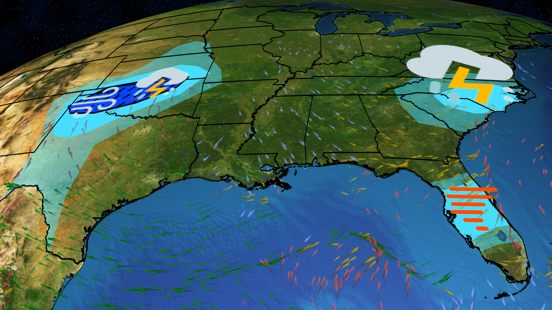
Stormy Pattern Bringing More Severe Weather, Flooding
Scattered severe storms and heavy rain will affect the South to end this week. Here's what to know.
Stormy Pattern Bringing More Severe Weather, Flooding
Severe Thunderstorms Ahead For The Plains, Southeast
Two potent systems threaten severe thunderstorms in the Plains and Southeast Wednesday. Damaging wind gusts are likely. Here’s what you need to know.
Severe Thunderstorms Ahead For The Plains, Southeast
Why Millions May Never Return Home
From deadly flooding in Brazil to extreme natural disasters in the U.S., millions could be displaced by what’s known as climate migration.
Why Millions May Never Return Home
'Human Chain' Saves Woman From Drowning
Quick thinking police and bystanders form a human chain to save a drowning woman.
'Human Chain' Saves Woman From Drowning
Please enable JavaScript to continue using this application.