| Above: Hurricane Lorenzo as seen by the MODIS instrument on NASA's Terra satellite on Friday morning, September 27, 2019. At the time, Lorenzo was a Category 4 hurricane with 140 mph winds. Image credit: NASA. |
Spectacular Hurricane Lorenzo continues to churn in the Central Atlantic in a region where no hurricane so intense or so large has ever been observed. At 11 am EDT Friday, Lorenzo had weakened slightly to a Category 4 hurricane with 140 mph winds; Lorenzo had peaked with 145 mph winds and a central pressure of 937 mb at 5 am EDT Friday at 42.1°W longitude. Both the winds and the pressure at that time were all-time records for a hurricane so far east in the Atlantic. According to NHC, the only comparable hurricane in recent times near Lorenzo’s location was Gabrielle of 1989, which peaked as a Category 4 hurricane with 145 mph winds at 55.7°W. Update: As of 5 pm EDT Friday, Lorenzo had weakened further to Category 3 strength, with top winds of 125 mph.
#Lorenzo had a minimum central pressure (MSLP) of 937 hPa at 42.1°W - the lowest for a #hurricane this far east in the Atlantic on record. Prior record for <=937 hPa was Eduoard at 47°W in 1996. MSLP has been consistently recorded in Atlantic hurricane database since 1979. pic.twitter.com/g6OBylwj9D
— Philip Klotzbach (@philklotzbach) September 27, 2019
Lorenzo’s intensity was based solely on satellite estimates, as the hurricane was too far from any airports that the Hurricane Hunters could fly from. That will change Friday afternoon, when two NOAA hurricane hunter aircraft, which left Barbados on Friday morning, will be conducting a research mission into Lorenzo. I’m not familiar with any hurricane hunter missions ever done on a storm so far to the east.
With moderate wind shear (10 – 20 knots) and warm sea-surface temperatures near 27.5 - 28°C (around 82°F) expected through Sunday, Lorenzo has the opportunity to maintain major hurricane status into early next week. Satellite images from early Friday afternoon showed a modest degradation of the eyewall thunderstorms compared to early Friday morning, but Lorenzo still presented a formidable spectacle due to its huge size and prominent eye surrounded by intense eyewall thunderstorms with very cold cloud tops.
With winds of 145 mph, Hurricane #Lorenzo really is in a league of its own for this time of year. pic.twitter.com/PDz6BCt1YK
— Michael Lowry (@MichaelRLowry) September 27, 2019
Models agree that Lorenzo will carry out a classic recurving path over the central and eastern Atlantic as it gradually weakens, reaching the northwestern Azores Islands on Tuesday afternoon or evening. Lorenzo will be a massive wave generator due to its high intensity, longevity, and huge size. Lorenzo’s tropical-storm-force winds extended out 450 miles from northwest to southeast at 11 am EDT Friday. On Thursday afternoon, when Lorenzo’s wind field was not as expansive, an analysis of the Atlantic hurricane database by Eric Webb found that Lorenzo was the largest hurricane ever observed so far east, with a size that ranked in the 85th percentile for all historical Category 4 and 5 hurricanes.
The strongest #hurricane to make landfall in the Azores on record did so in 1926. Hurricane 8 that year made landfall on the island of Sao Miguel with max winds of 105 mph. #Lorenzo pic.twitter.com/wrBIlInlav
— Philip Klotzbach (@philklotzbach) September 26, 2019
Azores hurricane history
Over the past 50 years, 20 named storms have tracked through the Azores, including four Category 1 hurricanes, according to NOAA’s Historical Hurricane Tracks website. None of these storms did significant damage, according to EM-DAT (the international disaster database) and National Hurricane Center storm summaries. There was just one fatality from these storms: Tropical Storm Bonnie, which killed one person in the Azores in 1992. The islands did have one bad hurricane in less recent times, though: a 1946 Category 1 hurricane killed 27 people in the Azores, according to EM-DAT. The strongest hurricane to make landfall in the Azores was Hurricane 8 of 1926, which made landfall on the island of Sao Miguel as a Category 2 storm with 105 mph winds.
 |
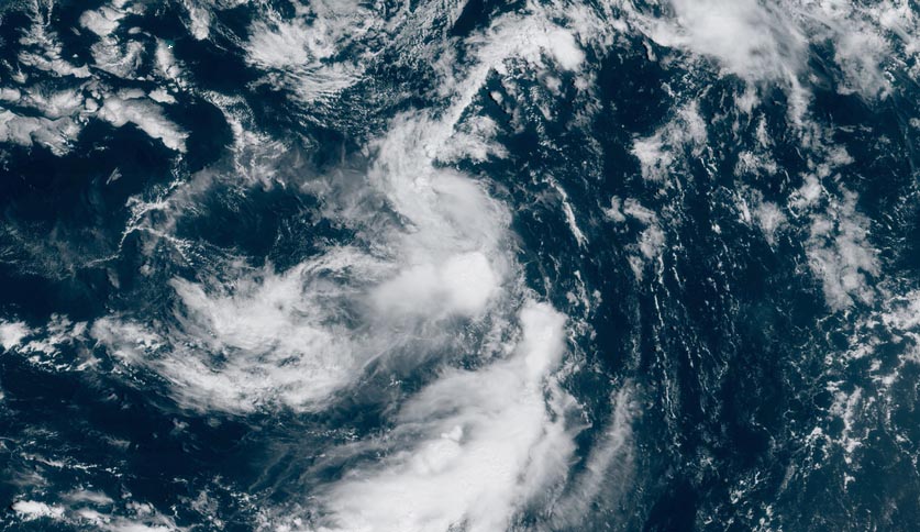
Figure 1. Tropical Depression Karen near death at 11:20 am EDT September 27, 2019. Image credit: NOAA/RAMMB. |
Karen decays to a tropical depression
Karen decayed to a tropical depression at 11 am EDT Friday and is not expected to survive into Saturday, as it becomes increasingly disorganized due to wind shear and dry air. Satellite images late Friday morning showed a system barely recognizable as a tropical cyclone, with an elongated circulation and barely any heavy thunderstorms. Wind shear was a moderately high 15 – 20 knots, which was driving very dry air to Karen’s north into the circulation. Our top global models for hurricane tracking all agree that Karen will not survive beyond Saturday. Karen should have no impact on any land areas. Update: At 5 pm EDT Friday, NHC declared Karen to be a remnant surface trough with 35-mph winds in its final advisory on the system.


