Skip to Main Content
_
Sensor Network
Maps & Radar
Severe Weather
News & Blogs
Mobile Apps
More
Search
close
gps_fixed
gps_fixed
Find Nearest Station
Manage Favorite Cities
Log In
Go Ad Free
account_box
Log in
Go Ad Free
settings
Settings
Sensor Network
Maps & Radar
Severe Weather
News & Blogs
Mobile Apps
Historical Weather
star
Current Weather for
Popular
Cities
San Francisco, CA
52
°
F
Cloudy
Manhattan, NY
warning
60
°
F
Rain
Schiller Park, IL (60176)
53
°
F
Mostly Cloudy
Boston, MA
64
°
F
Cloudy
Houston, TX
warning
68
°
F
Clear
St James's, England, United Kingdom
65
°
F
Mostly Cloudy
Search
close
gps_fixed
gps_fixed
Find Nearest Station
Manage Favorite Cities
settings
--
Feels like
--
--
--
/
--
--
--
--
--
--
--
--
--
--
12AM
6AM
NOON
6PM
12AM
May 15
+0000
May 16
Full Forecast
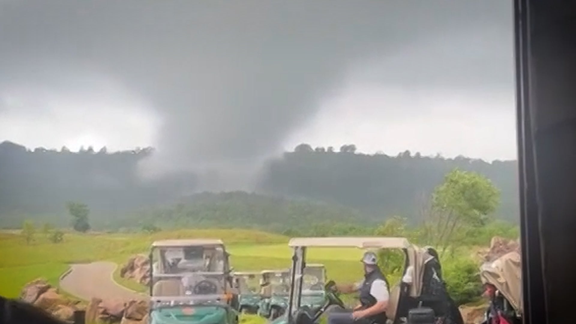
Golfers Race To Get Away From Tornado
One golfer yelled, “It’s coming right for us!” as others ran to get away from a tornado heading right for a golf course. Watch the dramatic video.
Golfers Race To Get Away From Tornado
How Did A Falling Billboard Kill 14 People?
More than 85 people were trapped and at least 14 people died when a billboard collapsed in Mumbai, India, amid storms and high winds. How did so many people die as a result of this tragedy?
How Did A Falling Billboard Kill 14 People?
Tree Rings Show Last Summer Was Hottest In 2,000 Years
Researchers used tree rings and weather data to study climates from centuries ago, and what they found raised the alarm.
Tree Rings Show Last Summer Was Hottest In 2,000 Years
Stormy Pattern Bringing More Severe Weather, Flooding
Scattered severe storms and heavy rain will affect the South to end this week. Here's what to know.
Stormy Pattern Bringing More Severe Weather, Flooding
Why Millions May Never Return Home
From deadly flooding in Brazil to extreme natural disasters in the U.S., millions could be displaced by what’s known as climate migration.
Why Millions May Never Return Home
Please enable JavaScript to continue using this application.