Skip to Main Content
_
Sensor Network
Maps & Radar
Severe Weather
News & Blogs
Mobile Apps
More
Search
close
gps_fixed
gps_fixed
Find Nearest Station
Manage Favorite Cities
Log In
Go Ad Free
account_box
Log in
Go Ad Free
settings
Settings
Sensor Network
Maps & Radar
Severe Weather
News & Blogs
Mobile Apps
Historical Weather
star
Current Weather for
Popular
Cities
San Francisco, CA
55
°
F
Cloudy
Manhattan, NY
warning
59
°
F
Showers in the Vicinity
Schiller Park, IL (60176)
53
°
F
Partly Cloudy
Boston, MA
56
°
F
Rain
Houston, TX
warning
75
°
F
Partly Cloudy
St James's, England, United Kingdom
60
°
F
Rain
Search
close
gps_fixed
gps_fixed
Find Nearest Station
Manage Favorite Cities
settings
--
Feels like
--
--
--
/
--
--
--
--
--
--
--
--
--
--
12AM
6AM
NOON
6PM
12AM
May 16
+0000
May 17
Full Forecast
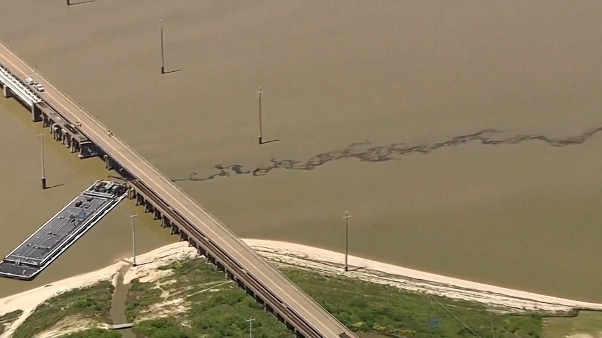
Partial Bridge Collapse Cut Off Island; Oil Pours Into Galveston Bay
Here's what we know so far.
Partial Bridge Collapse Cut Off Island; Oil Pours Into Galveston Bay
Stormy Pattern Bringing More Severe Weather, Flooding Through Friday
Scattered severe storms and flooding rain will affect the South to end this week. Here's what to know.
Stormy Pattern Bringing More Severe Weather, Flooding Through Friday
Millions May Never Return Home
From deadly flooding in Brazil to extreme natural disasters in the U.S., millions could be displaced by what’s known as climate migration.
Millions May Never Return Home
Gusty Winds Send Men Flying During A Midnight Snack
Here’s a good case for checking the weather before you decide to eat outside…
Gusty Winds Send Men Flying During A Midnight Snack
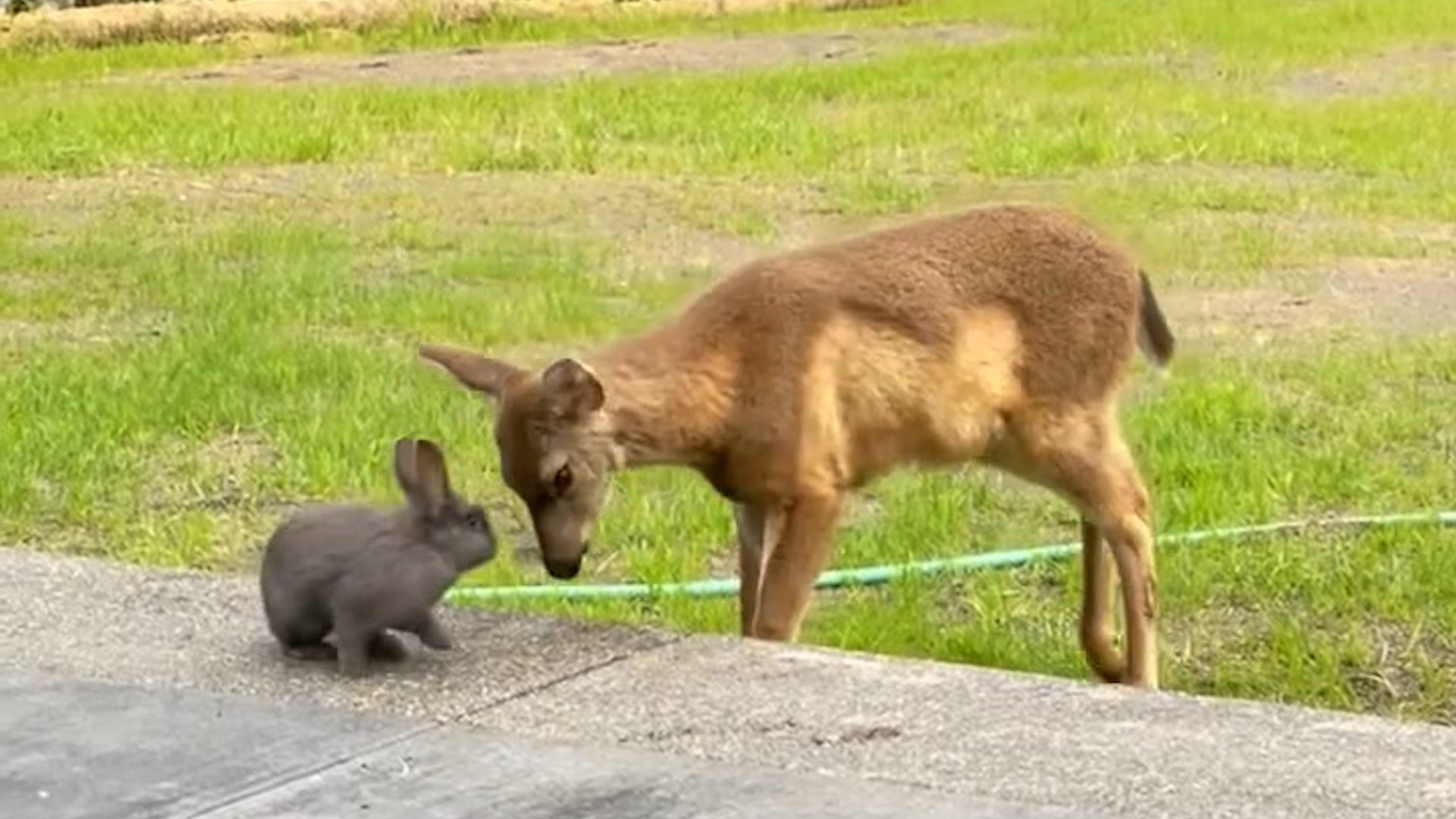
Watch This Magical Moment Between Real-Life Bambi & Thumper
A homeowner in Oregon looked out into his back yard to see a Disney cartoon had come to life.
Watch This Magical Moment Between Real-Life Bambi & Thumper
Please enable JavaScript to continue using this application.