Skip to Main Content
_
Sensor Network
Maps & Radar
Severe Weather
News & Blogs
Mobile Apps
More
Search
close
gps_fixed
gps_fixed
Find Nearest Station
Manage Favorite Cities
Log In
Go Ad Free
account_box
Log in
Go Ad Free
settings
Settings
Sensor Network
Maps & Radar
Severe Weather
News & Blogs
Mobile Apps
Historical Weather
star
Current Weather for
Popular
Cities
San Francisco, CA
warning
53
°
F
Partly Cloudy
Manhattan, NY
52
°
F
Sunny
Schiller Park, IL (60176)
54
°
F
Sunny
Boston, MA
50
°
F
Partly Cloudy
Houston, TX
73
°
F
Partly Cloudy
St James's, England, United Kingdom
71
°
F
Sunny
Search
close
gps_fixed
gps_fixed
Find Nearest Station
Manage Favorite Cities
settings
warning
Active Advisory
:
Dense Fog Advisory
(
See More
)
--
Feels like
--
--
--
/
--
--
--
--
--
--
--
--
--
--
12AM
6AM
NOON
6PM
12AM
May 11
+0000
May 12
Full Forecast
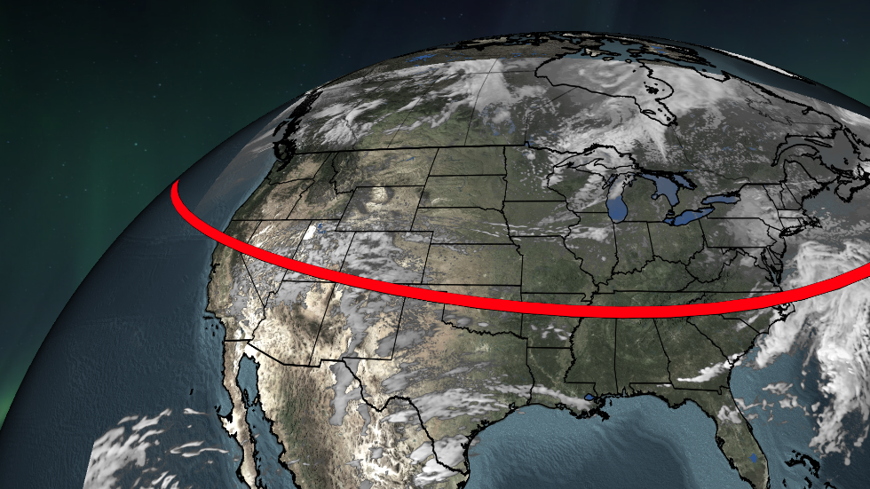
3 Things To Know About This Weekend's Solar Storm, Auroras
Get ready for a rare celestial event – here are the key things to know.
3 Things To Know About This Weekend's Solar Storm, Auroras
Severe Flooding Washes Away Neighborhoods, Death Toll Rises To 107
From a horse stranded on a roof to dogs trapped in buildings, rescuers are working to save as many animals and people as they can from extreme flooding in Brazil.
Severe Flooding Washes Away Neighborhoods, Death Toll Rises To 107
The Signs That We're At Risk For Another Pandemic
Could humans be contributing to another pandemic? A new study says yes.
The Signs That We're At Risk For Another Pandemic
Goofy Pet Photo Award Finalists Revealed; The Images Are Hilarious
There’s a grinning donkey, some goofy horses, and a lot of funny cats and dogs. Which is your favorite Comedy Pet Photo Award finalist?
Goofy Pet Photo Award Finalists Revealed; The Images Are Hilarious
Weekend Aurora Viewing Forecast
Aurora activity is expected to be high Friday night into Saturday morning. To see it, you need a clear dark sky away from city lights.
Weekend Aurora Viewing Forecast
Please enable JavaScript to continue using this application.