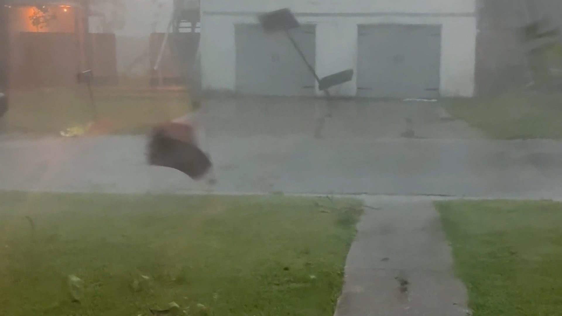
Bishop, TX

4:14 PM CDT on May 27, 2012 (GMT -0500)
Elev: 75 ft
Lon: 97.8° W
Lat: 27.6° N
Source
Rapid Fire Updates™
Updated 3:56 PM CDT Get Free Weather Stickers® Share:
Your Custom Weather Sticker®

Copy the following lines of HTML:
Tropical Weather: Tropical Storm Beryl (North Atlantic) Tropical Storm Sanvu (Western Pacific)
Weather Summary
Weather Underground Forecast for Sunday, May 27, 2012. More interesting weather for many parts of the country is expected Sunday. Subtropical Storm Beryl will continue on its path toward the northeast coast of Florida near Georgia. It is expected to make landfall with tropical storm strength winds either late Sunday night or early Monday morning. This storm will not be a signficant wind threat, and the rain associated with it will mostly be a blessing to this region as it has suffered through an exceptional drought.

Elsewhere, an intense heat wave will continue for the Plains and Southeast while also spreading northward into the Ohio Valley and Upper Midwest. Maximum temperature records are most likely to be broken for many areas as temperatures will soar into the 90s and 100s. Even more dangerous will be the heat index values over 100 degrees. The heat index tells you how hot the air feels. The more humid the weather, the higher the heat index will soar. Thankfully, many areas will not experience the extremely high humidity common during the Summer months.

In the West, a strong storm will move through the Northern Rockies and into the Dakotas. This storm will bring widespread rain and even some snow from Idaho through Minnesota. The associated cold front will move through the Plains, possibly instigating some strong thunderstorms that could become severe.

The Northeast will rise into the 70s and 80s, while the Southeast and Southern Plains will see temperatures in the 90s and 100s. The Northwest will rise into the 70s.

Bishop Weather at a Glance

Updated 3:56 PM CDT
Weather Station
Elevation
49 ft
Report Station
You are about to report this weather station for bad data.

Please select the information which is incorrect and click 'Submit' otherwise click 'Cancel'.

Cancel

Now
Scattered Clouds
Scattered Clouds
Temperature
88 °F
Feels Like 94 °F
Wind(mph)
17
Sunrise / Set
6:36 AM
8:20 PM
Moon
Waxing Crescent
Tonight
Partly Cloudy 73 °F
Partly Cloudy
Tomorrow
Partly Cloudy 93 °F
Partly Cloudy
Tomorrow Night
Partly Cloudy 75 °F
Partly Cloudy
Tuesday
Partly Cloudy 95 | 75 °F
Partly Cloudy
Wednesday
Partly Cloudy 97 | 77 °F
Partly Cloudy
Thursday
Partly Cloudy 97 | 73 °F
Partly Cloudy
Tomorrow is forecast to be nearly the same temperature as today.
Conditions
Pressure
29.86 in
Visibility
10.0 miles
Clouds
Few 3800 ft
Scattered Clouds 7500 ft
Moisture
Humidity
57%
Rainfall
0.00 in
Snow Depth
Not available.
METAR
METAR KNQI 272056Z AUTO 12015G21KT 10SM FEW038 SCT075 31/22 A2987 RMK AO2 SLP112 T03110217 56014
Don't speak METAR? Read our FAQ.
Weather Radio
Temperature
Heat Index
94 °F
Dew Point
71 °F
Wind
Speed / Dir
17 mph from ESE
Wind Gust
24 mph
Health
7 out of 16
Pollen
6.00 out of 12
Pollen Forecast
Ozone
Good
PM2.5
Good
Flu Activity
Sporadic
View Flu Map
Loading…
Source: BestForecast
Descriptive Forecast
Sunday Night
nt_partlycloudy Partly cloudy. Low of 73F. Winds from the SE at 5 to 20 mph.
Monday
partlycloudy Mostly cloudy in the morning, then partly cloudy. High of 93F with a heat index of 99F. Breezy. Winds from the SE at 10 to 20 mph.
Monday Night
nt_partlycloudy Partly cloudy. Low of 75F. Breezy. Winds from the SE at 10 to 20 mph.
Tuesday
partlycloudy Partly cloudy. High of 95F with a heat index of 104F. Winds from the SE at 5 to 15 mph.
Tuesday Night
nt_partlycloudy Partly cloudy. Fog overnight. Low of 75F. Breezy. Winds from the SE at 10 to 20 mph.
Wednesday
partlycloudy Partly cloudy in the morning, then mostly cloudy. High of 97F with a heat index of 104F. Winds from the SSE at 10 to 15 mph.
Wednesday Night
nt_partlycloudy Partly cloudy. Low of 77F. Breezy. Winds from the SSE at 10 to 20 mph.
Thursday
partlycloudy Mostly cloudy in the morning, then partly cloudy. High of 97F with a heat index of 115F. Winds from the SSE at 10 to 15 mph.
Thursday Night
nt_partlycloudy Partly cloudy. Fog overnight. Low of 73F. Winds from the SE at 5 to 15 mph.
Friday
partlycloudy Partly cloudy. High of 95F with a heat index of 102F. Winds from the ESE at 5 to 15 mph.
Friday Night
nt_mostlycloudy Mostly cloudy. Low of 75F. Winds from the SE at 5 to 15 mph.
Saturday
mostlycloudy Mostly cloudy. High of 93F. Winds from the SE at 5 to 20 mph.
Saturday Night
nt_partlycloudy Partly cloudy. Low of 75F. Breezy. Winds from the SE at 10 to 20 mph.
Sunday
mostlycloudy Mostly cloudy. High of 91F. Breezy. Winds from the SE at 10 to 20 mph.
Sunday Night
nt_partlycloudy Partly cloudy. Low of 75F. Breezy. Winds from the SE at 10 to 20 mph.
Monday
mostlycloudy Overcast. High of 93F. Winds from the SE at 10 to 15 mph.
Monday Night
nt_partlycloudy Partly cloudy. Low of 75F. Winds from the SSE at 10 to 15 mph.
Tuesday
clear Partly cloudy. High of 93F with a heat index of 117F. Winds from the SSE at 10 to 15 mph.
Tuesday Night
nt_clear Partly cloudy. Low of 77F. Winds from the SSE at 10 to 15 mph.
Wednesday
partlycloudy Partly cloudy. High of 93F with a heat index of 117F. Winds from the SE at 10 to 15 mph.
Wednesday Night
nt_clear Partly cloudy. Low of 75F. Winds from the SE at 10 to 15 mph.
Thursday
clear Clear. High of 91F with a heat index of 117F. Winds from the SE at 5 to 15 mph.
Thursday Night
nt_clear Clear. Low of 75F. Winds less than 5 mph.
Loading…
 
First Previous Last Next  
Updated:  


Forecast

View Calendar 10-Day Forecast for station KNQI

Sunday, 27
Partly Cloudy
91 | 73 °F
Partly Cloudy
Chance of
Precipitation
10%
Monday, 28
Partly Cloudy
93 | 75 °F
Partly Cloudy
Chance of
Precipitation
0%
Tuesday, 29
Partly Cloudy
95 | 75 °F
Partly Cloudy
Chance of
Precipitation
10%
Wednesday, 30
Partly Cloudy
97 | 77 °F
Partly Cloudy
Chance of
Precipitation
0%
Thursday, 31
Partly Cloudy
97 | 73 °F
Partly Cloudy
Chance of
Precipitation
0%
Friday, 1
Partly Cloudy
95 | 75 °F
Partly Cloudy
Chance of
Precipitation
0%
Saturday, 2
Mostly Cloudy
93 | 75 °F
Mostly Cloudy
Chance of
Precipitation
0%
Sunday, 3
Mostly Cloudy
91 | 75 °F
Mostly Cloudy
Chance of
Precipitation
0%
Monday, 4
Mostly Cloudy
93 | 75 °F
Mostly Cloudy
Chance of
Precipitation
0%
Tuesday, 5
Clear
93 | 77 °F
Clear
Chance of
Precipitation
0%
Source: BestForecast at 3:43 PM CDT on May 27, 2012
Descriptive Forecast
Sunday Night
nt_partlycloudy Partly cloudy. Low of 73F. Winds from the SE at 5 to 20 mph.
Hourly Forecast 6AM 12 Noon 6PM 12 Midnight
Temp. | Dew Point 76 | 74 87 | 70 84 | 72 78 | 73
Wind 9 mph SE 15 mph SSE 16 mph SE 10 mph SE
Humidity 88% 56% 67% 86%
Chance of Precip. 10% 10% 10% 0%
Cloud Cover 46% 79% 64% 40%
Conditions Partly Cloudy Mostly Cloudy Mostly Cloudy Partly Cloudy
Sunrise & Sunset
6:36 AM
8:20 PM
The quality of the forecasted high temperature for this day is excellent. MaxT RMSE [1.14], Average RMSE [1.48]
The National Weather Service forecast quality is excellent. MaxT RMSE [1.37], Average RMSE [1.58] : Use NWS
Source: BestForecast at 3:43 PM CDT on May 27, 2012
Descriptive Forecast
Monday
partlycloudy Mostly cloudy in the morning, then partly cloudy. High of 93F with a heat index of 99F. Breezy. Winds from the SE at 10 to 20 mph.
Monday Night
nt_partlycloudy Partly cloudy. Low of 75F. Breezy. Winds from the SE at 10 to 20 mph.
Hourly Forecast 6AM 12 Noon 6PM 12 Midnight
Temp. | Dew Point 74 | 73 91 | 71 86 | 72 78 | 73
Wind 7 mph SSE 13 mph SSE 15 mph SE 11 mph SE
Humidity 95% 52% 60% 88%
Chance of Precip. 0% 0% 0% 0%
Cloud Cover 58% 42% 26% 51%
Conditions Partly Cloudy Partly Cloudy Partly Cloudy Partly Cloudy
Sunrise & Sunset
6:36 AM
8:20 PM
The quality of the forecasted high temperature for this day is excellent. MaxT RMSE [1.26], Average RMSE [1.38]
The National Weather Service forecast quality is good. MaxT RMSE [1.55], Average RMSE [1.52] : Use NWS
Source: BestForecast at 3:43 PM CDT on May 27, 2012
Descriptive Forecast
Tuesday
partlycloudy Partly cloudy. High of 95F with a heat index of 104F. Winds from the SE at 5 to 15 mph.
Tuesday Night
nt_partlycloudy Partly cloudy. Fog overnight. Low of 75F. Breezy. Winds from the SE at 10 to 20 mph.
Hourly Forecast 6AM 12 Noon 6PM 12 Midnight
Temp. | Dew Point 75 | 72 91 | 75 88 | 71 79 | 76
Wind 8 mph SSE 10 mph SSE 15 mph SE 10 mph SE
Humidity 93% 59% 56% 92%
Chance of Precip. 10% 10% 10% 0%
Cloud Cover 56% 44% 39% 17%
Conditions Partly Cloudy Partly Cloudy Partly Cloudy Clear
Sunrise & Sunset
6:36 AM
8:21 PM
The quality of the forecasted high temperature for this day is excellent. MaxT RMSE [1.42], Average RMSE [1.43]
The National Weather Service forecast quality is good. MaxT RMSE [1.82], Average RMSE [1.94] : Use NWS
Source: BestForecast at 3:43 PM CDT on May 27, 2012
Descriptive Forecast
Wednesday
partlycloudy Partly cloudy in the morning, then mostly cloudy. High of 97F with a heat index of 104F. Winds from the SSE at 10 to 15 mph.
Wednesday Night
nt_partlycloudy Partly cloudy. Low of 77F. Breezy. Winds from the SSE at 10 to 20 mph.
Hourly Forecast 6AM 12 Noon 6PM 12 Midnight
Temp. | Dew Point 75 | 73 91 | 74 90 | 78 79 | 76
Wind 9 mph SSE 13 mph SSE 15 mph SE 11 mph SE
Humidity 93% 58% 67% 89%
Chance of Precip. 10% 10% 0% 0%
Cloud Cover 15% 44% 35% 62%
Conditions Fog Partly Cloudy Partly Cloudy Partly Cloudy
Sunrise & Sunset
6:36 AM
8:21 PM
The quality of the forecasted high temperature for this day is good. MaxT RMSE [1.67], Average RMSE [1.80]
The National Weather Service forecast quality is good. MaxT RMSE [2.41], Average RMSE [2.14] : Use NWS
Source: BestForecast at 3:43 PM CDT on May 27, 2012
Descriptive Forecast
Thursday
partlycloudy Mostly cloudy in the morning, then partly cloudy. High of 97F with a heat index of 115F. Winds from the SSE at 10 to 15 mph.
Thursday Night
nt_partlycloudy Partly cloudy. Fog overnight. Low of 73F. Winds from the SE at 5 to 15 mph.
Hourly Forecast 6AM 12 Noon 6PM 12 Midnight
Temp. | Dew Point 77 | 75 92 | 75 92 | 80 77 | 73
Wind 10 mph SSE 12 mph SSE 12 mph SE 6 mph SE
Humidity 95% 58% 66% 85%
Chance of Precip. 0% 0% 0% 0%
Cloud Cover 13% 47% 47% 62%
Conditions Clear Partly Cloudy Partly Cloudy Partly Cloudy
Sunrise & Sunset
6:36 AM
8:22 PM
The quality of the forecasted high temperature for this day is good. MaxT RMSE [1.68], Average RMSE [1.60]
The National Weather Service forecast quality is good. MaxT RMSE [2.35], Average RMSE [2.52] : Use NWS
Source: BestForecast at 3:43 PM CDT on May 27, 2012
Descriptive Forecast
Friday
partlycloudy Partly cloudy. High of 95F with a heat index of 102F. Winds from the ESE at 5 to 15 mph.
Friday Night
nt_mostlycloudy Mostly cloudy. Low of 75F. Winds from the SE at 5 to 15 mph.
Hourly Forecast 6AM 12 Noon 6PM 12 Midnight
Temp. | Dew Point 75 | 71 91 | 72 86 | 76 78 | 74
Wind 5 mph ESE 7 mph ESE 11 mph East 7 mph ESE
Humidity 87% 54% 71% 88%
Chance of Precip. 0% 10% 0% 0%
Cloud Cover 22% 62% 42% 41%
Conditions Fog Partly Cloudy Partly Cloudy Partly Cloudy
Sunrise & Sunset
6:36 AM
8:22 PM
The quality of the forecasted high temperature for this day is good. MaxT RMSE [1.65], Average RMSE [1.92]
The National Weather Service forecast quality is good. MaxT RMSE [2.36], Average RMSE [2.33] : Use NWS
Source: BestForecast at 3:43 PM CDT on May 27, 2012
Descriptive Forecast
Saturday
mostlycloudy Mostly cloudy. High of 93F. Winds from the SE at 5 to 20 mph.
Saturday Night
nt_partlycloudy Partly cloudy. Low of 75F. Breezy. Winds from the SE at 10 to 20 mph.
Hourly Forecast 6AM 12 Noon 6PM 12 Midnight
Temp. | Dew Point 76 | 74 89 | 72 89 | 73 80 | 76
Wind 6 mph SE 12 mph SE 16 mph ESE 10 mph ESE
Humidity 95% 56% 60% 88%
Chance of Precip. 0% 10% 0% 0%
Cloud Cover 100% 51% 49% 42%
Conditions Overcast Partly Cloudy Partly Cloudy Partly Cloudy
Sunrise & Sunset
6:36 AM
8:22 PM
The quality of the forecasted high temperature for this day is good. MaxT RMSE [2.15], Average RMSE [1.74]
The National Weather Service forecast quality is good. MaxT RMSE [2.43], Average RMSE [2.34] : Use NWS
Source: BestForecast at 3:43 PM CDT on May 27, 2012
Descriptive Forecast
Sunday
mostlycloudy Mostly cloudy. High of 91F. Breezy. Winds from the SE at 10 to 20 mph.
Sunday Night
nt_partlycloudy Partly cloudy. Low of 75F. Breezy. Winds from the SE at 10 to 20 mph.
Hourly Forecast 6AM 12 Noon 6PM 12 Midnight
Temp. | Dew Point 76 | 74 87 | 71 85 | 71 78 | 73
Wind 9 mph SE 14 mph SE 16 mph SE 10 mph SE
Humidity 91% 57% 60% 86%
Chance of Precip. 0% 0% 0% 0%
Cloud Cover 32% 100% 57% 37%
Conditions Partly Cloudy Overcast Partly Cloudy Partly Cloudy
Sunrise & Sunset
6:36 AM
8:22 PM
The quality of the forecasted high temperature for this day is good. MaxT RMSE [2.46], Average RMSE [2.26]
Source: BestForecast at 3:43 PM CDT on May 27, 2012
Descriptive Forecast
Monday
mostlycloudy Overcast. High of 93F. Winds from the SE at 10 to 15 mph.
Monday Night
nt_partlycloudy Partly cloudy. Low of 75F. Winds from the SSE at 10 to 15 mph.
Hourly Forecast 6AM 12 Noon 6PM 12 Midnight
Temp. | Dew Point 75 | 73 87 | 70 88 | 74 78 | 73
Wind 9 mph SSE 11 mph SSE 13 mph SE 13 mph SE
Humidity 91% 55% 60% 84%
Chance of Precip. 10% 0% 0% 0%
Cloud Cover 86% 36% 100% 58%
Conditions Mostly Cloudy Partly Cloudy Overcast Partly Cloudy
Sunrise & Sunset
6:36 AM
8:22 PM
The quality of the forecasted high temperature for this day is good. MaxT RMSE [2.46], Average RMSE [1.77]
Source: BestForecast at 3:43 PM CDT on May 27, 2012
Descriptive Forecast
Tuesday
clear Partly cloudy. High of 93F with a heat index of 117F. Winds from the SSE at 10 to 15 mph.
Tuesday Night
nt_clear Partly cloudy. Low of 77F. Winds from the SSE at 10 to 15 mph.
Hourly Forecast 6AM 12 Noon 6PM 12 Midnight
Temp. | Dew Point 76 | 72 89 | 83 88 | 79 78 | 72
Wind 11 mph SSE 12 mph SSE 14 mph SE 13 mph SE
Humidity 88% 84% 78% 81%
Chance of Precip. 0% 0% 0% 0%
Cloud Cover 33% 21% 23% 22%
Conditions Partly Cloudy Clear Clear Clear
Sunrise & Sunset
6:36 AM
8:22 PM
Source: BestForecast at 3:43 PM CDT on May 27, 2012
Descriptive Forecast
Wednesday
partlycloudy Partly cloudy. High of 93F with a heat index of 117F. Winds from the SE at 10 to 15 mph.
Wednesday Night
nt_clear Partly cloudy. Low of 75F. Winds from the SE at 10 to 15 mph.
Hourly Forecast 6AM 12 Noon 6PM 12 Midnight
Temp. | Dew Point 77 | 73 89 | 82 88 | 79 78 | 72
Wind 10 mph SSE 12 mph SSE 13 mph SE 11 mph SE
Humidity 87% 83% 77% 82%
Chance of Precip. 0% 0% 0% 0%
Cloud Cover 20% 21% 26% 24%
Conditions Clear Clear Partly Cloudy Clear
Sunrise & Sunset
6:36 AM
8:22 PM
Source: BestForecast at 3:43 PM CDT on May 27, 2012
Descriptive Forecast
Thursday
clear Clear. High of 91F with a heat index of 117F. Winds from the SE at 5 to 15 mph.
Thursday Night
nt_clear Clear. Low of 75F. Winds less than 5 mph.
Hourly Forecast 6AM 12 Noon 6PM 12 Midnight
Temp. | Dew Point 76 | 73 89 | 83 88 | 79 -9998 | -9998
Wind 9 mph SSE 10 mph SE 13 mph SE -9998 mph North
Humidity 89% 84% 76% 81%
Chance of Precip. 0% 0% 0% 0%
Cloud Cover 16% % % %
Conditions Clear Clear Clear Clear
Sunrise & Sunset
6:36 AM
8:22 PM
Nearby
History & Almanac
May 27, 2012 Max Temp Min Temp
Normal 88 °F 70 °F
Record 95 °F (2001) 68 °F (2002)
Yesterday 91 °F 75 °F
Choose a date
Earthquake Activity
City Distance Mag. Time & Date
No recent earthquake activity has been reported nearby.
Minimum magnitude displayed is 2.5.
Air Quality
  Air Quality AQ Index Pollutant
Yesterday Good
OZONE
Yesterday Good
PM2.5
Current Good
OZONE
Current Good
PM2.5
Sunday Good
OZONE
Sunday Good
PM10
Monday Good
OZONE
Monday Good
PM10
Tuesday Good
OZONE
Tuesday Good
PM10
Coastal Water Temperatures
Place Temperature
Baffin Bay Point of Rocks, TX 84.9 °F
Packery Channel, TX 82.9 °F
Port Aransas, TX 80.1 °F
Malaquite Beach (Corpus Christi), TX 80.1 °F
Port Ingleside, TX 82.0 °F
Astronomy
May. 27, 2012 Rise Set
Actual Time 6:36 AM CDT 8:20 PM CDT
Civil Twilight 6:10 AM CDT 8:46 PM CDT
Nautical Twilight 5:39 AM CDT 9:17 PM CDT
Astronomical Twilight 5:06 AM CDT 9:50 PM CDT
Moon 12:25 PM CDT 12:43 AM CDT
Length Of Visible Light 14h 35m
Length of Day
13h 43m
Tomorrow will be 0m 48s longer.
Waxing Crescent, 40% of the Moon is Illuminated
Today
Waxing Crescent
May 28
First Quarter
Jun 4
Full
Jun 11
Last Quarter
Jun 19
New
Today's Extremes
State Highs State Lows
96 °F
Perryton
95 °F
Granbury
95 °F
Borger
95 °F
Gainesville
32 °F
Austin
55 °F
Marfa
57 °F
Hereford
60 °F
Dumas
Snow Depth
Station Depth Elevation
No new snow has been reported.
WunderPhotos®
Memorial Day Weekend
Tornado just passed
Uploaded by: MTOUTDOORSMAN
1,496,699 photos uploaded!
WunderBlogs®

There are no recent blogs in this area. Why not create your own?

Travel & Activities
Travel Planning
Destination? *
When are you going?
to
Is there an activity you would like to explore?
* Required field
Nearby Events
Event Date Forecast
No events within 10 mi of location. View all events.
Event data courtesy eviesays.com
Aviation
City Temp. Conditions Updated
Kingsville NAS 88 °F Scattered Clouds 3:56 PM CDT
Robstown 89 °F Scattered Clouds 3:55 PM CDT
Alice 91 °F Mostly Cloudy 3:53 PM CDT
Corpus Christi 88 °F Scattered Clouds 3:51 PM CDT
Flight To ETA Status
No flights were found.
Flight Tracker by FlightAware FlightAware
Type Condition
Flight Rule: VFR (KNQI)
Wind Speed: 15.0 kts.
Wind Dir: 120° (ESE)
Ceiling: Unlimited

METAR KNQI 272056Z AUTO 12015G21KT 10SM FEW038 SCT075 31/22 A2987 RMK AO2 SLP112 T03110217 56014

Sports
Event Date Forecast
Rockies vs. Reds 1:10 PM EDT on May 27, 2012 Partly Cloudy, 94 °F
Padres vs. Mets 1:10 PM EDT on May 27, 2012 Partly Cloudy, 79 °F
Event Date Forecast
Huesca vs. Deportivo 8:00 PM CEST on May 27, 2012 Chance of Rain, High 62° F/ 17° C
Celta Vigo vs. Gimnàstic 8:00 PM CEST on May 27, 2012 Scattered Clouds, High 75° F/ 24° C
Event Date Forecast
Coca-Cola 600 6:16 PM EDT on May 27, 2012 Partly Cloudy, 85 °F
FedEx 400 benefiting Autism Speaks 1:15 PM EDT on June 03, 2012 Average High 79° F/ 26° C
Event Date Forecast
the Memorial Tournament presented by Nationwide Insurance 8:30 AM EDT on May 31, 2012 Partly Cloudy, 56 °F
the Memorial Tournament presented by Nationwide Insurance 8:30 AM EDT on June 01, 2012 Chance of a Thunderstorm, 56 °F
Weather Stations
Station Location Temp. Heat Index Dew Point Humidity Wind Precipitation Elevation Updated Type Website
Robstown, TX 87.1 °F 96 °F 75 °F 67% SE  at  21.0 mph 0.00 in / hr 79 ft 4:14 PM CDT Rapid Fire  
Annaville, Corpus Christi, TX 88.6 °F 97 °F 73 °F 61% ESE  at  10.0 mph 0.00 in / hr 32 ft 3:54 PM CDT Normal
Harlan's Annaville Weather Station, Corpus Christi, TX 91.4 °F 99 °F 72 °F 54% SE  at  12.7 mph 0.00 in / hr 75 ft 4:14 PM CDT Rapid Fire
La Paloma, Riviera, TX 92.8 °F 103 °F 74 °F 55% ESE  at  14.0 mph 0.00 in / hr 45 ft 4:13 PM CDT Normal  
King Estates, Corpus Christi, TX 85.6 °F 94 °F 75 °F 70% ESE  at  12.0 mph 0.00 in / hr 17 ft 4:14 PM CDT Rapid Fire  
Would you like to share your weather data with the rest of the world? Add Your Weather Station!