Skip to Main Content
_
Sensor Network
Maps & Radar
Severe Weather
News & Blogs
Mobile Apps
More
Search
close
gps_fixed
gps_fixed
Find Nearest Station
Manage Favorite Cities
Log In
Go Ad Free
account_box
Log in
Go Ad Free
settings
Settings
Sensor Network
Maps & Radar
Severe Weather
News & Blogs
Mobile Apps
Historical Weather
star
Current Weather for
Popular
Cities
San Francisco, CA
warning
61
°
F
Partly Cloudy
Manhattan, NY
80
°
F
Mostly Cloudy
Schiller Park, IL (60176)
86
°
F
Partly Cloudy
Boston, MA
66
°
F
Sunny
Houston, TX
87
°
F
Partly Cloudy
St James's, England, United Kingdom
62
°
F
Cloudy
Search
close
gps_fixed
gps_fixed
Find Nearest Station
Manage Favorite Cities
settings
warning
Active Advisory
:
Small Craft Advisory
(
See More
)
--
Feels like
--
--
--
/
--
--
--
--
--
--
--
--
--
--
12AM
6AM
NOON
6PM
12AM
Jun 3
+0000
Jun 4
Full Forecast
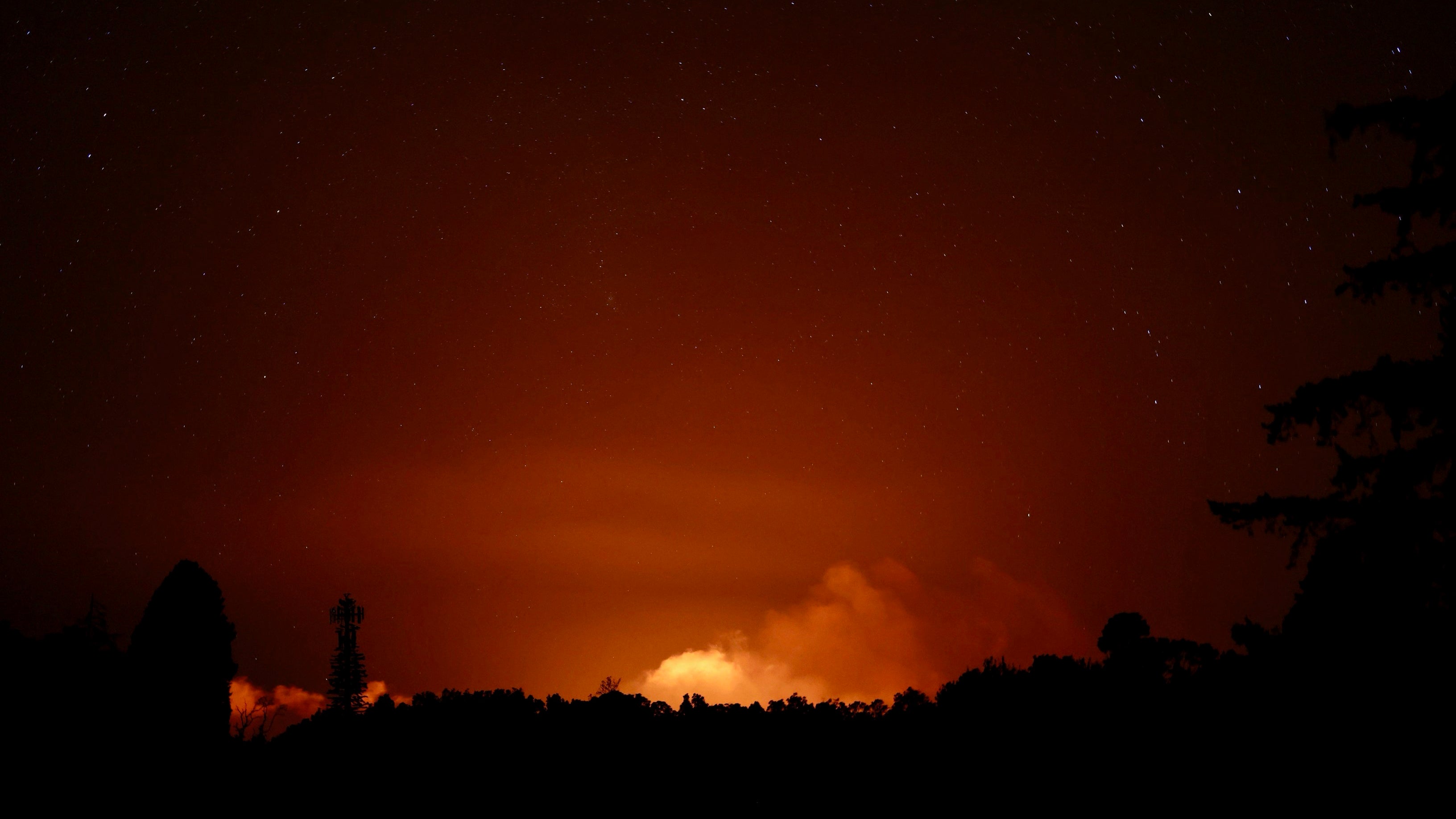
Spewing Lava In Hawaii
Hawaii's Kilauea volcano began erupting Monday. It's one of the most active volcanoes in the world.
Spewing Lava In Hawaii
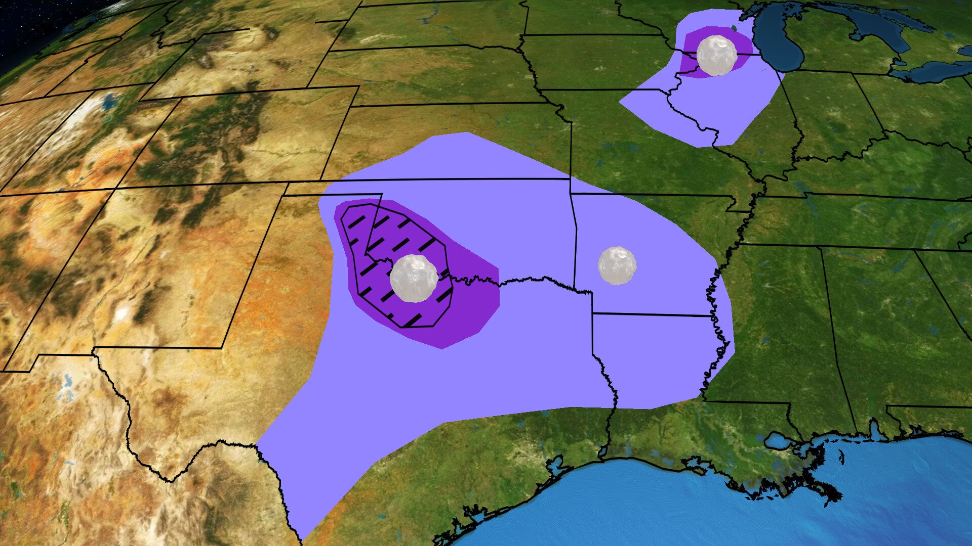
Today's Triple Threat: Strong Winds, Large Hail, Possible Tornadoes
Severe thunderstorms will threaten parts of the Plains and Midwest early this week as disturbances combine with plenty of moisture. Damaging winds, large hail and a couple of tornadoes are possible.
Today's Triple Threat: Strong Winds, Large Hail, Possible Tornadoes
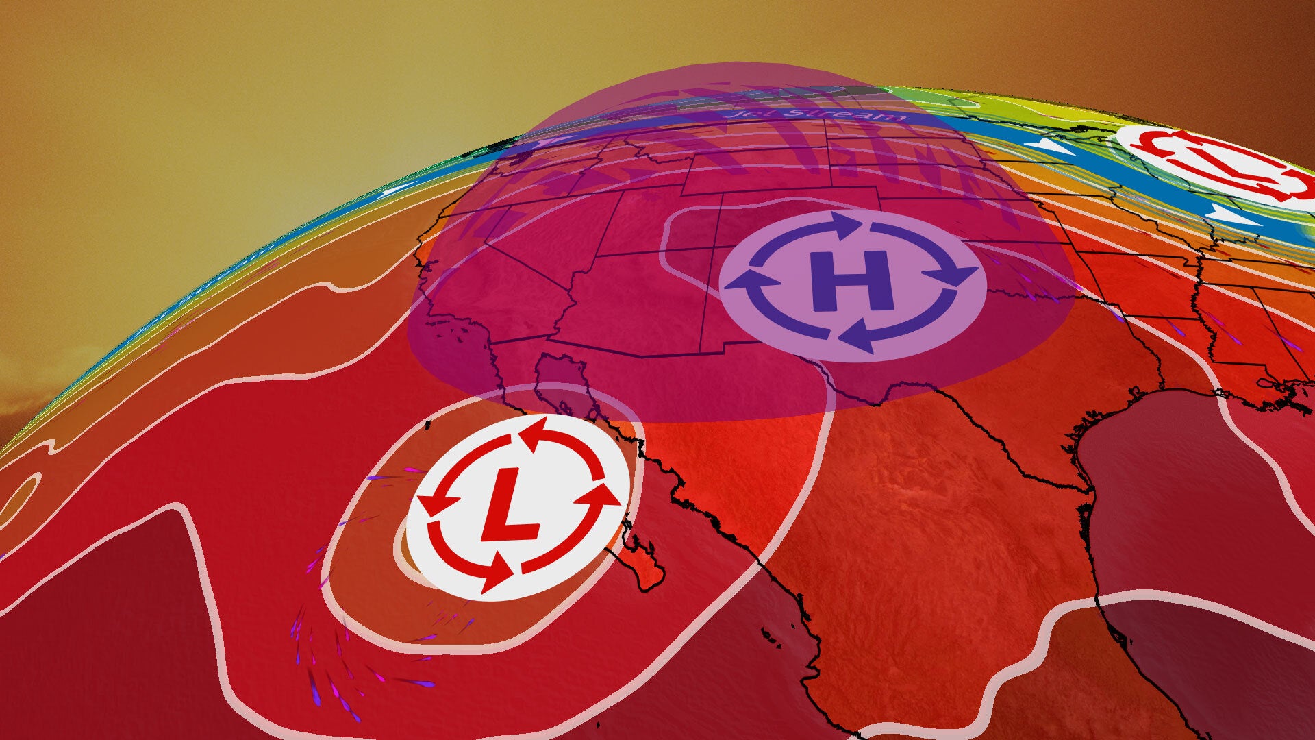
Dangerous Heat Dome To Scorch West With Record High Temperatures
A heat dome will build across parts of the West this week and daily record highs are possible. Here’s what to know about this dangerous heat.
Dangerous Heat Dome To Scorch West With Record High Temperatures
Shark Attack On California Coast; One Injured
A stretch of beach north of San Diego was closed temporarily on Sunday after a swimmer was attacked by a shark.
Shark Attack On California Coast; One Injured
Huge Wildfire Destroys Home; Firefighters Make Progress
The Corral Fire began Saturday afternoon near the city of Tracy, California, and exploded to more than 22 square miles.
Huge Wildfire Destroys Home; Firefighters Make Progress
Please enable JavaScript to continue using this application.