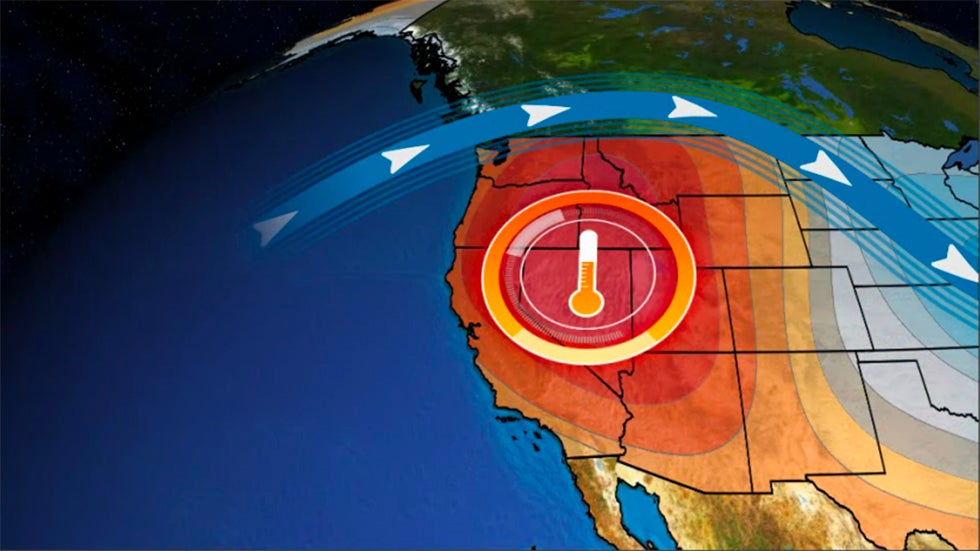
Find the Weather for any City, State or ZIP Code, or Airport Code or Country
Fast Forecast
Signup
Features:
Tropical / Hurricane
Marine
Severe
Astronomy
Ski
Education
Web Cams
Blogs
Climate Change
Favorites
Personal Weather Stations
Sign Up
Email:
Password:

Wunder Photos

View More Photos:

Maps

Health Maps
International

Information

Vacation Deals
  • Save On Vacation Condo Rentals
  • Save money with Timeshare rentals
  • Shawnee Condos and Vacations
    Condominiums for sale, for rent, and vacation rentals
  • Miami Condos
  • Shawnee Condos
  • Denver Condos
  • Beach Towels
  • Shawnee Tickets and Technology
  • VOIP Phone Systems
  • Disney Tickets
  • Event and Concert Tickets
  • Discount Disney Tickets
  • Real Estate Guide
  • Shawnee Homes For Sale
  • Hot Travel Savings
  • Shawnee Car Rentals
  • Shawnee Hotels
  • Shawnee Airline Tickets
  • Las Vegas Travel Deals
  • Real Estate
  • Shawnee Homes For Sale
  • Shawnee Foreclosures
  • Oklahoma Homeowners Insurance
  • Financial Advice on...
  • Shawnee Foreclosure
  • Oklahoma Bankruptcy
  • Shawnee Jobs
  • Short Funny Stories
  • Shawnee Stories
  • How To Save Money On...
  • Shawnee Homes for Sale
  • Shawnee Travel Deals
  • Jewelry
  • Magnets
  • Real Estate
  • For Sale By Owner
    Flat Fee MLS Listing
  • Reverse Mortgages
    Mortgage Loans
  • Tickets and Worldwide Attractions
  • Disney Tickets
  • Tours and Tickets
  • Canadian Pharmacy
  • Canada Pharmacy
  • Cheap Hotels
  • Cheap Hotel
  • Find Jobs In Your City
  • Shawnee Jobs
  • Condos for Sale
  • Condos for Sale
  • Playa del Carmen Condos
  • Wholesale Flowers
  • College Students
  • Fraternity
  • Sorority
  • Puerto Escondido
  • Google Search
    Search the Net!
    Powered by Google
    l3a9
    May 6 2008 13:07:27

    Shawnee, Oklahoma

    Add to My Favorites
    • RSS
      • RSS
      • Add to Any!
    - iCal Feed RSS
    Local Time: 2:58 PM CDTSet My Timezone Lat/Lon: 35.3° N 96.9° W (Google Map)
    Tropical Weather: Tropical Storm Rammasun (Western Pacific)
    Active Advisory: Tornado Watch (US Severe Weather)
    Current Conditions     
     
    Shawnee, Oklahoma (Airport)
    Updated: 2:56 PM CDT on May 13, 2008
    Scattered Clouds
    81 °F / 27 °C
    Scattered Clouds
    Humidity: 70%
    Dew Point: 70 °F / 21 °C
    Wind: 15 mph / 24 km/h / 6.7 m/s from the SSW
    Pressure: 29.76 in / 1008 hPa (Rising)
    Heat Index: 84 °F / 29 °C
    Visibility: 10.0 miles / 16.1 kilometers
    UV: 8 out of 16
    Clouds:
    Scattered Clouds 2800 ft / 853 m
    Scattered Clouds 3500 ft / 1066 m
    Scattered Clouds 4200 ft / 1280 m
    (Above Ground Level)
    Elevation: 1073 ft / 327 m
    Rapid Fire Updates:
    Enable Disable
    Source for Current Conditions:
    PWS & Airport Airport Only

    » Weather History for This Location

    Radar Webcam
    Local Radar
    Click Radar to Enlarge
    Local Radar Local Radar
    WunderMap new!
    Regional Radar Regional Radar
    Local Satellite Local Satellite
    Trip Planner Trip Planner
    Weather Stations Weather Stations
    Select a source for your current conditions:
    Flight Rule: VFR (KSNL)
    Wind Speed: 15 mph / 24 km/h / 6.7 m/s
    Wind Dir: 200° (SSW)
    Ceiling: Unlimited
    Full ReportPilot Maps
     
    Nearby Airports
    City: Temp.: Conditions: Updated:
    » Shawnee 81 °F / 27 °C Scattered Clouds 2:56 PM CDT
      Seminole 77 °F / 25 °C Scattered Clouds 2:50 PM CDT
      Tinker AFB 81 °F / 27 °C Mostly Cloudy 1:55 PM CDT
      Chandler This station is not reporting.
    History & Almanac Hide
      Max Temperature: Min Temperature:
    Normal (KTIK) 75 °F / 23 °C 56 °F / 13 °C
    Record (KTIK) 86 °F / 30 °C (2006) 46 °F / 7 °C (2002)
    Yesterday 75 °F / 24 °C 48 °F / 9 °C
    Detailed History and Climate
    Meet
    Locals
    read their Hotel Tips
    and Travel Guides for
    Shawnee, OK
    TripAdvisor - Hotels and Vacation Packages
    Unbiased reviews
    and advice for
    Shawnee
    Today's State Extremes Hide
    State Highs:
    Lawton 86°F / 30°C
    Cushing 86°F / 30°C
    Duncan 84°F / 29°C
    Oklahoma City 84°F / 29°C
    Fort Sill 84°F / 29°C
    State Lows:
    Guymon 52°F / 11°C
    Gage 55°F / 13°C
    Woodward 57°F / 14°C
    Ponca City 59°F / 15°C
    Alva 60°F / 16°C
    Astronomy Hide
    May 13, 2008 Rise: Set:
    Actual Time 6:24 AM CDT 8:23 PM CDT
    Civil Twilight 5:56 AM CDT 8:52 PM CDT
    Nautical Twilight 5:22 AM CDT 9:26 PM CDT
    Astronomical Twilight 4:45 AM CDT 10:03 PM CDT
    Moon 2:42 PM CDT 2:57 AM CDT
    Length Of Visible Light: 14h 55m
    Length of Day
    13h 59m
    Tomorrow will be 1m 35s longer.

    Extended View

    Waxing Gibbous, 67% of the Moon is Illuminated
    Today
    5 / 19
    Full
    5 / 27
    Last Quarter
    6 / 3
    New
    6 / 10
    First Quarter

    For more information about the solar system:

    Free Weather Stickers® for Your Homepage!
    We've cooked up some fun dynamic images for you to put on your homepage.
    • 18 NEW Stickers!
    • Multiple Styles to Choose From
    • Display Current conditions

    Get Your Weather Sticker!

    Shawnee, OK
    81 °F / 27 °C
    Scattered Clouds
    at 2:56 PM CDT

    (Click for forecast)

    5-Day Forecast for ZIP Code 74801 Customize Your Icons!
    Tuesday Wednesday Thursday Friday Saturday
    Chance of a Thunderstorm
    79° F | 61° F
    26° C | 16° C
    Thunderstorm
    70° F | 56° F
    21° C | 13° C
    Mostly Cloudy
    65° F | 49° F
    18° C | 9° C
    Clear
    74° F | 56° F
    23° C | 13° C
    Clear
    85° F | 59° F
    29° C | 15° C
    Chance of T-storms
    30% chance of precipitation
    T-storms
    70% chance of precipitation
    Mostly Cloudy Clear Clear
    Today is forecast to be nearly the same temperature as yesterday.
    Nowcast as of 2:40 PM CDT on May 12, 2008
    Now
    regional weather discussion... scattered showers will move northward and cross the Red River region of south-central and southeast Oklahoma through 330 PM. This particular activity...occurring east of a line from Seminole and Ada...down to Marietta is not expected to be severe. However...new thunderstorm development will be possible between 3 and 4 PM near a wind shift line that will extend from near Stillwater...to just east of Oklahoma City...to Duncan. This wind shift line is out ahead of a slow moving cold front and is expected to stall over the next few hours. New thunderstorm development along this line will likely be surface based and will quickly become severe. With adequate instability and deep layer shear in place...and recent observations indicating a weakening cap...any storms that develop will likely become supercells and produce very large and damaging hail. The greatest coverage of strong and severe storms may actually occur later on this evening and overnight across southern Oklahoma and western North Texas Texas...as a cold front stalls near the Red River. This thunderstorm activity would then spread back to the north and west Wednesday and Wednesday night.
    Forecast for Pottawatomie Hide
    Updated: 4:20 am CDT on May 13, 2008
    cloudy
    Today
    Mostly cloudy. A 30 percent chance of thunderstorms late in the afternoon. Some thunderstorms may be severe. Highs in the lower 80s. South winds 10 to 20 mph.
    nt_cloudy
    Tonight
    Cloudy with a 50 percent chance of thunderstorms. Some thunderstorms may be severe in the evening. Lows in the lower 60s. North winds 10 to 15 mph.
    tstorms
    Wednesday
    Cloudy with thunderstorms likely. Cooler. Highs in the lower 70s. Northeast winds around 10 mph. Chance of thunderstorms 70 percent.
    nt_tstorms
    Wednesday Night
    Cloudy with thunderstorms likely. Lows in the mid 50s. North winds around 10 mph. Chance of thunderstorms 70 percent.
    cloudy
    Thursday
    Mostly cloudy. Highs in the upper 60s. North winds 10 to 15 mph.
    nt_partlycloudy
    Thursday Night
    Partly cloudy. Lows in the upper 40s.
    partlycloudy
    Friday
    Mostly sunny. Highs in the mid 70s.
    nt_sunny
    Friday Night
    Clear. Lows in the mid 50s.
    partlycloudy
    Saturday
    Mostly sunny. Warmer. Highs in the mid 80s.
    nt_sunny
    Saturday Night
    Clear. Lows around 60.
    sunny
    Sunday through Monday
    Mostly clear. Highs in the mid 80s. Lows in the lower 60s.
    Alternate Computer Forecast: AVN MOS Weather Graph
    Scientific Forecaster Discussion (NWS)
    Sports Weather Hide
    MLB: Date: Forecast:
    Red Sox vs. Orioles 7:05 PM EDT on May 13, 2008 Clear, 63 °F / 17 °C
    Athletics vs. Indians 7:05 PM EDT on May 13, 2008 Partly Cloudy, 63 °F / 17 °C
    Football (Soccer): Date: Forecast:
    Hearts vs. Gretna 7:45 PM BST on May 13, 2008 Scattered Clouds, High 57° F/ 14° C
    Rangers vs. Zenit St. Petersburg 7:45 PM BST on May 14, 2008 Scattered Clouds, High 62° F/ 17° C
    NASCAR: Date: Forecast:
    Sprint Showdown 7:45 PM EDT on May 17, 2008 Chance of Rain, 68 °F / 20 °C
    NASCAR Sprint All-Star Race 9:00 PM EDT on May 17, 2008 Chance of Rain, 68 °F / 20 °C
    PGA Golf: Date: Forecast:
    AT&T Classic 8:30 AM EDT on May 15, 2008 Thunderstorm, 61 °F / 16 °C
    AT&T Classic 8:30 AM EDT on May 16, 2008 Chance of a Thunderstorm, 65 °F / 18 °C
    View Schedules: MLB | IFB | NASCAR | PGA Golf
    Blogs in This Area Hide
    City: Member: Title: Last Activity:
    Edmond Mewsicat Mewsicat's Wunder Blog 3 days ago
    Luther sssshark sssshark's Wunder Blog 11 days ago
    Blogs for people who love weather and the outdoors! View All Blogs »
    Weather Stations Hide
    Station Location Temp. Dew Point Humidity Wind Pressure Precipitation Heat Index Elevation Updated Type  
    DDMET Earlsboro, OK, Earlsboro, OK 79 °F / 26.1 °C 71 °F / 22 °C 76%
    North  at   mph / 0.0 km/h / 0.0 m/s
    29.75 in / 1007.3 hPa 0.00 in / 0 mm / hr 82 °F / 28 °C 994 ft 1:57 PM CDT MADIS Website
    Northwest Seminole, Seminole, OK 77.9 °F / 25.5 °C 71 °F / 22 °C 80%
    SE  at  8.7 mph / 14.0 km/h / 3.9 m/s
    28.76 in / 973.8 hPa 0.00 in / 0 mm / hr 80 °F / 27 °C 951 ft 2:58 PM CDT Normal Website
    Three9 LLC, Choctaw, OK 84.0 °F / 28.9 °C 67 °F / 19 °C 56%
    East  at  7.2 mph / 11.6 km/h / 3.2 m/s
    28.58 in / 967.7 hPa 0.00 in / 0 mm / hr 86 °F / 30 °C 1240 ft 2:57 PM CDT Rapid Fire  
    Choctaw XXX and Reno, Choctaw, OK 87.8 °F / 31.0 °C 62 °F / 17 °C 43%
    South  at  12.9 mph / 20.8 km/h / 5.8 m/s
    29.80 in / 1009.0 hPa 0.00 in / 0 mm / hr 88 °F / 31 °C 1250 ft 2:58 PM CDT Rapid Fire Website
    ARLINGTON, OK (6 mi N of Prague), PRAGUE, OK 81.1 °F / 27.3 °C 69 °F / 21 °C 67%
    SSE  at  12.0 mph / 19.3 km/h / 5.4 m/s
    29.68 in / 1005.0 hPa 0.00 in / 0 mm / hr 84 °F / 29 °C 950 ft 2:58 PM CDT Rapid Fire  

    Would you like to share your weather data with the rest of the world?

    Add Your Weather Station!

    Warnings and Notices
    Tornado Watch
    Sponsored by State Farm

    Statement as of 2:05 PM CDT on May 13, 2008


    The NWS Storm Prediction Center has issued a
    Tornado Watch for portions of

           much of central and eastern Oklahoma
           a large part of northern Texas

    Effective this Tuesday afternoon and evening from 205 PM until
    900 PM CDT.

    Tornadoes... hail to 3.5 inches in diameter... thunderstorm wind
    gusts to 80 mph... and dangerous lightning are possible in these
    areas.

    The Tornado Watch area is approximately along and 85 statute
    miles east and west of a line from 50 miles west of Temple Texas
    to 30 miles north northwest of Muskogee Oklahoma. For a complete
    depiction of the watch see the associated watch outline update
    (wous64 kwns wou1).

    Remember... a Tornado Watch means conditions are favorable for
    tornadoes and severe thunderstorms in and close to the watch
    area. Persons in these areas should be on the lookout for
    threatening weather conditions and listen for later statements
    and possible warnings.

    Discussion... very unstable air mass with MLCAPES aoa 3000 j/kg and
    little remaining inhibition are in place ahead of cold front across
    nrn TX/srn OK. Thunderstorms expected to develop rapidly during the
    afternoon along/ahead of cold front and the dry line extending swd
    in nrn TX. MDT/stg deep layer shear will support supercells
    including threat of very large hail and tornadoes.

    Aviation... tornadoes and a few severe thunderstorms with hail
    surface and aloft to 3.5 inches. Extreme turbulence and surface
    wind gusts to 70 knots. A few cumulonimbi with maximum tops to
    550. Mean storm motion vector 24030.


    ... Hales


    Please Visit Our Sponsors:

     
    Classmates
     

    Copyright © 2008 The Weather Underground, Inc.