Skip to Main Content
_
Sensor Network
Maps & Radar
Severe Weather
News & Blogs
Mobile Apps
More
Search
close
gps_fixed
gps_fixed
Find Nearest Station
Manage Favorite Cities
Log In
Go Ad Free
account_box
Log in
Go Ad Free
settings
Settings
Sensor Network
Maps & Radar
Severe Weather
News & Blogs
Mobile Apps
Historical Weather
star
Current Weather for
Popular
Cities
San Francisco, CA
54
°
F
Partly Cloudy
Manhattan, NY
60
°
F
Cloudy
Schiller Park, IL (60176)
77
°
F
Clear
Boston, MA
54
°
F
Rain
Houston, TX
warning
82
°
F
Clear
St James's, England, United Kingdom
52
°
F
Mostly Cloudy
Search
close
gps_fixed
gps_fixed
Find Nearest Station
Manage Favorite Cities
settings
--
Feels like
--
--
--
/
--
--
--
--
--
--
--
--
--
--
12AM
6AM
NOON
6PM
12AM
May 19
+0000
May 20
Full Forecast
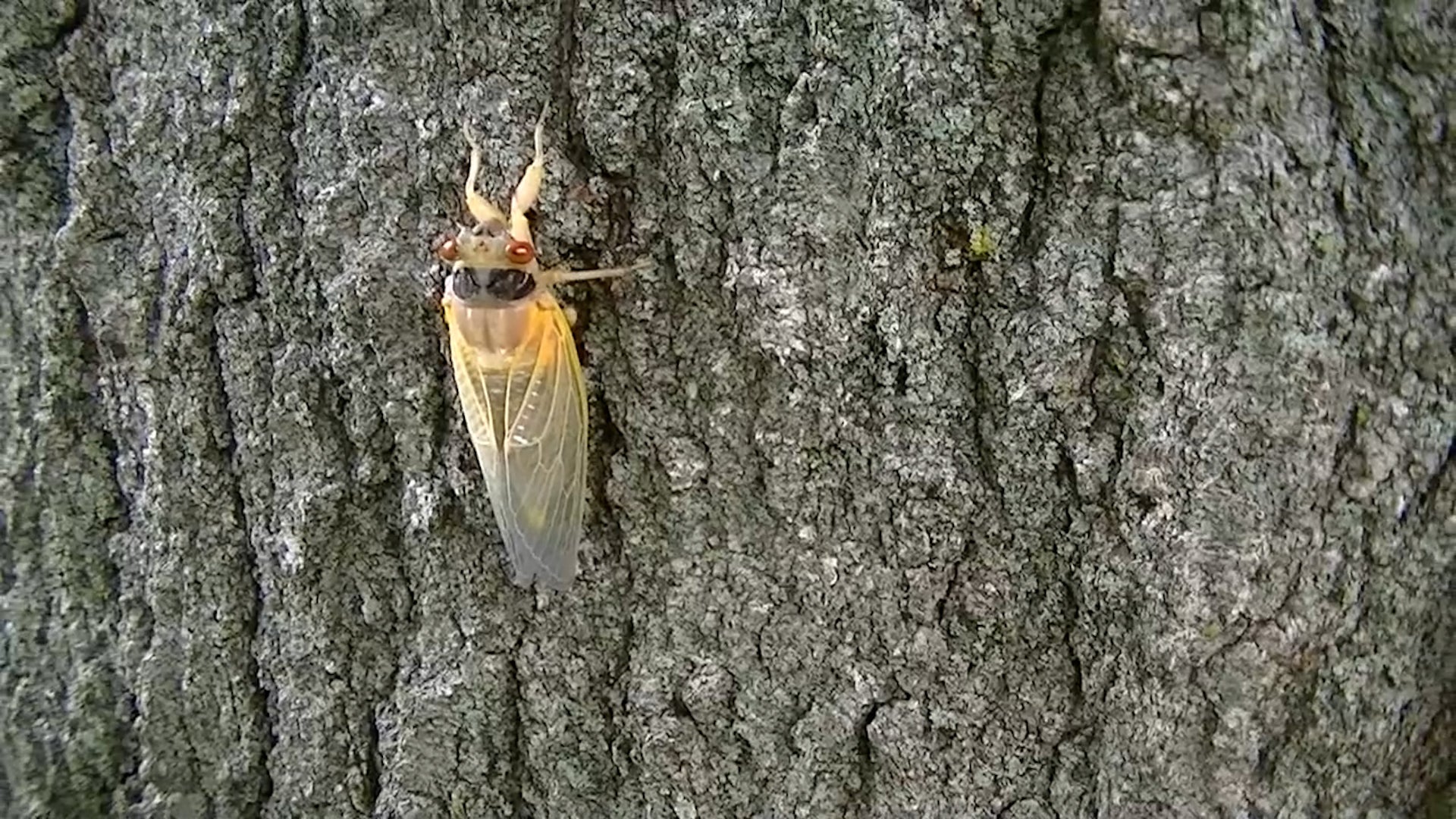
Big Cicada Emergence Ramps Up; Here's Where
A dual cicada emergence that hasn’t been seen in more than 200 years is ramping up, with the noisy critters having been spotted in 11 states.
Big Cicada Emergence Ramps Up; Here's Where
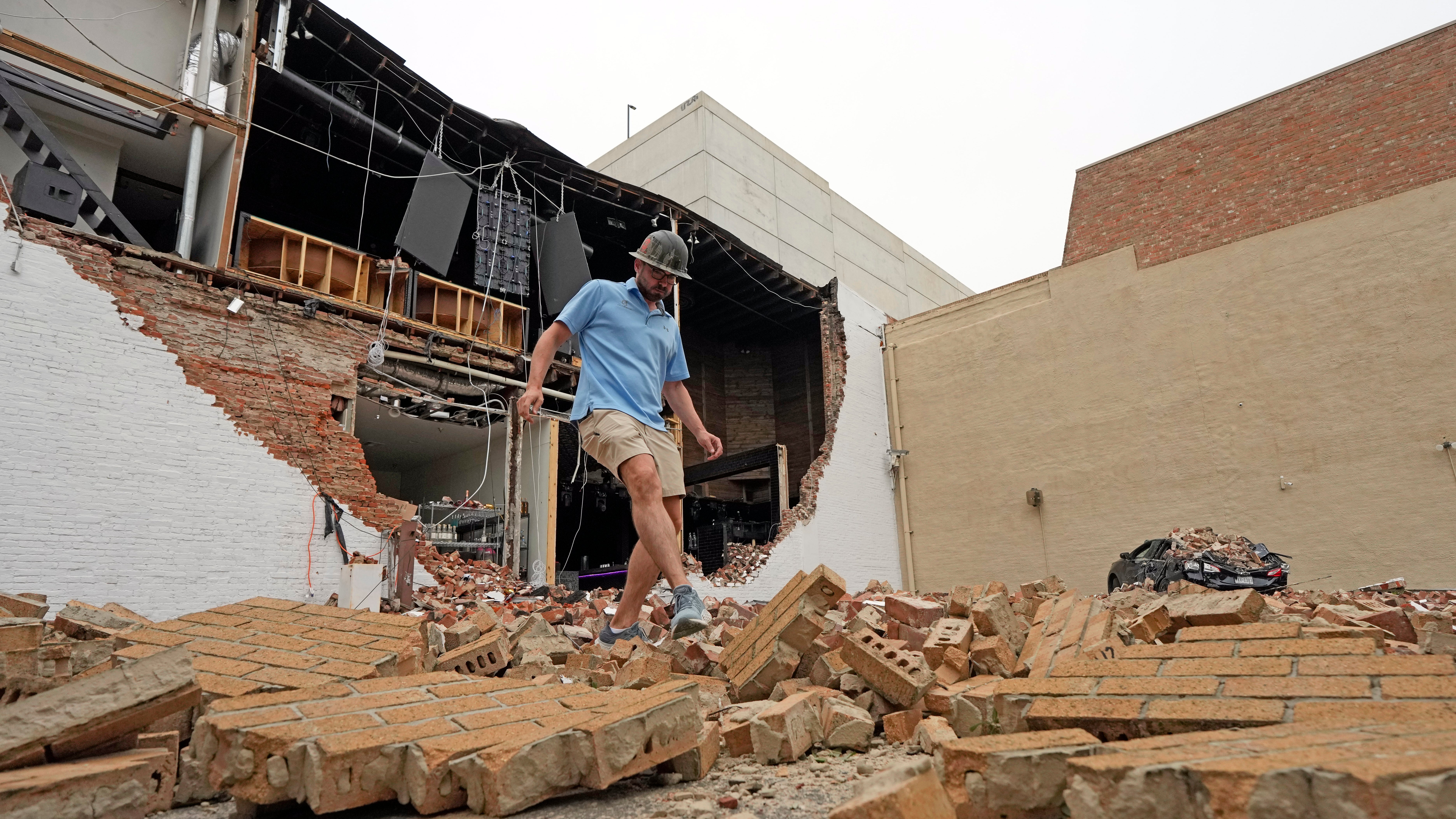
Devastation In Houston, Power Could Be Out For Weeks
A double disaster of power outages and high temperatures could be brewing after a derecho battered Houston.
Devastation In Houston, Power Could Be Out For Weeks
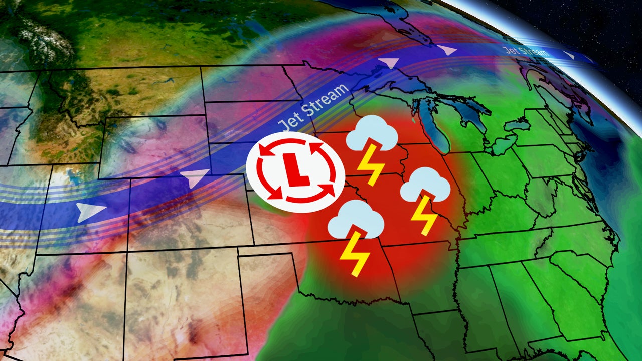
Hail, High Winds And Possible Tornado Threats Returns To Plains
A pattern change means the chance of severe weather will increase in the Plains and Midwest in the coming days.
Hail, High Winds And Possible Tornado Threats Returns To Plains
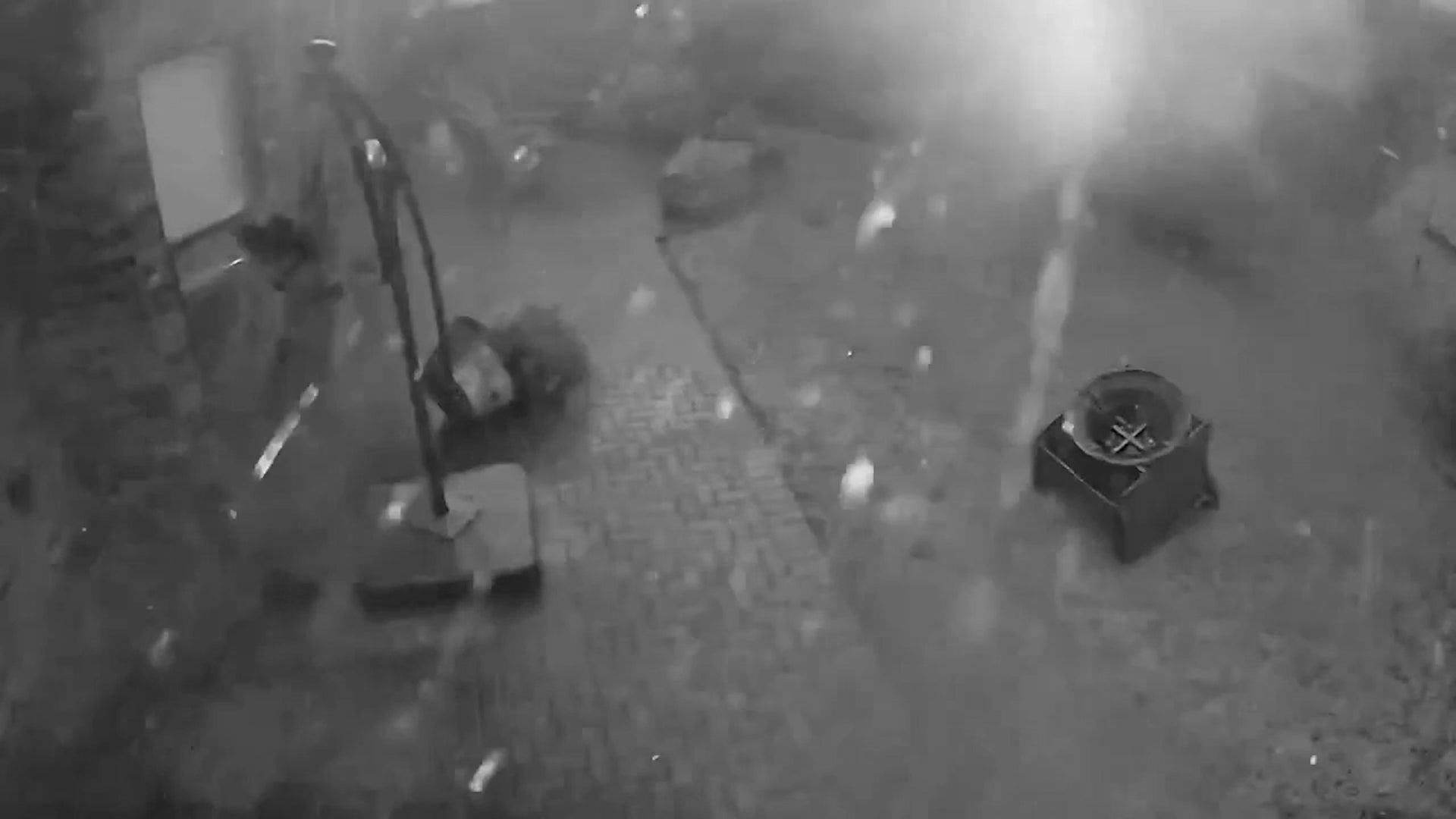
Tornado Caught On Surveillance Camera Amid Houston Derecho
Watch as a derecho with at least one embedded tornado blows through the suburbs northwest of Houston.
Tornado Caught On Surveillance Camera Amid Houston Derecho
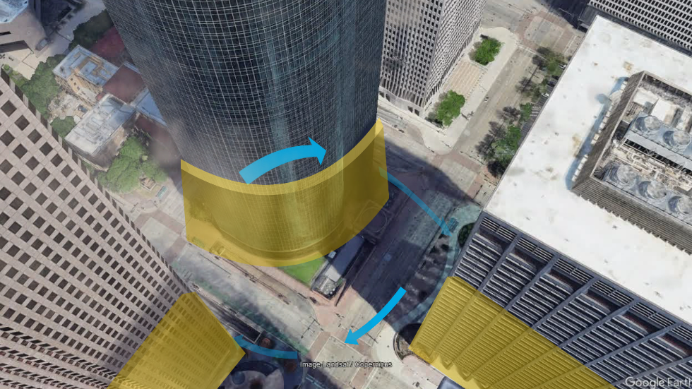
Why DId So Many High-Rise Windows Blow Out In Houston?
Downtown Houston was littered with glass from blown-out high-rise windows after Thursday night’s storm. Here’s the weather behind how that happens.
Why DId So Many High-Rise Windows Blow Out In Houston?
Please enable JavaScript to continue using this application.