Skip to Main Content
_
Sensor Network
Maps & Radar
Severe Weather
News & Blogs
Mobile Apps
More
Search
close
gps_fixed
gps_fixed
Find Nearest Station
Manage Favorite Cities
Log In
Go Ad Free
account_box
Log in
Go Ad Free
settings
Settings
Sensor Network
Maps & Radar
Severe Weather
News & Blogs
Mobile Apps
Historical Weather
star
Current Weather for
Popular
Cities
San Francisco, CA
warning
66
°
F
Fair
Manhattan, NY
72
°
F
Sunny
Schiller Park, IL (60176)
74
°
F
Partly Cloudy
Boston, MA
65
°
F
Partly Cloudy
Houston, TX
warning
71
°
F
Thunderstorm/Wind
St James's, England, United Kingdom
59
°
F
Cloudy
Search
close
gps_fixed
gps_fixed
Find Nearest Station
Manage Favorite Cities
settings
warning
Active Advisory
:
Small Craft Advisory
(
See More
)
--
Feels like
--
--
--
/
--
--
--
--
--
--
--
--
--
--
12AM
6AM
NOON
6PM
12AM
May 2
+0000
May 3
Full Forecast
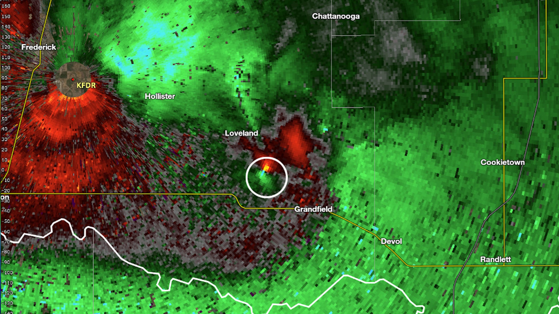
Oklahoma Tornado Did Something That 99% Don't Do
A tornado in Oklahoma Tuesday evening didn't spin in the normal direction we see in the Northern Hemisphere. It was in the rare 1% of tornadoes that spin the opposite direction.
Oklahoma Tornado Did Something That 99% Don't Do
Shocking Video Of Boaters Sparks Outrage
Outrage grows after video of boaters behaving badly during Boca Bash gets posted online.
Shocking Video Of Boaters Sparks Outrage
Child's 'Monster' Turns Out To Be Homeowner's Nightmare
A toddler's innocent claim of “monsters” in her bedroom unraveled a chilling discovery in a family’s century-old farmhouse.
Child's 'Monster' Turns Out To Be Homeowner's Nightmare
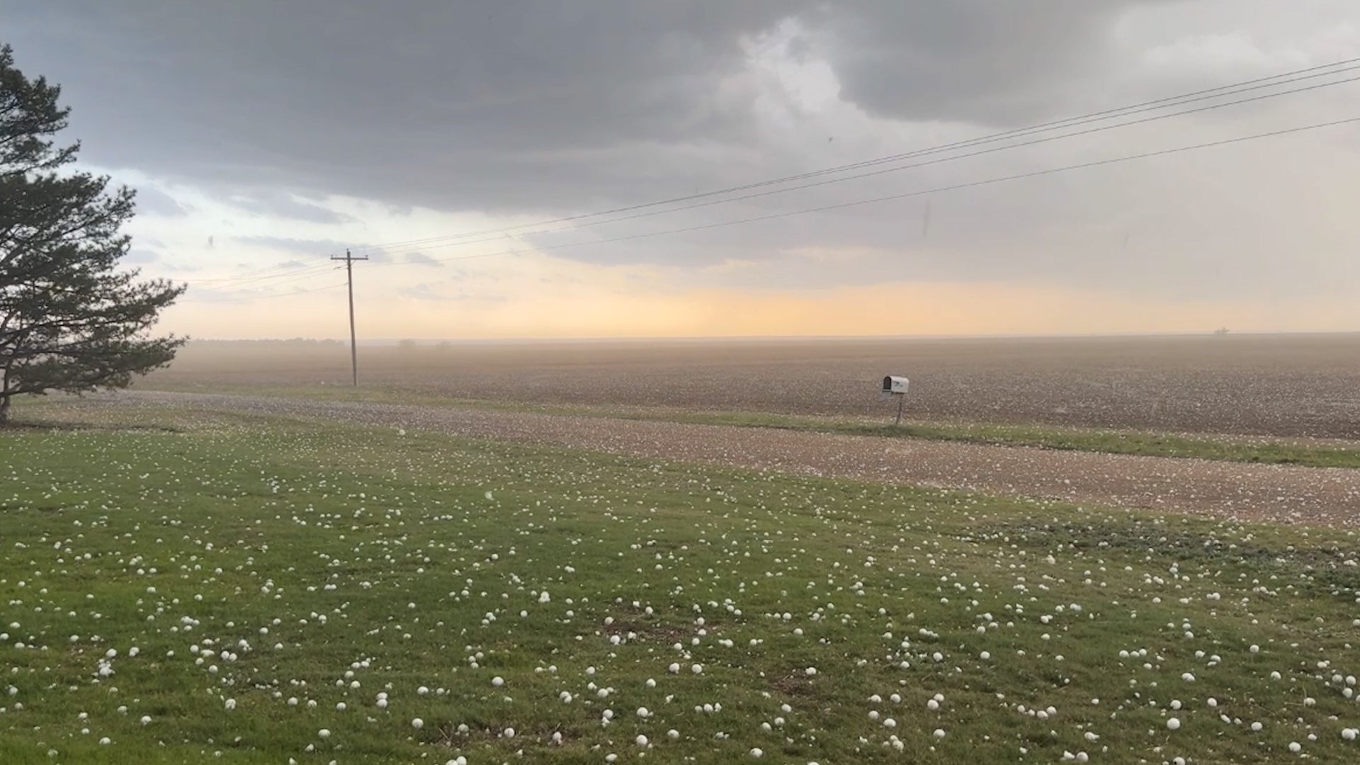
Window-Smashing Hailstones Rain Down In Kansas Plains
Storm chasers captured intense hail as storms moved across the Plains. Reports indicate these stones were baseball size or larger.
Window-Smashing Hailstones Rain Down In Kansas Plains
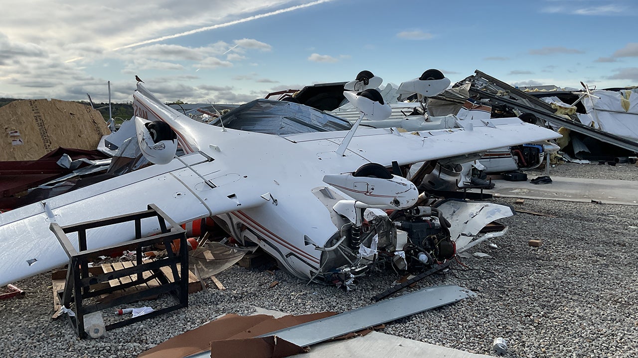
Outbreak Saw 120+ Confirmed Tornadoes; The Wildest Things We Saw
Here are the things meteorologists were most fascinated by during this outbreak.
Outbreak Saw 120+ Confirmed Tornadoes; The Wildest Things We Saw
Please enable JavaScript to continue using this application.