West Texas was hit hard with a rash of severe weather that spawned multiple tornadoes, large hail and heavy rain. Children in the town of Hawley were given the option of missing school if needed to help their families with ongoing recovery efforts. More severe weather could be on the way, making recovery even more imperative.
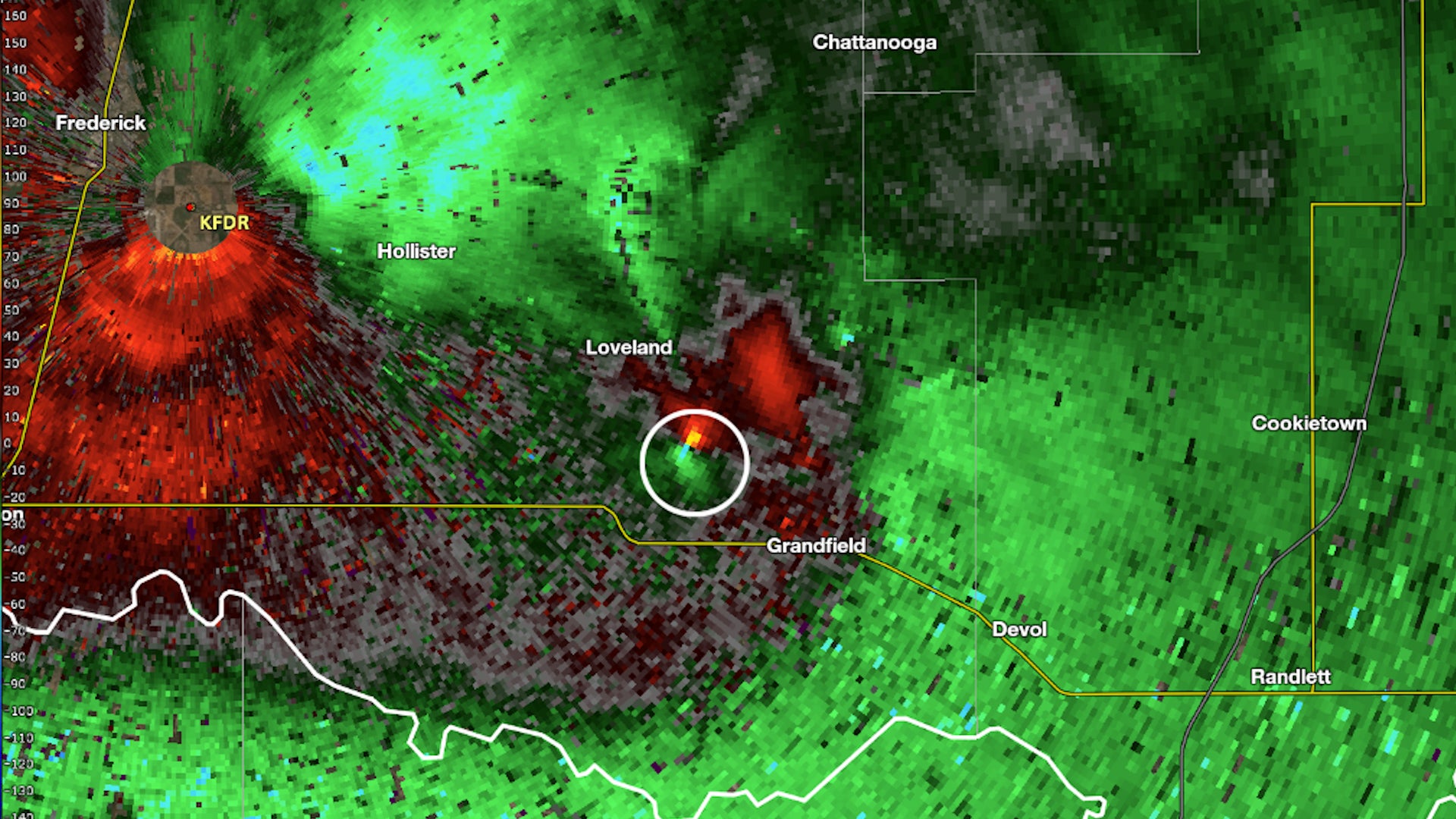
A tornado in Oklahoma Tuesday evening didn't spin in the normal direction we see in the Northern Hemisphere. It was in the rare 1% of tornadoes that spin the opposite direction.