Skip to Main Content
_
Sensor Network
Maps & Radar
Severe Weather
News & Blogs
Mobile Apps
More
Search
close
gps_fixed
gps_fixed
Find Nearest Station
Manage Favorite Cities
Log In
Go Ad Free
account_box
Log in
Go Ad Free
settings
Settings
Sensor Network
Maps & Radar
Severe Weather
News & Blogs
Mobile Apps
Historical Weather
star
Current Weather for
Popular
Cities
San Francisco, CA
66
°
F
Clear
Manhattan, NY
warning
63
°
F
Sunny
Schiller Park, IL (60176)
warning
59
°
F
Light Rain with Thunder
Boston, MA
55
°
F
Mostly Cloudy
Houston, TX
warning
79
°
F
Cloudy
St James's, England, United Kingdom
66
°
F
Sunny
Search
close
gps_fixed
gps_fixed
Find Nearest Station
Manage Favorite Cities
settings
--
Feels like
--
--
--
/
--
--
--
--
--
--
--
--
--
--
12AM
6AM
NOON
6PM
12AM
May 9
+0000
May 10
Full Forecast
At Least Four Dead Amid Marathon Of Severe Storms
At least two people are dead after the Midwest endured a third day of deadly severe storms, including tornadoes, now stretching into the Southeast.
At Least Four Dead Amid Marathon Of Severe Storms
Severe Weather Expected To Bring Tornadoes, Wind, Hail, And Flooding
Another severe thunderstorm outbreak is spreading through the South and East. Here's a look at the forecast.
Severe Weather Expected To Bring Tornadoes, Wind, Hail, And Flooding
The 7 Billion-Dollar Weather Disasters This Year (So Far)
From freezing weather to deadly tornadoes, take a look at the seven billion-dollar disasters that have happened so far this year.
The 7 Billion-Dollar Weather Disasters This Year (So Far)
Airport Outage Leaves Thousands Of Passengers Stranded
Long lines of passengers were wrapped around terminals across the U.K. after a nationwide problem caused huge delays at some of the world’s busiest airports.
Airport Outage Leaves Thousands Of Passengers Stranded
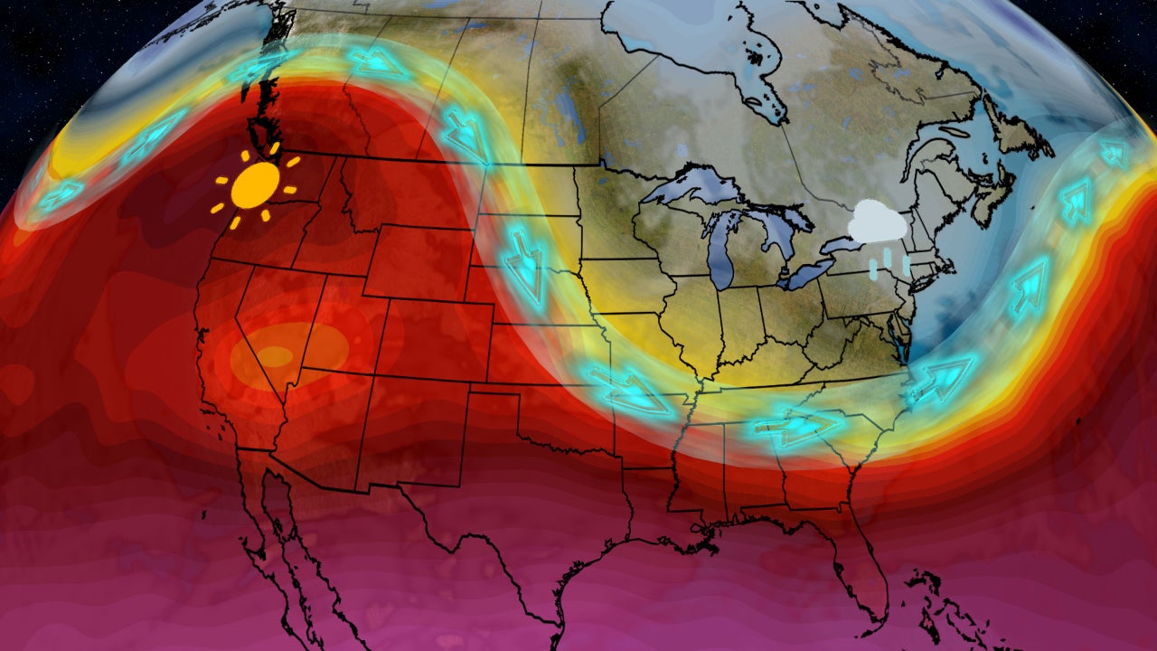
Pattern Change Ahead; What That Means For Your Forecast
Feel like your weather has been stuck in a rut? Here are the changes ahead.
Pattern Change Ahead; What That Means For Your Forecast
Please enable JavaScript to continue using this application.