Skip to Main Content
_
Sensor Network
Maps & Radar
Severe Weather
News & Blogs
Mobile Apps
More
Search
close
gps_fixed
gps_fixed
Find Nearest Station
Manage Favorite Cities
Log In
Go Ad Free
account_box
Log in
Go Ad Free
settings
Settings
Sensor Network
Maps & Radar
Severe Weather
News & Blogs
Mobile Apps
Historical Weather
star
Current Weather for
Popular
Cities
San Francisco, CA
56
°
F
Mostly Cloudy
Manhattan, NY
warning
80
°
F
Fair
Schiller Park, IL (60176)
75
°
F
Sunny
Boston, MA
71
°
F
Partly Cloudy
Houston, TX
92
°
F
Partly Cloudy
St James's, England, United Kingdom
66
°
F
Sunny
Search
close
gps_fixed
gps_fixed
Find Nearest Station
Manage Favorite Cities
settings
--
Feels like
--
--
--
/
--
--
--
--
--
--
--
--
--
--
12AM
6AM
NOON
6PM
12AM
May 25
+0000
May 26
Full Forecast
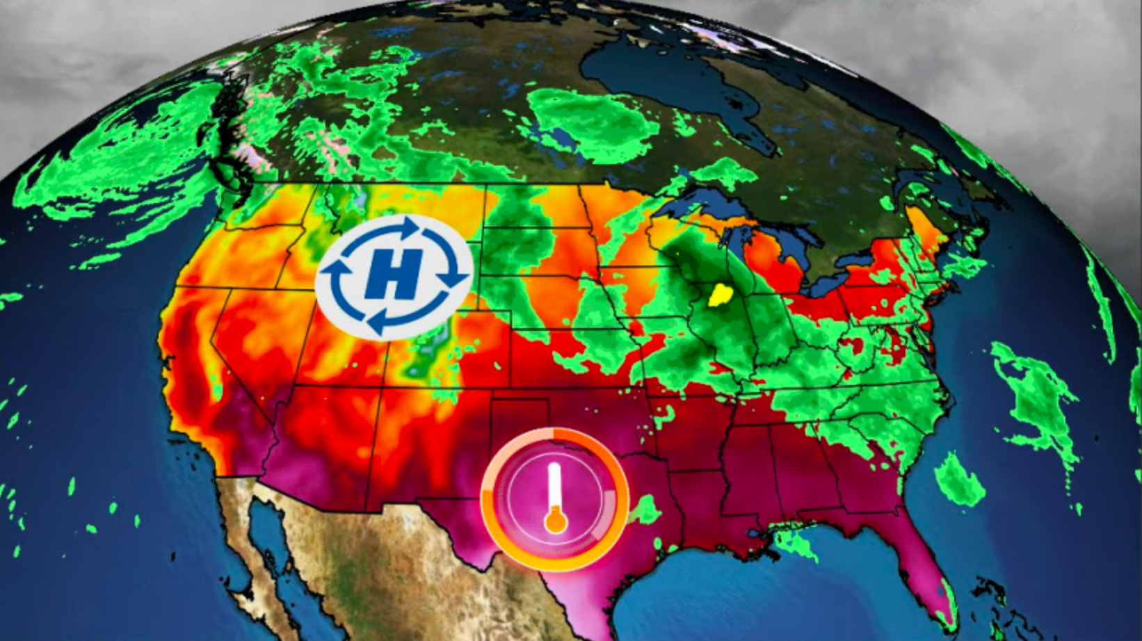
Today's Threat: Intense Tornadoes, Giant Hail Possible
An outbreak of severe storms is expected over Memorial Day weekend. Intense tornadoes and giant hail could accompany supercells on Saturday.
Today's Threat: Intense Tornadoes, Giant Hail Possible
This State Just Got Hit With 20 Inches Of Snow...In May
Could you live in a place where the snow is still falling in late May? Have a look at this spot in southern Montana where it happened Thursday. Parts of the state received up to 20 inches of snow from this storm.
This State Just Got Hit With 20 Inches Of Snow...In May
Your Memorial Day Weekend Forecast
Memorial Day, holiday, weather, forecast, The Weather Channe
Your Memorial Day Weekend Forecast
100s Feared Dead In Devastating Landslide
Residents and rescuers are working to find survivors after a landslide hit a remote village in the mountains.
100s Feared Dead In Devastating Landslide
Hail, Flooding Inundate Streets After Deadly Tornado
Video captures the moments during and after deadly severe weather wreaked havoc in Mexico.
Hail, Flooding Inundate Streets After Deadly Tornado
Please enable JavaScript to continue using this application.