Skip to Main Content
_
Sensor Network
Maps & Radar
Severe Weather
News & Blogs
Mobile Apps
More
Search
close
gps_fixed
gps_fixed
Find Nearest Station
Manage Favorite Cities
Log In
Go Ad Free
account_box
Log in
Go Ad Free
settings
Settings
Sensor Network
Maps & Radar
Severe Weather
News & Blogs
Mobile Apps
Historical Weather
star
Current Weather for
Popular
Cities
San Francisco, CA
51
°
F
Clear
Manhattan, NY
53
°
F
Cloudy
Schiller Park, IL (60176)
50
°
F
Partly Cloudy
Boston, MA
49
°
F
Cloudy
Houston, TX
warning
74
°
F
Cloudy
St James's, England, United Kingdom
51
°
F
Cloudy
Search
close
gps_fixed
gps_fixed
Find Nearest Station
Manage Favorite Cities
settings
--
Feels like
--
--
--
/
--
--
--
--
--
--
--
--
--
--
12AM
6AM
NOON
6PM
12AM
May 6
+0000
May 7
Full Forecast
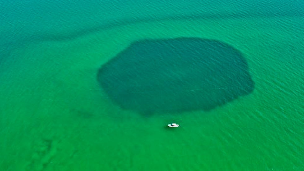
New Secrets From The Planet's Deepest Blue Hole
As featured in
Frontiers,
a seemingly bottomless sinkhole called Taam Ja' Blue Hole, has been crowned the new titan of the deep.
New Secrets From The Planet's Deepest Blue Hole
Severe Weather, Possible Tornadoes Again This Week; See The Timing
Another potentially widespread bout of severe thunderstorms could be on the horizon. Here's a look at the forecast.
Severe Weather, Possible Tornadoes Again This Week; See The Timing
Shocking Video Of Boaters Sparks Outrage
Outrage grows after video of boaters behaving badly during Boca Bash gets posted online.
Shocking Video Of Boaters Sparks Outrage
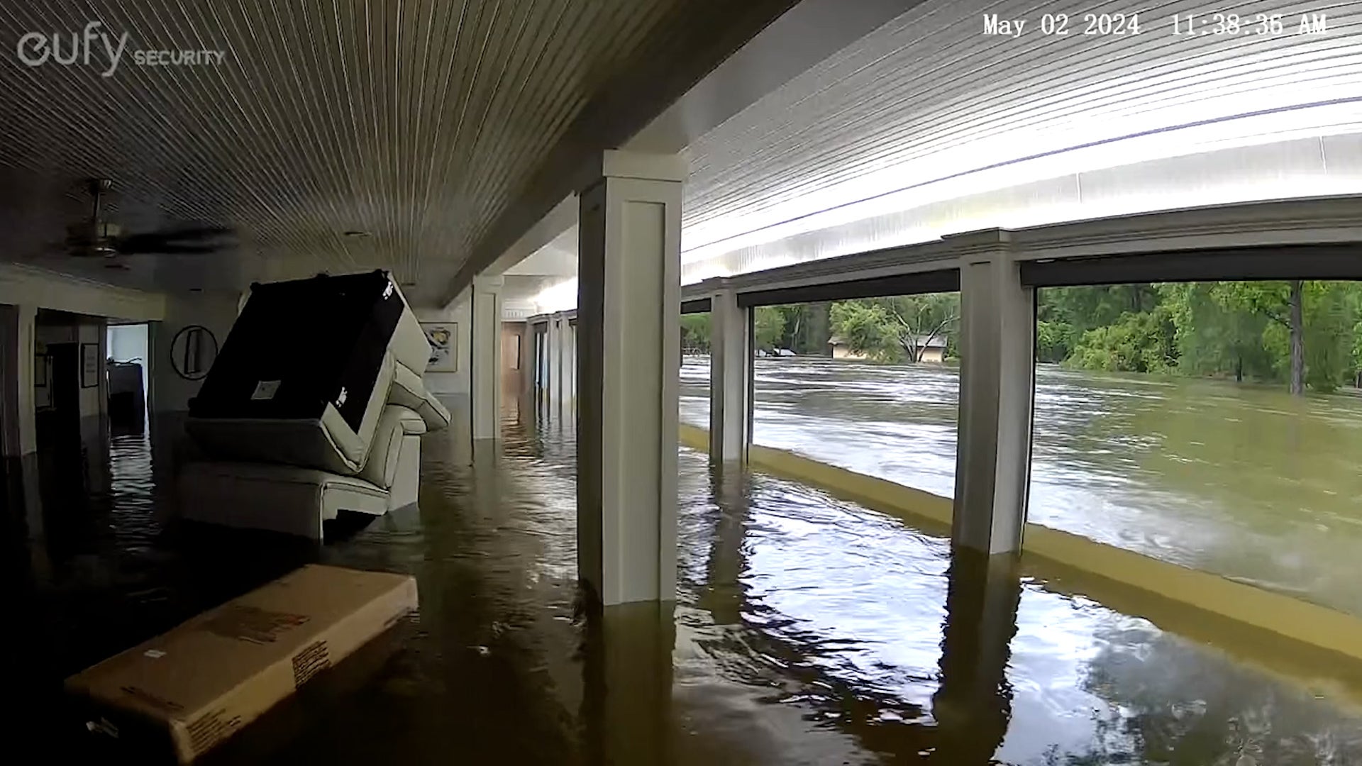
Texas Homeowner's Security Camera Captures House Flood
In shocking footage captured by a home security camera, a Texas homeowner watched as floodwaters filled her house.
Texas Homeowner's Security Camera Captures House Flood
Officer On Jetski Plucks Man, 3 Dogs From Texas Flood
A man was struggling to get himself and his dog to safety after a Houston trailer park was swamped by heavy rain and flooding. Watch as a police officer comes to their rescue on a jet ski, and saves two other dogs.
Officer On Jetski Plucks Man, 3 Dogs From Texas Flood
Please enable JavaScript to continue using this application.