Skip to Main Content
_
Sensor Network
Maps & Radar
Severe Weather
News & Blogs
Mobile Apps
More
Search
close
gps_fixed
gps_fixed
Find Nearest Station
Manage Favorite Cities
Log In
Go Ad Free
account_box
Log in
Go Ad Free
settings
Settings
Sensor Network
Maps & Radar
Severe Weather
News & Blogs
Mobile Apps
Historical Weather
star
Current Weather for
Popular
Cities
San Francisco, CA
warning
53
°
F
Clear
Manhattan, NY
51
°
F
Cloudy
Schiller Park, IL (60176)
62
°
F
Rain
Boston, MA
46
°
F
Cloudy
Houston, TX
75
°
F
Mostly Cloudy
St James's, England, United Kingdom
44
°
F
Cloudy
Search
close
gps_fixed
gps_fixed
Find Nearest Station
Manage Favorite Cities
settings
warning
Active Advisory
:
Small Craft Advisory
(
See More
)
--
Feels like
--
--
--
/
--
--
--
--
--
--
--
--
--
--
12AM
6AM
NOON
6PM
12AM
Apr 28
+0000
Apr 29
Full Forecast
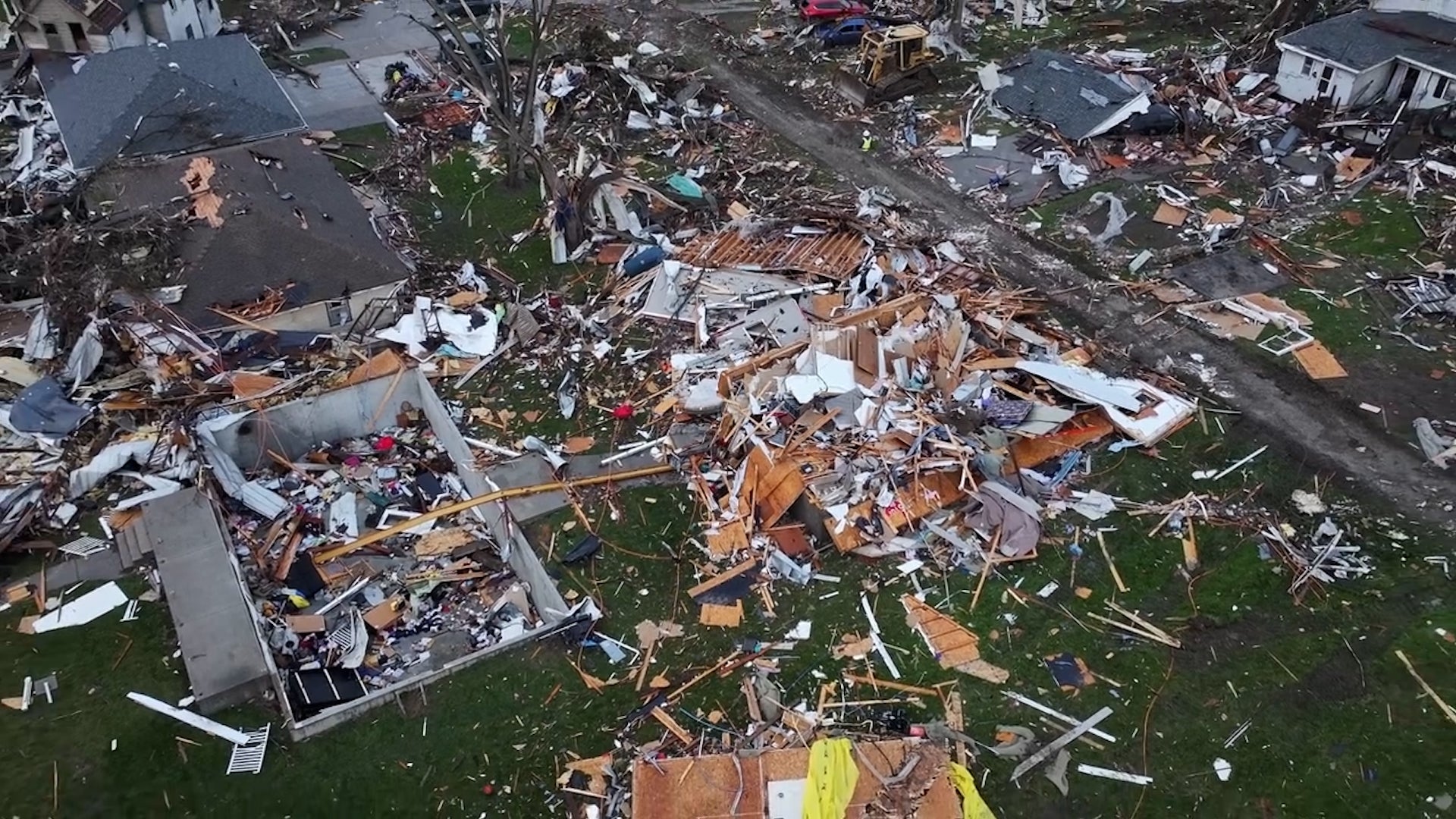
Damaged Homes, Crumbling Businesses
Severe weather carved a path across parts of the Central and Southern Plains for a second day in a row Saturday.
Damaged Homes, Crumbling Businesses
What We Are Tracking Right Now
The chance of tornadic storms continues in the Plains. Here's what to know.
What We Are Tracking Right Now
Intense Video Shows Nebraska Tornado’s Massive Debris Vortex
Frightening footage captured the moments a tornado tore through Lincoln, Nebraska, creating a massive, swirling mass of debris.
Intense Video Shows Nebraska Tornado’s Massive Debris Vortex
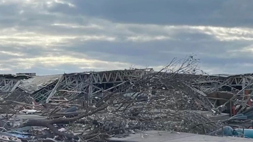
Drone Shows Iowa Town Split Apart By Tornado
The town of Minden, Iowa, lies devastated following a relentless tornado, leaving residents facing a daunting recovery ahead.
Drone Shows Iowa Town Split Apart By Tornado
Nebraska Tornado Hits Business With 70 Inside
A business in Lancaster County, Nebraska was hit by a tornado Friday afternoon. 70 workers were inside Garner Industries when the tornado hit. Only minor injuries were reported.
Nebraska Tornado Hits Business With 70 Inside
Please enable JavaScript to continue using this application.