More than 85 people were trapped and at least 14 people died when a billboard collapsed in Mumbai, India, amid storms and high winds. How did so many people die as a result of this tragedy?
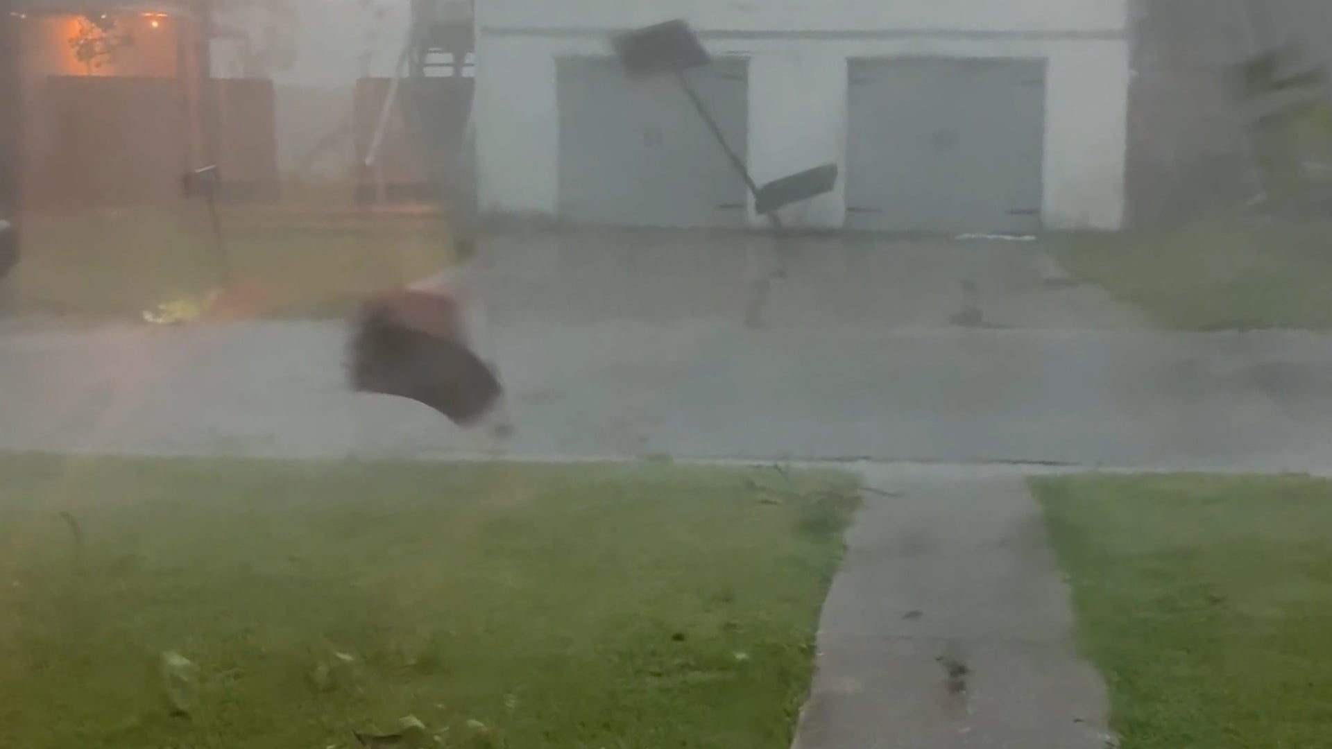
As tornado-warned storms hit Sulphur, Louisiana, one couple was stopped in their tracks when they saw what was happening outside their dining room window.